
the Inclosure Award Map (1815) & Davis’s Map (1794)
Like other Chiltern Parishes, the Ancient Parish of Watlington was long & narrow, being nowhere more than a mile wide & about 5-miles long, excluding Warmscombe, which was separated from the Main Body of the Parish by a part of Pishill Parish. Watlington ran, as it does now, from the Cuxham Boundary in the North in a South-easterly direction across a shallow Chalk Basin & up into the Chilterns. At the highest point on Christmas Common, it divides into 2, a Northern Finger cutting through Pyrton Parish and stretching as far as Launders Farm, while the other Finger stretched South to Whitelands Farm. The 2-Fingers were separated by Pyrton Parish. Before the Boundaries were altered in 1931 Watlington covered 3,690-acres; of this, 278-acres were in Warmscombe. By the Boundary changes Watlington gave Warmscombe to Pishill with Stonor Parish and acquired 175-acres from Britwell & 10 from Pyrton, and so came to cover 3,597 acres.
In late-Saxon Times part of Pishill appears to have been included in Watlington and was no doubt the area which later separated Warmscombe from Watlington Parish, but by the 12thC Pishill had become a separate Parish, and the Boundaries of Watlington probably remained largely unaltered until modern times. The Boundaries mostly ran along Valley Bottoms, and in the 18thC, they were said to extend upwards of 20 miles. Processioning‘ or Beating the Bounds still took place once every 3-yrs in the early-19thC, and the ‘Rights & Customs‘ involved were set out in detail in 1816 by John Badcock, a Local Antiquarian. In such Wooded Country, the exact line of the Boundary must always have been difficult to determine and at least one dispute has been recorded. The low-lying Clay part of the Parish lies below the 300-ft Contour line. At the highest point round Watlington Park & Christmas Common, the ground rises to 770 & 788-ft. Much of the High Chalkland is covered with Juniper Trees & Beech Woods such as Greenfield Wood, Greenfield Copse, & Howe Wood, of which the last has recently become the Property of the National Trust. On the Slope of Watlington Hill, which is also a National Trust Property, being the Gift of Lord & Lady Esher, there is an 18thC ‘Folly‘, 270-ft long & 36-ft wide, and originally intended to represent an Obelisk. It was cut into the Chalk on the Orders of Edward Horne of Greenfield in 1764.
John Badcock born in 1775 in Ashbury, Berks the 6th child of Joseph Badcock, Farmer, and his wife Elizabeth. By the 1780s the family were in the Watlington area. In due course John & his brother inherited Joseph’s substantial Property in Watlington; they were doing well and lived in Watlington until about 1820, where he was a Tanner by Profession & a Churchwarden. He was married to Anne Carter in Shipton-on-Cherwell in 1802, and they had 5-children Baptised in Watlington. The 2-eldest, both boys, died in infancy, leaving Emily Anne, born in 1808, Alfred Joseph in 1812 & Arthur William in 1814. While living there Badcock wrote a History of Watlington (d.1841)
Greenfield Manor, Christmas Common, Watlington
Farmhouse, now House. 2-Ranges: early 17thC to Right, c.1700 to left. Flemish Bond Brick to right; English Bond Brick to left. Gabled old tile Roof; Brick Ridge & end Stacks. Lobby-entry right Range extended to T-plan c.1700. Single-Storey & Attic, 2-window Range to Right has blocked Door, 20thC windows & 2-light leaded casements reset in Gabled Dormers (originally half-Dormers): 2-Storey & Attic, 2-window Range to left has early-20thC Brick Gabled Porch, Segmental Arches over 3-light cross windows (one reset Right of Porch) and 20thC flat Arches over 2nd-Floor Casements set in 2 Cross Gables. Leaded Casement and mid-19thC Pedimented Doorway to Rear. Rear Wing of c.1700: 2-Storey, 2-window Range of Tile-hung 1st-Floor over Flemish Bond Brick with flared headers; Gabled old Tile Roof, Brick end Stack, 18thC sash. It adjoins rear left rendered Stair-Turret.
Interior: Open Fireplace & quartered ovolo-moulded Beams, Queen-post Roof with Clasped Purlins, to right. Left Range has chamfered Beams & early-18thC dog-leg with Landing Staircase, with turned Balusters on closed String: 1st-Floor & Attic not inspected.

The Icknield Way, a pre-Roman Track called by Henry of Huntingdon one of the Principal Roads of Britain, was one of the Parish’s Chief Roads. Today the Watlington portion of it is partly a Grass Track which can be followed by Walkers and partly a side Road to Dame Lys (formerly Dame Alice Farm). The Chief Modern Road is the Road from Cuxham which divides in Watlington, the Northern Branch going past the Obelisk Cut up Watlington Hill to Christmas Common and the Southern by Howe Farm to Pishill. These 2-Roads link Watlington with High Wycombe, Henley, & Oxford, and their course is the same as it was in the 18thC. An Estate Map of 1780 names the Northern Branch Hill Way and the other ‘Howe’ Way.

The Watlington & Princes Risborough Railway Co was formed in 1859 by the Earl of Macclesfield and others. It built this Line with Stations at Watlington, Aston Rowant, & Chinnor and ran as a small Private Company until 1884 when it was taken over by the GWR. The Rolling Stock and so on had to be altered and only the Station Buildings remained of the Original Design. Watlington had its own Stationmaster.
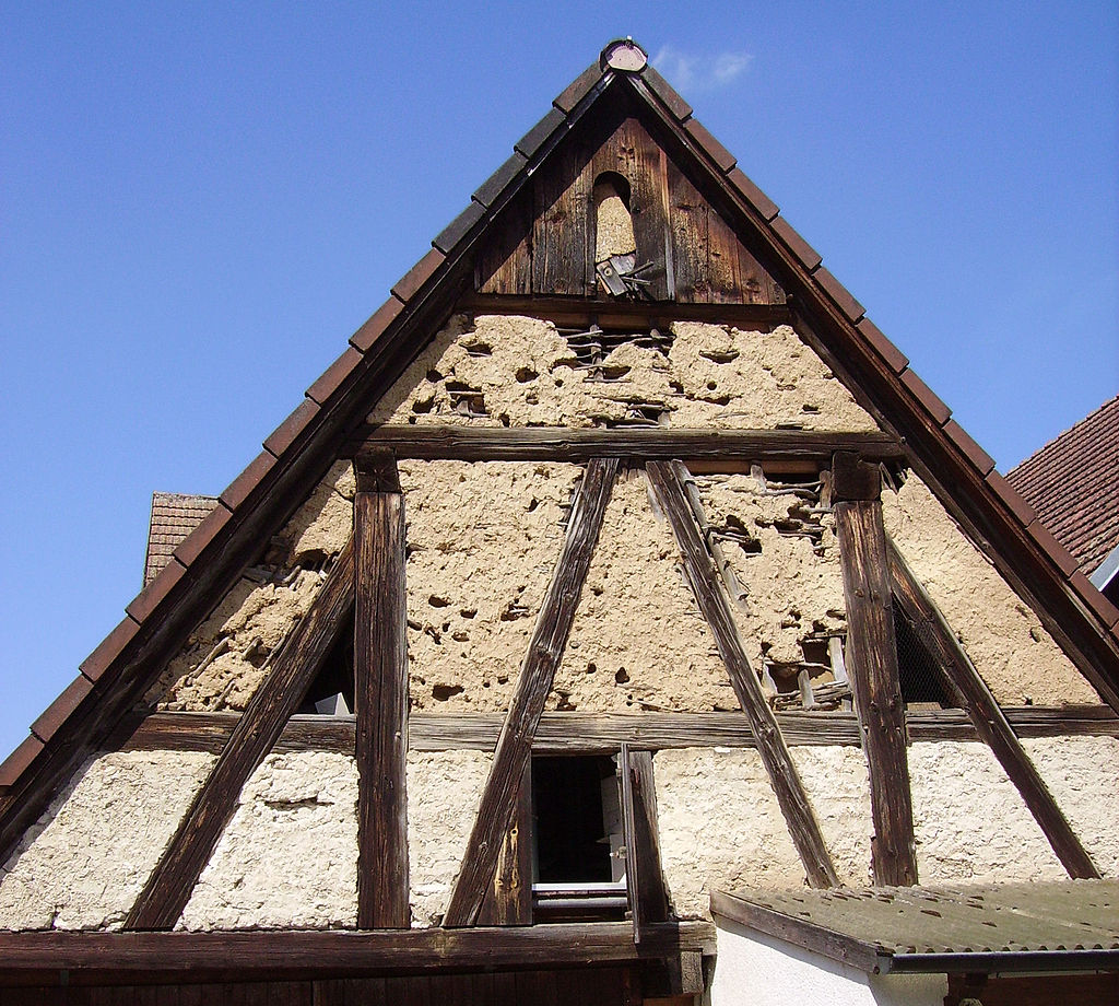
The Town of Watlington lies in the North of the Parish on a slight Hill about 350-ft up. Its site on the Southern Slopes was determined by a small rivulet and the Settlement is at least as Old as the 6thC. Its name probably means the ‘ton of the people of Waecal‘. The early-Medieval Town may once have been concentrated nearer the Church, which now stands in a rather isolated position on the Northern Outskirts, but Hearne was probably right in supposing that the Great Foundations of Old Buildings there in his time were those of the ‘Castle‘ rather than the Town. A Ditch on the South side of the Site of the Castle is supposed to be the remains of its Moat. Brewer, writing in 1819, noted that the older Buildings lay in the North part of Watlington and that the last of them had been recently taken down. They were all built of Wattle & Mud (Daub) in the method common in the District, Mortar or Mud being thrown on to Wattle or Flake Hurdles so as to obtain the right thickness.

The Principal Manor-House & Oseney Abbey’s Grange were certainly in this area. The earliest reference to the Manor-House occurs in c.1250 when a Pit in the curia of Richard, Earl of Cornwall, is mentioned. Nicholas de la Beche was given Licence to Crenellate in 1338 and may have Fortified or Rebuilt the House. Some years later in 1349 & 1350, the King’s sons were staying there. When the Site of the Manor was Granted for 40s a year to the King’s Sergeant Richard Lyllyng in 1442 all the Houses built on it, 20-Crofts, 2-Meadows, & the Water called a ‘Mote‘ around the Site were mentioned. This Moat was partly in the present Churchyard and is still met with in digging Graves and partly beyond the end of Church Street where it is still visible. The Manor-House was not kept up and in the early 17thC the King’s Bailiff was accused of giving away the Timber & Stone instead of using it for the Repair of the King’s Tenements in Watlington. In 1660 the Vicar said that its 24-acres of Meadow had been divided up.
East of the Manor-House & Court Meadow, as it is still called, was the 20-acre Croft given to Oseney by Halinad de Bidun in the 12thC and in 2-acres here, also given by him, their curia was built. A small stream ran into the Pit in Earl Richard’s Court and also into that in the Canons’ Court. The Canons’ Garden was also mentioned: it reached the Arable Fields which lay along the Boundary with Pyrton. From their Croft, a Lane led into the High Street of Watlington. It was called Munchen Lane (i.e. Monks’ Lane) but had been renamed Hogg Lane by the early-16thC, and later it became Chapel Street when the Wesleyans had built a Chapel there.

Medieval Documents indicate that much of the Modern Street Plan was in existence in the 14thC if not much earlier. Cochynes-lane (Couching Street) & Brook Street are recorded and the High Street must have had Houses.


An Elizabethan or early-17thC Rental and an Assessment for the Poor Rate of 1688 gives an idea of where the better-off Townsman then lived. Thomas Nash of a well-known Family paid Rent for a Tenement in Goldwell Lane and Thomas Eustace for one in Brook Street, where the Swan Inn was. The Black Lion was situated on Brook Street. A Morrell’s Pub which closed in the 1960s when it was run by the King Family. In 1688 there were 35-Ratepayers living in ‘Cowchin Lane‘, 29 in High Street, 22 in Church Lane & Hogg Lane, 16 in an unspecified part of the Parish, & 11 in Shirburn Street. Some of the unspecified Properties may have been in Goldwell, as Gorville Street was called, or in the modern Brook Street, but some may have been outside the Town. ‘Cowchin Lane‘ was evidently already a Superior Street, for 2-Leading Families, those of Eustace & Hester, resided there, while the Nash Family, for long leading Tradesmen, were strongly Established in High Street. Mr Thomas Nash, Gentleman, had the best House there, and 3 other Members of the Family, 2 of them, Grocers, had the next best.


The Red Lion Public House, Watlington. 22 Couching Street
Terraced House. Late 16th early-17thC ~ probably an Inn with Vehicle Entrance to left; remodelled & re-Fronted late 18th early-19thC. Grey Vitrified Bricks in Header Bond with Red Brick dressings forming panels. Slated King-post Roof with Brick Stacks. Single depth Plan with Stair in former outshot; short cross-wing of Purple Brick with tiled Roof & full-height Chimney Stack to the rear. 2-Storeys & Cellar. 4 windows. Gauged Red Brick Segmental Heads to 2-Entrances with part-glazed panelled Doors flanked by gauged Red Brick segmental Arched sashes, the 2 right-hand being hornless. 1st-Floor similar arched windows with 1 x 4-pane sash & 3 metal-framed casements with glazing bars.
Interior has chamfered Spine Beams with Scroll Stops. The front Southern Room has built-in fielded panel cupboards to the left of the Fireplace, good late 19thC panelled Door with geometrical patterned coloured glass glazing & sliding sash into Cross-Wing Room with fielded panel Corner Cupboard. Upstairs front-room divided with a folding Timber Partition. Formerly the Red Lion Public House at the end of the 18thC it was one of 6–Watlington Inns which came into the hand’s of Local Brewers, the Haywards (Henry, James, William & William Webb 1770-1850) by the early-19thC. The screen divided front-room was reputedly later used for Tea Dances. Former Vehicle Entrance led to Stabling & Barn at rear.


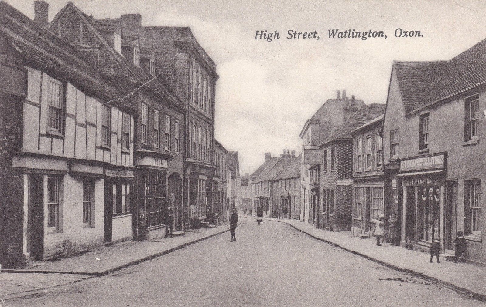
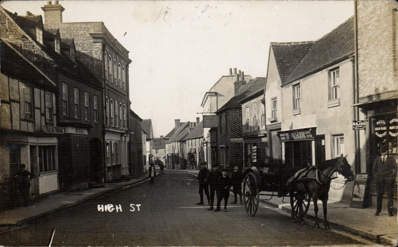
Today Watlington’s 3 Main Streets – High Street, Couching Street, & Shirburn Street – form a T, with the 17thC Townhall at the Junction of the 3. Like another Chiltern Town, Chinnor, Watlington is also Built around a Central Green, High Street, Couching Street, Brook Street, & Gorville Street, where there are comparatively few Houses, forming the 4-sides of a Parallelogram. Church Street leading to St Leonard’s Church on the Northern Outskirts is a quiet backwater. The prevailing Building Material is Brick, which superseded the Wattle & Daub of Earlier Buildings. Among the many 16th & 17thC Cottages & Houses to survive in the Modern Town, some have been little altered, but many have been refaced in the 18thC or later, and their real age can only be observed from the Rear or the Inside. Many of these Houses preserve their Medieval Plan: they have a narrow Frontage on the Street with rear Buildings running back a considerable way & approached by a Side Passage.

Among the most interesting is the ‘Barley Mow‘ was situated at 13 High Street. This Brakspears Pub closed c.1960: its Timber-framed Upper Storey has Plaster Filling & Oversails the Lower Storey which is Built of Flint, Brick & Ragstone. Its Gable End faces the Street. For a nearby Timber-framed House of 16th-17thC date Herring-bone Brick and not Plaster is used as a Filling.
The ‘Pineapple‘ accessed from Couching Street via a small secure Passageway, though it has an 18thC Facade, is another Timber-built House of some size. In Brook Street & Couching Street, there are more good examples of the Period. ‘The Lilacs‘, (No.50 Brook Street) built of Timber & Plaster, has 2-Storeys & Attics, and its Double-Gabled Front faces the Road. Its Gables have moulded Barge-boards, and its large central Chimney-Stack has 2-Flues in a rectangle flanked by a Diamond Shaft on either side.

‘Pilgrim Cottage‘ (No.49 Brook Street) formerly The Black Lion Public House has plain Brick & Herring-bone Brick Filling, and a plinth of Flint. A Morrell’s Pub which Closed in the 1960s when it was run by the King Family.

A similar Cottage adjoining the ‘Black Horse‘ in Chapel Street is Thatched as were most of the Cottages until the end of the 19thC, and another one in the same Street is built partly of Flint and partly of Clunch, a Limestone material commonly used for the older & smaller Dwellings. A Timber-framed Cottage in Couching Street has an Oversailing Upper Storey; No.3 Church Street is partly Timber-framed and partly built of rubble Stone; and the ‘Old Thatch‘, once 2 Cottages, has Timber Framing & Brick Filling.
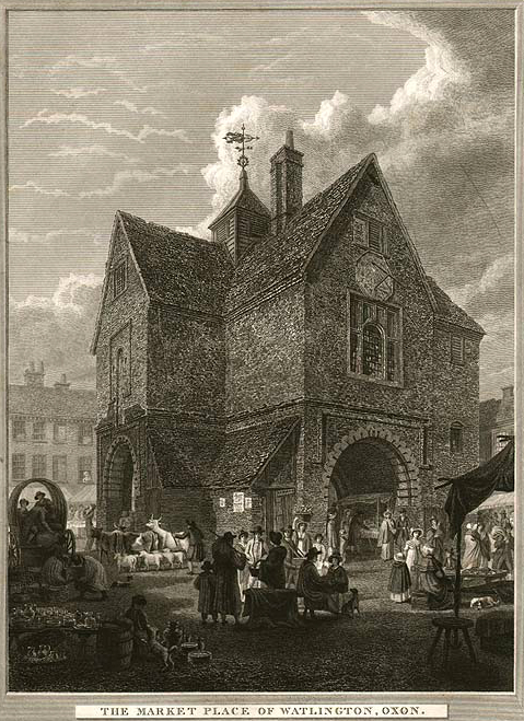
The finest survival of 17thC Architecture is the Town Hall, a 2-Storeyed Building of Brick with Stone windows. The Roof is Hipped & Tiled and has a small Weather-boarded Turret at the junction of the Ridges. The Hall was erected at the expense of Thomas Stonor in 1664/5 on Ground belonging to the Lords of the Manor. He undertook that he and his Heirs would be responsible for repairs. The original plan was T-shaped: its symmetry was somewhat spoilt by the Annex containing the Staircase on the South-East side which was evidently erected at a later date, the Bricks used being of a larger size. It is conjectured that it was substituted in the late 18thC for the original Circular Staircase leading only to the Schoolroom, the Clock & Bell being reached by a Ladder. An early-19thC Print by F Mackenzie (inset) shows the Ground Floor still open at the South-East angle. The Open Archways were 1st closed by Wooden Doors and later by Iron Grilles. Until the 1870s the Upper part of the Building was in constant use as a Boy’s Grammar School and on occasions, it was used for Courts Leet & Baron, & for the County Ball. In 1895 the Building was described as ‘falling to pieces‘ and in 1907 an appeal was made for its Restoration & £800 was raised. The Owner, F Symonds-Jeune of Watlington Park, Conveyed it to 4-Trustees and in 1907, when the work of Restoration was completed, it was Conveyed to the Parish Council.

For the 18thC houses Coursed Flint or Vitreous Brick with Red-Brick Dressings were commonly used, but there are also many surviving examples of Chequer Brick & Plain Brick. Most of the Houses are modest 2-Storeyed Dwellings and have little or no ornamentation beyond Brick dentilled Eaves, Red-Brick surrounds to the windows & Red-Brick Quoins. Some of the larger Houses, like ‘The Old House‘ in Shirburn Street, which was possibly ‘the large & handsome House‘ belonging to Richard Wiggins in 1763, stand back from the Road behind a low Wall with a screen of Railings, but most face directly onto the Street. Of the more imposing Houses, the Old Bank House (once an Antique Shop) in Couching Street is outstanding. This Street, long favoured by the Town’s better-Class Residents, was much Modernised in the 18thC and has preserved the character of the Period more than most.

Couching Street (East side) No.56 Cherry Pie
House. Mid/late 16thC, remodelled in early 19thC. Originally Timber-framed. Front of early-19thC colour-washed Brick; Gabled old tile Roof; Brick end & lateral Stacks. L-plan with rear left Wing. 2-Storeys; 1-window Range. Broken Pediment over 4-panelled Door. Sashes set in early-19thC Canted Bay. Outshut to rear Right. Late-16thC rear Wing of 2-Storeys, 2-Bay Range: right-side 1st-Floor Wall has Jettied square Timber-framing flanked by tension braces, horizontal sliding sash and 19thC Iron Casements; Gabled old tile Roof with rear end Stack.
Interior: Front Range has jowled & moulded Post to chamfered Beam, chamfered & stopped Bressumer over Open Fireplace & 18thC Cupboard with panelled Doors on the 1st-Floor: 3-Bay Collar Truss Roof with Clasped Purlins & curved Wind-braces includes No.58. Rear Range has quartered chamfered & stopped Beams & similar 2-Bay Roof.
The 17thC Ratepayers, whose names are listed in the Overseers’ Accounts, lived in such Houses as ‘Cherry Pie‘ and the 2 adjoining ones, which are all older than their 18thC Fronts suggest. These 3 are Built of Brick: one has an elaborate Cornice of moulded wood, another Brick dentilled Eaves. Until recently, when they were converted into the Co-operative Stores, there were 2-adjoining 18thC houses of Vitreous Brick, also of 3-Storeys and with a Wooden Frieze & Hipped Roofs; and there is still a contemporary 3-Storeyed House to the North-East.

Couching Street (West side) The Hare & Hounds Hotel
Includes No.1 High Street (South side). Inn & former Hotel. Early-17thC, remodelled & extended c.1720/30. Early-18thC Front of grey header bond Brick with Red Brick Dressings; Gabled Old Tile Roof; 17thC Brick Ridge Stack. Original 3-unit cross-Passage Plan extended c.1720/30. 2-Storeys; 8-window Range with 4-Central Bays brought forward. Gauged Brick Flat Arch and 19thC Flat Hood over 18thC 8-panelled Door to left. Segmental Arch over 20thC Venetian window to Left: Gauged Brick Flat Arches over 5-blocked windows, late-18thC Ground-Floor Sashes and c.1720/30 1st-Floor Sashes with thick glazing bars: raised Red Brick Storey Band. c.1720/1730 5-Bay extension to right in similar materials & style has 19thC Flat Hood over 19thC double Doors with Overlight, late-18thC Ground-Floor Sashes & c.1720/30 1st-Floor Sashes with similar Sash in the Right Gable Wall. 18thC rear 2-Storey Stair-Turret adjoining mid-19thC 2-Storey Lean-to with Sashes.
Interior: 17thC 3-unit Range to left has chamfered Beams in Cellars; chamfered & stopped Beams; chamfered Bressumer over open Fireplace to left; Queen-post Roof. Dog-leg Staircase with turned Balusters and turned Finials on square Newel Posts. Ballroom to right has dado Panelling & c.1720/30 Fireplace.


The former ‘Hare & Hounds‘ is of some Antiquity. It was re-Built in the 18thC, apparently next door to the earlier Inn which was probably the 8-Bays of Building forming the left-hand portion of the former Hotel. It was the Host of this Inn, one Thomas Robinson, a Supporter of Lord Parker and the New Interest, who is alleged to have Drunk on his knees on 17th September 1758 ‘damnation to all friends of the Old Interest in General‘. The Tradition that Robert Parslowe was its Innkeeper cannot be substantiated: his Will says that he was a Yeoman. The ‘Hare & Hounds‘ was the Principal Inn throughout the 19th & 20thC is now an Office Complex.
The High Street also has some Houses of merit, notably High Street House & an adjoining Shop. The ‘House‘ of 3-Storeys is built of Vitreous Brick with Red-Brick Dressings. It has a moulded String at the 2nd-Floor Level, a heavily moulded Brick Cornice, and a Parapet with moulded Stone Coping. There is a deeply moulded Cove of Plaster over the Ground Floor windows. The Ground Floor windows have moulded Sills & Aprons, the upper ones are Segmental-headed. The Doorcase has fluted Pilasters and a Segmental Pediment. Two other Houses, ‘Stanshead‘ & ‘Weycroft‘, built of Vitreous & Red Brick, also have well-executed details.
There has been comparatively little 19thC Building. The Methodist Chapel of Chequer Brick with Cast-Iron Grecian details in Shirburn Street was erected in 1812; the ‘Hostel‘ in Brook Street was an early-19thC Stucco House with a Wrought-iron Balcony; a few Older Houses have early-19thC Fronts and so do some Shops, notably a former Tallow Chandler’s Shop in Couching Street dated ‘SQ 1833‘. The Old Vicarage off Brook Street, built by the Vicar in about 1841 and now known as Ingham House, and the Police Station of 1860, are other 19thC Buildings.

OS Map 1937 Sth Oxon XLVII.14 (Watlington)
There has been some Development on the Outskirts of the Town in the 20thC: between the World Wars 34-Houses were Built in Spring Lane, Britwell Road, & Love Lane; and in and since 1951 Chiltern Gardens (22-Houses) & 46 others. All are of a traditional pattern & are Constructed of Brick & Tile.
Beside the main Settlement at Watlington, there were a number of other small offshoots lying mostly in the Wooded Upland parts of the Parish: several still survive though in some cases they have been so greatly reduced in size that only a Single Farmhouse remains; others have so totally disappeared that even their Sites are uncertain. In the 1st Group, there are Christmas Common, Greenfield, Seymour Green, & Warmscombe on the Hill & The Howe at the Foot-hills. In the 2nd Group are Anthills, Ingham, Syresfield, & Watcombe. Two isolated Farmhouses, those of Glebe & Lamp Farms, are not the nuclei of Ancient Hamlets, but comparatively modern creations resulting from the early-19thC Inclosure Act. Similarly, the 2 – 17thC Mill-houses, Mill Farm & Hoo Mill, appear always to have been isolated Buildings, though their History goes back to Domesday.
Today the most interesting of the Hamlets is Christmas Common on account of its Park & Great House, and attractive smaller houses. Nothing is known of its Early History apart from that of the Medieval Park. It has been suggested that the Hamlet took its name from the Holly Trees that abound on the Chalk Hills and are commonly associated with Christmas. The 2nd name of Common derives from the fact that one of the Parish’s 4-principal pieces of Common Land Lay at Christmas. In the Census of 1811, when it had 6-Inhabited Houses, it was described as the Liberty of Christmas Common. For Administrative purposes, it was then in the Liberty of Greenfield, but there was undoubtedly some Historical justification for this description, for it lies in the Medieval Park or Warren created in the early-13thC by Richard, Earl of Cornwall, and was therefore specially privileged & protected.
OS Map of Area 1881 Britwell Salome, Christmas Common, Cookley Green, Fawley, Greenfield, Huntercombe End, Maidensgrove, Northend, Nuffield, Park Corner, Pishill, Russell’s Water, Stonor, Swyncombe, Turville Heath.
In 1632 William Stonor bought the Freehold of the Park from Charles I, who was selling Crown Property to Finance his Personal Government. In 1718 Rawlinson, who was unusually knowledgeable about Watlington, as his informant was the Local Schoolmaster, reported this fact & added that ‘from a Warren‘ the Land ‘was converted into a Park and a Large House built here by the Stonors in which Family it has continued ever since‘. The fact that before his death in 1651 William Stonor was obliged to borrow ‘much money‘ may perhaps be attributed to the cost of the Building & Landscaping part of the Park as well as to heavy Recusancy Fines. In 1654 the Park was let for 21-yrs to John Dew of Didcot by Thomas Stonor, but after the Lease had fallen in he himself went to live there until 1681. The House, which Old Maps show as Built on an H-Plan, was one of some pretensions for it was assessed at 20-Hearths for the Hearth Tax of 1665, and it may be noted here that Thomas Stonor was at this time affluent enough to build a new Market-house & Schoolroom for Watlington. After Thomas Stonor’s death in 1683 Watlington Park may have been occupied by younger sons of the Stonor Family, but mostly it seems to have been Let to Roman Catholic Tenants of Importance.
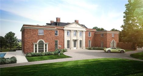
This was certainly so in the 1730s & early-1740s when Sir Redmond Everard from Co Tipperary, the Marquess of Caernarvon, Samuel Foot & possibly Lady Nassau were Tenants. In 1753 negotiations were begun for the Sale of the House for £1,500 to John Tilson, the son of the Under-Secretary of State, though the actual Conveyance was not signed until 1758. Tilson evidently Built the present Mansion in the fashionable Palladian Style in the mid-1750s and used the old Stonor House or part of it as Kitchen Quarters. Tradition ascribes the Building to Abraham Swan, a Leading Carpenter, but it cannot be substantiated. He was never a Plasterer so in any case cannot be responsible for one of the outstanding features of the House, the elegant Rococo Ceiling of the Drawing-room. The House appears to have remained virtually unaltered until the late 19thC when it was bought & enlarged by J F Symonds Jeune. Arthur Rensham & the Hon Oliver Brett, later Lord Esher, the respective Purchasers in 1920 & 1921, continued the work of enlargement & modernisation. In 1921 the Architect Philip Tilden designed a Columned Loggia and painted monochrome Wall Paintings in the Palladian style in the Entrance Hall. In 1928 the Victorian Northside was remodelled to the Designs of Lord Gerald Wellesley.
In 1954 Major the Hon Lionel Brett, the then Owner and himself an Architect decided to reduce the House to its Georgian dimensions. This involved the Demolition of the recent 19th & 20thC Work & the Kitchen Range, which was the nucleus of the original Stonor House. The Tilson Building now stands free. The main East front of Brick is of 2-Storeys crowned by a Pediment. The House has a modillioned cornice of wood, a Parapet, and flat-topped Slate Roof, with flat-topped Dormers. There is a central Doorway with a Doric Porch of Stone. The reduced House has been most successfully related to its environment by Major Brett. The Entrance Front has been extended by a pair of Brick Pavilions to fit the Avenue of Limes aligned on it and which was a principal part of the original Stonor Plan. A new rear-Court of Turf, Flagstones & Flint has also been made.
In the Village, Christmas Farm, once Tenanted by the Christmas Family, is now a substantial House of 5-Bays, built of coursed Flint with Brick quoins and Dressings. It has 2-Gabled Dormers, flanking Chimneys with Brick Shafts, and an 18thC Doorway, though parts of the House are earlier. The Stonors used to pay Quit-rents for it to Watlington Manor and it provided the Endowment for the Boy’s Grammar School. The Gabled ‘Fox & Hounds‘ (Upper Fox) close by also dates from the 17th & 18thCs. It is partly constructed of Flint & partly of Brick, and the Cottage at the back is Timber-framed. They formerly stood behind a Round Pond and formed a picturesque group.
Greenfield, though probably never a nucleated Village like those commonly found in the Lowlands of Oxon, has been settled since the early-Middle Ages. A Roger at Greenfield occurs as a Witness in 1327 and the Township almost certainly had Common Fields on the Hill in the Middle Ages. In the 16thC its name was used alternatively for Watcombe in Bailiffs’ Accounts of the Ancient Watcombe Fee and by the 18thC its name had entirely superseded Watcombe and the Upland part of Watlington Parish was called Greenfield Liberty. Rawlinson noted that the Village had ‘a pleasant Green‘, but in 1960 there were only the 2-Farmhouses of Upper & Lower Greenfield and some scattered Cottages left.
Upper Greenfield Farm was once called Ovey’s and later Lambourn’s, for John Ovey, an Overseer of the Poor in 1667, was the Chief Landowner in Greenfield in the 17thC and was succeeded by Richard Lambourn, probably his son-in-law. The House lies about 760-ft up and is now mainly an 18thC building of Brick & Flint. It was Rated on 6-Hearths for the Hearth Tax of 1665. Lower Greenfield Farm dates from the 17thC when it was known as the Manor-House and belonged to the Weld Family. It now has an early-18thC Right Wing and a 19thC Left Wing. Both Houses have Ancient Weather-boarded Barns, of which some were Thatched, and there was a 3-Bay Granary standing on Staddle Stones.
To the South-West of Lower Greenfield is Seymour Green. The early form of its name seems to have been Syresmerefield, which was sometimes described as ‘next Greenfield‘. Tenements, which were once part of the Norman Préaux Abbey’s Estate and later went to the Stonors, are mentioned there from the 14th to the 16thC. There were still a few Cottages there in 1960, but most of them were just on the Swyncombe side of the Parish Boundary.
Descending from the Chilterns to Watlington by Howe Hill the Road runs between the 2-Farmhouses of Howe Hamlet, so named from the Old English hōh, meaning a Ridge. Here probably was the Medieval Manor-house of Hoo Manor, and also possibly of Watcombe Manor too. In 1960 Howe consisted of a few Houses & Cottages. Howe Combe Farm, formerly called Howe Farm, lies at an altitude of 470-ft and was built c. 1620, added to in 1728 and altered in 1904. Its Jacobean Staircase was removed during the last alterations, but it still retains one 17thC open Fireplace. The House is constructed of Flint & Brick and makes a striking group with its Weather-boarded Outbuildings and pair of Timber-framed & Brick Cottages. The Cottages date from the 16thC or possibly earlier and may once have been the original Farmhouse. The Flint & Brick House opposite, called ‘The Howe‘, was occupied by the Tooveys, a widespread Family in this part of the Chilterns, and about 1728 they enlarged it so that it now has a 5-Bay Front. Some of its windows are mullioned & transomed and date from the 17thC. The Village, according to Rawlinson, had for ‘ages past been the habitation of the Tooveys‘. The 12thC Knightly Family of Hatcombe may have lived on or near the Site of this House, close to the Family of William de la Hoo, for there are still Atcomb Closes just above the Howe.

Howe Combe – Small Country House. Dated 1908. By T Frank Green. Flint with Red Brick Dressings, hipped Plain Tile Roof. Central Entrance Hall flanked by Dining & Sitting-rooms served by a rear Corridor; Stair Wing to rear right; Service Wing to rear left leading through to Service Courtyard. In Arts & Crafts Style with irregular Elevations. Brick Plinth, rusticated Quoins, bands, surrounds & Chimney caps; decorative use made of tile-on-edge; wooden leaded Casement windows, Transomed on the Ground-floor; 3-light Dormers with Hipped Roofs & Tile-hung cheeks; decorative dated Hoppers to Rainwater Pipes. 2-Storeys & Attic. Entrance, South-west, elevation: irregular 2:1:2-Bays. Near-central Gabled 2-Storey Porch: Brick step up to round-arched double-Door with moulded panels & decorative furniture; Tile Imposts & Voussoirs to stepped Brick arch; flanking gableted pilasters supporting Tiled Hood; 3-light window above with keyed Brick arch all in recessed panel; tiles in Gable read : AD 1908 AHD & ASD. To right of Porch, two 2-light windows on each Floor & one Dormer to Roof. To left, a 2-light window, two 1-light windows above and 1-Dormer. On their left, a decorative external Stack, semi-octagonal on Plan, with Tiled off-sets, triangular-section Pilasters with attached Brick Finials, 3-clay pots. To left again, Blind Bay under the sloping Roof. Oversailing Roof with exposed Rafter feet; Ridge Stack to right of Porch. Left return: 1:3:1:1-Bays. The 3-Bay Section has 2-light windows, a single Dormer, and broad cross-Ridge Stack on left; the flanking Bays are single-Storeyed under Cat-slide Roofs each with a 1-light window. The wider right-hand Bay projects under a Hipped Roof and has a 2-Storey 5-light Bow-Window with deep Cornice & flat Roof. Projecting from this Elevation on the left is the South-west side of the Service Courtyard: Single-Storeyed with two 2-light Hipped Dormers. Right return: on left, 2-Bay return of Main Range has 2-Storey 5-light Bow-Window to left and recessed Chimney Bay on right with Stack corbelled out on 1st-Floor. The return of this has 2-Bays under half-Hipped Roof with small 3-light Attic window, the left Bay having two 1-light windows to Ground Floor and a 3-light window above, all in a round-arched recess; the right Bay is a curved Stair Bay with a dominating 7-light double-transomed window with Tile off-set below & Conical Roof over. Service Wing has 1-light 1st-Floor windows, 2-Dormers, and is fronted by 7-Bay Colonnade linking it to the Service Courtyard Range. The Colonnade had Wooden Posts arch-braced to wall-plate, pent Tile Roof, herring-bone Brick Paving, and decorative open-work Gable to right Bay which has Board Door through to Service Courtyard & Bell (2 left Bays now glazed to form part of Kitchen). The Service Range continues to right, having Board Doors & small-pane windows; 2-Gabled projections (20thC infill between). Within Service Courtyard is Wooden Colonnade, partly infilled 20thC, fronting various Outbuildings with Board Doors & small-pane windows; at the South-west Corner is decorative Iron double Gate hung from Brick Pilasters.

Interior: largely unaltered, with original Woodwork including Skirting boards, picture Rails & Cornices; panelled Doors with decorative Iron-ware, window seats, cupboards & closets; Fireplaces with glazed Brick surrounds & decorative Architraves; decorative Iron catches to windows. The Dining & Sitting-rooms have moulded coffered Ceilings, wide Ingle-nook style Fireplaces with decorative Iron Stoves. The Dining-room has elaborate buffet & cupboards; the Sitting-room a Peacock Tile frieze to Fireplace & Pilastered surround & Ingle-seats. Entrance Hall has decorative Iron Chandelier & stencilled Compass to Ceiling.
Stair: dog-leg with Landing in window, turned Newels, moulded hand-rail, decorative Iron Lantern.
1st-Floor: Linen Cupboard off Corridor. Numerous Closets with brass hooks & rails and vented doors; Pilastered surrounds to windows in Rear Corridor.
The 3-Hamlets of Ingham, Syresfield, & Watcombe cannot now be Located with any certainty, and indeed the early-18thC Schoolmaster of Watlington Boy’s Grammar School, Mr Fairfax, who collected information with such ‘great assiduity‘ for Rawlinson could not then tell where these Hamlets lay. They were almost certainly deserted in the Middle Ages, as a result possibly of either Pestilence or Inclosure or both combined.
In the early-Middle-Ages Watcombe was the most important of all the Hamlets: it gave its name to Watcombe Fee; it was the centre of Préaux Abbey’s Large Estate, and for a short while, it had a Chapel of its own, but its Site is now a puzzle. The problem of Locating the Village is complicated by the existence of Watcombe Fee which had Land in all parts of the Parish. Nevertheless, there is enough evidence to indicate that the Hamlet was identical with the modern Howe or lay fairly near it. The name, meaning Wheat Coombe, suggests that it lay at the Foothills, and there is evidence that a Garden in Watcombe lay near the Icknield Way; in the 17thC ‘Chapel Close‘, which presumably took its name from the Medieval Chapel, was on the Hill just above Howe, and in the Reign of James I half Watcombe Manor was described as 6-Tenements in Howe.
Ingham is mentioned in 2-Anglo-Saxon Charters. From one it is clear that its Territory Lay on the Britwell Boundary and so it must have been Sited somewhere in the West of the Parish. An Estate at Ingham (Adingeham) is recorded in Domesday Book, and the name frequently occurs in Medieval & later Documents. An Estate Map of 1780 shows Ingham Lane South of Watlington and it is not unlikely that Ingham was Sited where Watcombe Manor now is. Local tradition supports this hypothesis: in 1816 John Badcock wrote that Ingham Manor-House was by Tradition in the Rick-yard of Watcombe Manor Farm. Common Ownership of Ingham & Watcombe Manors in the 18thC might well have led to Ingham Manor-House being renamed Watcombe, which was the more important Property.
Syresfield was a Medieval Tithing and its Tithingman is mentioned as attending Watlington Courts as late as the 15thC, but thereafter the name of the Hamlet disappears from the records. There were 13thC Lords of Syresfield, and in the 14thC, there are records of Dwellings there. It was certainly a part of the Watcombe Fee.
It is possible that there was another small Settlement at Anthills near Dame Alice Farm. The name of the Land is derived from its 13th & 14thC Owners William & Adam Anketil, who paid a fairly high Tax in the Tax Assessments of 1306 & 1327.
In the Middle-Ages Watlington was distinguished from its rural neighbours by being a Market-Town and consequently a more populous place. As its Manor belonged to the Honour of Wallingford it had also some importance as an Administrative Centre of the Honour, and the Park created by Richard, Earl of Cornwall, in the 13thC often brought the Earl and his son to the Town. They stayed presumably at the Manor-House near the Church, though there may have been a Hunting Lodge in the Park. Watlington’s 2nd largest Manor belonged to the Norman Abbey of Préaux, and the Abbot or his Representative stayed at Watcombe when they came to collect their Rents. Later the influential Family of Stonor, the successors of Préaux Abbey, were closely connected with the Parish. In the post-Reformation Period, apart from the Roman Catholic Stonors and in the mid-18thC the Tilsons at Watlington Park, the Chief Local Families were members of the lesser Gentry, Yeoman, or Trading Class. Such were the Tooveys of Howe & Greenfield & the Hornes of Watlington. The Parish was noted for its Nonconformity. In addition to the Roman Catholic Stonors & Simeons, there were the humbler Families of Protestant Nonconformists, the Quaker Whites & the Baptist Oveys.
During the Civil Wars Watlington was in the Middle of the Fighting Area for several years. Royalist Forces were Quartered at Watlington & Brightwell in April 1642 & straggling Companies were Plundering in the neighbourhood. In August 1642 Colonel Hampden Led a Force from Aylesbury toward Watlington, but they were turned back by the Royalist Forces. It was in this year too that the House of Commons, hearing that the Earl of Berkshire and others intended to Execute the King’s Commission of Array at Watlington, Commanded General Whitelock to prevent it & Ordered Troops under Colonels Goodwyn & Hampden to assist him. The Commissioners Fled to Sir Robert Dormer’s House at Dorton (Bucks) and were pursued there, where several of them, including a ‘Gentleman of Quality‘ from Watlington, were taken Prisoner. In May 1643 7–Troops of Royalist Horse were reported in the Town on their way to Wallingford and later, Troops from Wallingford were collecting Hay & other Provisions at Watlington & Goldor in Pyrton. In June, 200–Parliament men in Watlington Park chased off some of the King’s Horse approaching the Town. In the following year, Royalist Forces from Towcester came to Watlington in January and began Fortifying it. It was Reported that the King intended to keep a Garrison there under the Command of Sir John Wake & Sir Lewis Dives, but in February the Royalists left to Quarter nearer Oxford.
Some 150-yrs later Watlington prepared to meet a French Invasion by raising a Volunteer Troop of Cavalry. It was called the Watlington Division of the Oxfordshire Yeomanry Cavalry & Lord Macclesfield was the Captain. Sixty Privates ‘of respectability‘, a Trumpeter & a Farrier were Hired. Earlier in the Century, the Town had been the Centre of another kind of Fight when the 2nd Lord Macclesfield Feasted 300-Freeholders of Watlington during the ‘Great Election‘ Campaign of 1754.
The Local Antiquarian John Badcock has left a noteworthy description of the Town in the early-19thC. He says that the inconveniences of bad Roads in Winter, ill-paved & dirty Streets and bad Drainage were gradually disappearing; that the Principal Inhabitants were well informed, Social as well as Industrious; that a ‘proper sense of superior Rank and Talent, and the various Orders and Gradations which so much tend not only to the well being but even to the existence of a Community, was entertained and acknowledged; the minor and nice distinctions of situation which are too often the bane of Society in larger Market Towns was not so scrupulously observed here‘. In fact, the Inhabitants of Watlington were very Neighbourly & very Hospitable.

The Watlington Hoard was discovered on Private Land by Metal-detectorist James Mather in 2015. Comprising about 200-Coins (some of them fragmentary), 7-Items of Jewellery & 15-Ingots (Bars of Silver), the find is not particularly large, but it is hugely significant because it contains so many Coins of Alfred the Great, King of Wessex (r.871–899) and his less well known contemporary, Ceolwulf II of Mercia (r.874–c.879). The Hoard contains 13 examples of the rare ‘Two Emperors’ Penny that shows Alfred & Ceolwulf seated side by side below a winged figure of Victory or an Angel. The Image on the Coins suggests an Alliance between the Kingdoms of Wessex & Mercia.

This challenges the Accounts found in written sources which dismiss Ceolwulf as a Puppet of the Vikings. Ceolwulf II, the last King of Mercia, quietly disappeared from the Historical Record in uncertain circumstances and Alfred and his Successors then forged the New Kingdom of England by taking control of Mercia, before Conquering the Regions controlled by the Vikings. The Hoard can be dated by the presence of a single ‘Two-Line’ type Penny which was not produced until the late 870s, after the Battle of Edington, Wilts (May 878, Ethandun) between Alfred’s Forces and a Viking Army. Viking Forces moved both by Water & Land, and they likely used the Ancient Trackway known as Icknield Street which passes through Watlington, close to where the Hoard was found. It is possible that the Hoard was buried in the Wake of this violence or during the ensuing movement of peoples.

Reproduced from VCH Oxfordshire, availableat Brith History Online
