
How do Chalk Streams Form?
During the Winter, when Rainfall is heavy & able to Percolate through the Chalk, the Aquifer will be well topped up. The Head of the Stream moves up the Valley as the Water Table Rises. In Summer, little Rainfall Percolates into the Chalk as it is mostly taken up by Plants & Lost through Evaporation. The Water Table Drops & the Head of the Stream moves down the Valley, leaving the Top Section of the Stream Dry. This Section is called a ‘Winterbourne’ because it only Flows after the Winter Rains. Winterbourne Streams have their own special Wildlife which is adapted to cope with Intermittent Flows.
The Hamble Brook Flows through the peaceful Hambleden Valley, Bucks in the heart of the Chilterns Area of Outstanding Natural Beauty. The comings & goings of this delightful little Chalk Stream Brook are well Documented. In recent years it has spent Long Periods without Flow &, most recently, was Dry for 2-yrs during the Severe Drought of 2011/12. Now, however, after one of the Wettest years on record, the Hamble Brook has Sprung back to Life. This footage was Filmed for the Chilterns Chalk Streams Project on 19th February 2013. Led by the Chilterns Conservation Board, the Chilterns Chalk Streams Project is a Partnership which aims to Protect & Conserve the Chalk Streams of the Chilterns AONB & to encourage enjoyment & understanding of them. It rises in the aptly named Frog or Water Lane in Turville Valley & joins the River Thames at Hambleden Mill End. When Groundwater Levels fall further the entire River can Dry. The Hamble Brook is a naturally Ephemeral River.

The Fingest Church Graveyard has been known to Flood. The Fingest Bourn, a Tributary of the Hamble Brook that runs down the Hambleden Valley to the Thames at Mill End, is the rarest of the Tributaries of the Brook. It rises from Springs North of the Church & now usually Runs in the Highway Drains of Chequers Lane, but very occasionally these are Overtopped & the Flow of water appears in the Carriageways & in the lowest part of the Churchyard, where it can form a large Pond. These days the Level is kept in check by a large Gully leading to a Culvert under Fingest Lane at the side of the Chequers Inn Car Park. The Flow then emerges in the Copper Beech Field flowing down the Valley through Hespers joining the Brook at the Skirmett side of Keepers Cottage (now called Fingest Hill Cottage).


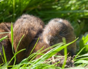
Ewelme Brook: There are only 210-Chalk Streams in the World, of which 160 are in England. Although, at around 2.5-miles, Ewelme Brook is the shortest Chalk Stream in the Chilterns we are privileged to have one of these Globally endangered important Wildlife Assets Flowing through this Village. The Brook brings a spine of natural beauty right into the Village & connects up with our nearest Local Nature Reserve, the Ewelme Watercress Beds. The Brook is important for Wildlife with some of the Birds including Kingfisher, Grey Wagtail, Grey Heron & Little Egret. Brown Trout & Bullhead can be seen if you look carefully, Water Voles have been recorded in the past but Less welcome news is that non-native Signal Crayfish are present. The lower reaches of the Brook flow through Benson’s most important area of semi-Natural Habitat, the Area around the Cuckoo Pen Nursery & Millbrook Mead. The 260M Culvert
between Benson & Ewelme is a Major Barrier to Wildlife. Click to Access Ewelme-Brook.pdf

Chalk Streams are fed from Groundwater held in the Chalk that makes up the Chiltern Hills, and this gives them some unusual features. Chalk is an Aquifer, which means that it is able to Soak up & Hold Water – a bit like a Sponge. Water can move through the Chalk in Cracks called Fissures. The Water emerges at Ground Level in the form of Springs that feed the Chalk Streams. Since Groundwater Levels in the Chalk vary according to Rainfall & Season, Chalk Streams are naturally Intermittent in their Flow.
Chalk Streams are a characteristic & attractive feature of the Chilterns Landscape. They are also a Globally rare Habitat, confined to North-West Europe & to the UK in particular. In fact, more than 85% of all the Chalk Streams in the World, are found in England. Chalk Streams are important Habitats for Wildlife & support a massive range of Plants & Animals. They are home to some of our most threatened Plants & Animals, such as the Water Vole & Brown Trout. They also have a fascinating History & supported many thriving Industries in the Past. The Chilterns‘ Chalk Streams are so important that a special Partnership Project has been created to Conserve them. Uniting all the Organisations with an interest in the Streams, the Chilterns Chalk Streams Project works with Local people across the Chilterns to improve River Habitats, improve Access & Enjoyment & promote the sustainable use of Water. Assendon Valley Spring

Discover – Chalk Streams
Eight Major Chalk Streams have their source within the Chilterns Area of Outstanding Natural Beauty, flowing South-eastwards down the Dip Slope of the Chalk Escarpment. The Hughenden Stream, River Wye & Hamble Brook Flow directly into the River Thames, whilst the River Ver, River Gade, River Bulbourne, River Chess & River Misbourne Flow into the River Colne & then into the River Thames.
River Ver: Rises in the Chiltern Hills close to the Beds/Herts Border near Lynch Lodge, Kensworth Lynch, on the West side of the A5 Trunk Road & stays on the West side for some half-mile or so. Afterwards crosses under the A5 in Culvert & runs through Markyate. The River exits above Ground at the Southern end of Markyate & on through Flamstead, Redbourn, St Albans & Park Street, finally joining the River Colne at Bricket Wood. It Flows for approximately 36-km & drops 60M over this Distance. The Ver has 1-Tributary, the River Red, which joins the Ver just South of Redbourn. The Ver has a rich & varied History. There is evidence of Human occupation as far back as 3000-BC. The Romans created an important City near the Ver, called Verulamium. The Perennial Head of the River has moved Downstream about 5-km (Markyate to Redbourn) in the past 70–yrs, while in that time Abstraction has increased substantially to 24M-Ltrs per day.
River Gade: The River Gade is about 25-km Long & Falls 60M on its way to join the Colne. The River Gade is a River running almost entirely through Herts. It rises from a Spring in the Chalk of the Chiltern Hills at Dagnall, Bucks & Flows through Hemel Hempstead, Kings Langley, then along the West side of Watford through Cassiobury Park. After passing Croxley Green it reaches Rickmansworth, where it joins the River Colne. The Gade & its Main Tributary the fully Flowing Bulbourne is about 7-miles in length & Downstream it finally Joins with the River Gade at Two Waters, in Apsley, near Hemel Hempstead. Along its Course, it has suffered many Diversions over time, including being Culverted in places entering Berkhamsted & then Ignominiously being Forced to weave in & out of the Canal, both in, & Downstream from, Berkhamsted. The River’s Headwaters & even down to Northchurch, are known as a Winterbourne River, whereby it is expected to Dry out at some Period during the Summer. In addition to the Abstraction, Modification & Culverting suffered by many of the Chilterns Streams, in several places the Gade Joins & is Lost entirely to the Grand Union Canal. This has Series Impacts on Water Quality & Wildlife. Above Hemel Hempstead the Gade is a high quality Chalk Stream with Mayflies, Caddisflies & Trout. Further Downstream in places where the River is Deep & Silty have fewer Invertebrates & some Coarse Fish, such as Roach, Chub, Perch, Bream & Carp.
The Bulbourne – is a small River in Dacorum. The word Bourne derives from the Anglo-Saxon word for a Stream. It is an unnavigable Tributary of the River Gade, which Flows into the River Colne, which in turn is a Tributary of the River Thames. The River is reduced in size, due to Human activity, the main one being the Building of the London to Birmingham Grand Union Canal through the Narrow Valley which takes most of the River’s Water. The River runs in a South-easterly direction from between Cow Roast & Dudswell in Northchurch, through Berkhamsted, Bourne End & Boxmoor, to where it joins the River Gade at Two Waters in Apsley near Hemel Hempstead. The current total Length of the River is 7-miles (11-km); from its Source to its Mouth it falls 30M (98-ft). The Bourne Gutter is a short 400-yds (370-M) Tributary of the Bulbourne, Rising between Berkhamsted & Bourne End. In very Wet years it Runs from Springs nearly 3-miles further up a side Valley, near Hockeridge Bottom. According to Local Legend it is a “Woe Water“, said to only Flow at a time of National Emergency. This is a Wintebourne & only Flows at time of High Groundwater. Of all the Chilterns Streams these Rivers have suffered the greatest Damage by Human activity.

River Chess: The Chess is a clear Fast-flowing River which Rises North & West of Chesham & Flows South East through Chorleywood to join the River Colne at Rickmansworth. The Chess supports a good range of Wildlife, including Brown Trout & Grayling. The Chess is the Last River in the Chilterns to hold on to a Water Vole Population (although a Populations have now be re-introduced elsewhere). The Water Vole is Britain’s fastest declining Mammal. Water Vole Colonies can be found along much of the River, feeding on the lush vegetation & Burrowing in the Riverbanks. Volunteers Survey the Population every other year. Click to Access Cherishing-the-Chess.pdf

River Misbourne: is 27-km in Length & Falls 90M over this Distance. Its Traditional Source is Mobwell Pond, North of Great Missenden, although its Source moves Seasonally Upstream & Downstream. The River passes through Great Missenden, Amersham, Chalfont St Giles & Chalfont St Peter before joining the Colne near Denham. The Misbourne has always suffered from Low Flows. In 1771 the Mills on the River were forced to Close for a long Period due to Lack of Flow. This Drying not only effects the Winterbourne Section at the Head of the River, but also the Middle Section from Amersham to Chalfont St Peter. There are 2-Main Factors which explain the Drying of the Middle Section. Firstly Local Geology is important. North of Amersham the River Flows over New Pit Chalk, which is described as ‘hard white Chalk with few Flints’. South of Amersham, there is a change to Lewes Nodular Chalk, described as ‘soft white Chalk with many Flints’. The softer material is likely to be more widely Fissured & hence more Permeable than the Middle Chalk. The 2nd Factor relates to Historic modification of the Channel, mainly for Milling. In a number of places the Channel has been raised on Embankments to create the Head of Water needed to turn the Mill Wheel. Water finds its way back down to the Chalk of the original Channel Bed wherever possible, so disappears from the Surface.

River Wye: Rises North West of West Wycombe in the Radnage Valley & Flows South East for approximately 17-km to join the River Thames at Bourne End. The Upper Reaches of the Wye near West Wycombe & Hidden River – in 1967, as part of the ‘Modernisation’ of the Town Centre the River Wye was diverted through Underground Pipes for around 840M of its length. At the time the Wye was a Polluted River & there was some Public support for removing it from sight. Unfortunately, the Toute of the Wye through the centre of High Wycombe cannot be seen until it emerges from a Culvert at the back of the Fire Station by the Swan Theatre. From there it passes under a Bridge in Queen Victoria Road to emerge for a short stretch in the small Gardens by the side of the Council Offices, before submerging again under the A40 & reappearing close to the entrance to the Rye Public Open Space. Eastwards from the Town Centre as far as Loudwater, the majority of the Main Stream has Public Access where it runs alongside the Rye, Holywell Mead, Wye Dene, the Wycombe Marsh Retail Park, London Road, King’s Mead & Boundary Park. As well as the Main River, a Backstream, often called Wycombe Marsh Brook, Flows from the Spring-fed Watercourses in Wycombe Abbey Grounds via the Dyke, a wide Artificial Watercourse alongside the South side of the Rye & part of Holywell Mead. It continues via Marsh Green, along Bowden Lane, between the Wye Dene Development & the former Railway Track & then along Kingsmead Road & the South side of King’s Mead to rejoin the Main River at Boundary Park. Additional Side Streams at the Eastern end of the Rye & in Boundary Park at Loudwater are Legacies of former Mills. The Beech Road Ford, adjacent to Kingsmead Road & the Deep River Channel near its Junction with Station Road in Loudwater are also linked to Historic Mills. The complex system of Watercourses between Loudwater & Wooburn Green also dates back to the numerous Former Water Mills in that area. A very good remaining example is near the Junction of Knaves Beech Road & Boundary Road where some of the Leats of the former Hedge Mill can still be seen. Former Mill Ponds & side Streams relating to the former Glory Mill are still visible, some having been retained as Landscaping features within Redevelopment Schemes. The Wye re-emerges into a Rural Landscape at the bottom of Holtspur Hill from where it crosses Meadows to the foot of Windsor Hill before Winding its way round Wooburn Manor Park to Town Lane, alongside Wooburn Park Recreation Ground & then Brookbank at Cores End. Much of the Wye between Cores End & the Confluence with the Thames near Andrews Reach, apart from Claytons Meadow Recreation Ground, has no Public Access. Views of the River however can be seen from Road Bridges within Housing areas & within the modern Business Parks in Bourne End where the River has been Incorporated within the Landscaping.
Historical Note: The Wye is Historically very Important. Its Waters attracted human life into the Wye Valley & Led to the Development of the Settlements that lie along its Course. The Wye was a source of Food & Water & also the Power that at one time drove over 30–Mill Wheels along its length. Many of the Mills that initially ground Corn into Flour or made ‘Fulling’ Cloth later changed to making Paper, for which the Wye Valley became a Major Centre. Some reverted to Corn Milling following Consolidation in the Paper Making Industry. The Wye Mills gained National Attention in 1830 when many Hand-paper Makers Rioted, smashing some of the New Paper Making Machines that had replaced them. With its close proximity to the Chiltern Woodlands, the River also Powered Saw Mills & other Machinery that supported the Local Furniture Industries. Over time, the Natural Course of the River was extensively modified to facilitate Milling & also, in its Rural Areas, to create Water Features in Private Parklands or to Aid Farming. These Developments, especially the Industrialisation of the Wye Valley & the Density of Housing, much of poor quality, that followed, had a dramatic impact on both the Landscape of the River Wye & its Water Quality. The Pollution caused by Industrialisation has been reduced significantly in Modern Times, but the Wye still remains vulnerable to the type of incidents & abuse that often unfortunately occur when a Fresh Water River runs through a Large Town.
Hughenden Stream, sometimes called the Hitchin, is a Tributary of the Wye which Rises near Cryers Hill. The Hughenden rarely Flows above the Pumping Station at the foot of Cryers Hill, but the Roadside Ditches in Warrendene Road & the Contours of the North Dean Valley beyond the Harrow Pub indicate that it has the potential to Flow from either or both of these Valleys in unusually Wet years. Although Classed as a Winterbourne, the Hughenden has a History of ceasing to Flow entirely, not just in Summer but for several years, following a succession of Dry Periods. The Hughenden Stream also enters a Culvert for the Last Section of its length, meeting the Wye somewhere underneath the Large Sainsbury’s in Wycombe Town Centre. This Culverting means a significant Section of River is devoid of Life & also presents a Series Barrier to Wildlife movements Up & Down River. The Hughenden Stream joins the Wye shortly after it enters the Town Centre Culvert.

Chalk Streams in Crisis
There are c.20 small Streams that rise from Springs along the Base of the Scarp Slope from the Ewelme Brook near Wallingford in the South to the Barton & Burwell Springs, North of Luton. The Ewelme Brook Flows directly into the River Thames, whilst the other Streams Flow North into the River Thame through a predominantly Dry Landscape.
Kingsey Cuttlebrook: This Water Course has 2-Arms, one running down from near Princes Risborough (the Kingsey Cuttle brook) & the other from near Chinnor (the so-called Chinnor Brook): with a further 2-Arms that Rise near Upper Farm, Henton & the Railway Line at Wainhill. The Former takes the Outflow from the Princes Risborough Sewage Treatment Works (STW), the latter from the STW at Henton (often called Chinnor STW) & another at Towersey. The 2-Branches converge 300M upstream of the Cuttlebrook Koi Farm (near Towersey) before continuing on to join the Scotsgrove Brook between Thame & Haddenham. Much of the Kingsey Cuttlebrook is the Boundary between Oxon & Bucks.

The Scotsgrove Brook: – starts off in Little Kimble, flows past Bishopstone & through Ford before skirting Haddenham & joining the Kingsey Cuttle Brook. Both Haddenham & Stone Sewage Treatment Works discharge into this Brook, resulting in the potential of a very large Phosphate, Nitrate & Ammonia load. Additionally, a Lot of new Housing Estates being added to the Villages will increase the Sewage Flow considerably. However, Thames Water maintain that the STW is more than capable of dealing with the Loads placed on it.
Chalgrove Brook in Oxon. It is made up of 3 small, Scarp-face Tributaries that rise in Lewknor, Shirburn & Watlington.
