The North was added to distinguish North Weston from South Weston. Both were originally just Weston, which is Anglo Saxon for a Homestead or Township to the West of some other place.
The Parish of South Weston was Abolished in 1954 when it was United to Lewknor, to which it had already Lost 25-acres in 1932. The Ancient Parish covered 460 acres & was the smallest in the County. It lay in the Plain at the foot of the Chilterns between the Parishes of Shirburn, Aston Rowant, Lewknor, Adwell, & Wheatfield. It had no natural Boundaries or marked physical features, except for Weston Brook, the Boundary line with Shirburn & that was so winding that local people, as Rawlinson recorded in about 1718, used ironically to say ‘as straight as Weston Brook‘. The Parish was Divided into 3-parts by the Road running from Lewknor through Weston Village to Adwell & Wheatfield & by ‘Salt Lane‘, which skirted Adwell Cop to join the London Road at Postcombe. The last was a Grass Road in 1847 & is now a Secondary Road.

In South Weston, a non-Conformist Chapel & a Public House were built in about 1600. The Pub was called The Salisbury Arms. After the Chapel became unused, the Chapel was converted into a Barn for the use of the Pub Owners. The Pub was converted into a House in 1982 & is now called Salisbury Lodge. Weston claims no ‘Worthies‘ & no Events of any importance are known to have occurred there. Except:-
Civil War Skirmish 1643: The Royalists, who at 07.30 were 2-miles away at Aston Rowant. At a Canter it took 15-mins for Sanders & Buller’s men to get to Aston Rowant & ½-mile ahead was Gunter’s men harassing General Percy’s Regiment. By 08.15 the Royalists were 1½-miles on from Aston Rowant in the direction of Chalgrove, near the Village of South Weston. The Highway to Weston is a Track shown on the 1797 Map & is depicted beginning at South Weston. The Track continues through Stokefield (Farm Nr Knightsbridge Lane) & up to Clare Crossroads at the Junction of Stoke Talmage Lane. This Lane joins the Ancient Track to Easington & Chalgrove & is also on the Direct Route from Thame. The Principal Officers who had left Thame before 08.00 would get to Clare Crossroads, a distance of 6-miles, on their fine Steeds, in around 35-mins.
Captains Sanders & Buller, Galloping in from Chinnor, joined Forces with Gunter, Crosse & Sheffield at around 08.00. At about 08.15 these 300 men Skirmished with the Royalists at South Weston trying desperately to slow them in the hope of Reinforcements from Thame. Parliament’s Men were ferociously attacked by Prince Rupert’s own Regiment & General Percy’s Regiment, 600-men, causing the Parliamentarians to be so ‘overborne with multitude, they Broke & Fled’, as related by Essex in his Letter. After beating up their Enemy the Royalist Troopers Galloped off to catch up with their Foot, leaving their Adversaries licking their wounds. This is the Skirmish that was confused with the Battle of Chalgrove & outlined in Essex’s letter as The Battle. Captain Dundasse’s Dragoons, who had left Thame at approximately 07.30, probably heard the Gunfire from the Skirmish. They may have seen the Royalist Infantry passing through Clare Crossroads & their Cavalry Galloping away to join them. Dundasse greeted Gunter with the News that Reinforcements were on their way from Thame.
Early OS Map of Oxford County 1797
Surveyed by Local man, Richard Davis of Lewknor & Published in 1797. This Large Map consists of 16–Sheets at an impressively detailed Scale of 1:31,680 or 2-ins to 1-mile. No more than 200-Copies were ever made, evidence being based on all Sets of the Map having Manuscript Serial No.s – this Image is part of No.34. Very few complete Copies Survive. In terms of what the Map shows, a clear break has been made from the Christopher Saxton-led traditional County Map, as here far more detail than previously is featured. Not only are County & Hundred Boundaries, Rivers & Streams, Towns & Villages, Parks & Woodland depicted, but here we have Roads, Tracks, Hedges, indeed every Field can be seen, and relief is beautifully represented by the use of hachures. Davis was also Topographer to His Majesty, George III.

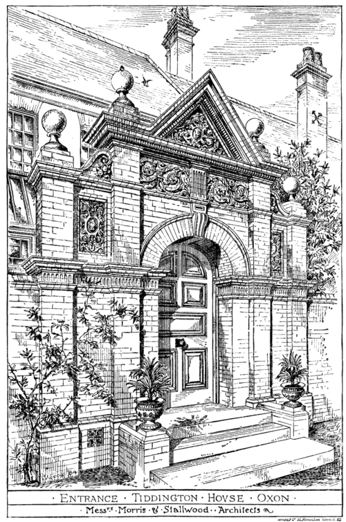
The Village of South Weston, or rather Hamlet, lies about 350-ft up on the West Brook some 3½-miles North of the Market-Town of Watlington. Its Dwellings straggle along the Road from Lewknor to the Church at the North End & along a Branch Road running Westwards to the Rectory. In the 17thC, there were 4 substantial Farmhouses besides the Manor House & Rectory. There were 4 other Houses occupied by Villagers who were sufficiently well off to be assessed for the Hearth Tax & probably a few unrated Cottages. At the end of the 18thC there were 24-Houses and in 1847 the Tithe Map shows 5-Farmhouses lying on either side of the Road to the Rectory, the Manor-House on the Lewknor Road & most of the Cottages clustering around the Church.
South Weston Tithe Map 1847
The largest of these was a Public House, called the ‘Salisbury Arms‘ & next to it, as was so often the case, was the Wesleyan Chapel. Nearby was the Village Bakehouse. On account of the decline in Population, many of the old Houses have now gone (c.1960). Apart from its Church, the most important Building is the Manor-House,
Built of Flint with Brick Quoins & Window Surrounds. The original ‘Mansion House‘ was a Building of 4-Bays with 2-Storeys & an Attic and was Built soon after 1728 for Thomas Cooper, who pulled down the Old House. In 1794 it was said to have 2-Parlours & a Study. It was extensively altered & enlarged in the 19thC. Another Bay, matching the others was added at the East end, the Attic Storey was removed and a new Slate Roof, with a wooden modillioned Cornice & New Chimney-Stacks, were added. The Granary of Brick & Timber standing on Staddle Stones, close to the House, has on it 1713 RCE.
OS Map 1919 Sth Oxon XLVII.3 (South Weston, Postcombe)
The Rectory was rebuilt in 1842 by the Patrons, the Queen’s College. The 17thC Rectory was an 8-Roomed House, which included a Hall or Study & stood in an Acre of Ground, with Barns & Stables. A Hop-garden was added to the Original Garden & an Orchard in the 18thC.

Manor: In 1086 Hugh d’Avranches, Earl of Chester, was recorded as Holding an Estate Assessed at 9-Hides in Weston. It is probable that part of Wheatfield, Warmscombe (in Watlington) & part of Wormsley were included in this total. The Overlordship, like that of Ardley in Ploughley Hundred, Descended through the Earls of Chester, who were also Lords of the neighbouring Manor of Pyrton, to the Earls of Arundel. In 1235, for instance, both Weston & Ardley were said to be held of the Fee of Hugh d’Aubigny, Earl of Arundel, under his Honour of Coventry. The South Oxfordshire Holding was described in 1242 as 1-Fee in Weston & in half of Wheatfield. Warmscombe is not mentioned, but there is little doubt that it was included in the Fee as it was in 1279 & in the 14thC & that this Estate & Wheatfield were reckoned as ¼-Fee each. Wormsley, which is also not mentioned, had already been Alienated to Abingdon Abbey. In 1243 Hugh d’Aubigny’s Lands were divided between his sisters & the Weston Fee like Ardley must have passed to Cecile, the youngest sister & her husband Roger de Montalt, for in 1275 their son Robert de Montalt held 1½-Fee in Ardley & Weston. In 1327 their Descendant Robert, Lord Montalt (d.1329), Sold the Reversion of all his Lands after the deaths of himself & his wife to Queen Isabella, her son John of Eltham & the King successively. Ultimately in 1358, the Overlordship reverted to the Crown. In 1346 Fulk de Rycote was returned as Lord of the Fee in Weston, Warmscombe, & Wheatfield & in 1428 Sir Walter de Beauchamp was said to Hold Lands described as ‘lately Fulk de Rycote’s‘. Both men Held other Land in the neighbourhood & their Tenancies were evidently Leases from the Overlords.

The Mesne Tenant in 1086 both at Ardley & Weston was Robert d’Oilly, the 1st Norman Constable of Oxford Castle & Lord of many other Oxon Manors. Like other D’Oilly Lands Weston became Merged in the Honour of Wallingford & subsequently of Ewelme. On Robert’s death in 1094 Weston passed to his brother & Heir Nigel (d. c.1115). Nigel’s son Robert (II) d’Oilly gave the Church and part of the Tithes to Osney Abbey but apparently no Land & the Mesne Tenancy of the Manor remained in the D’Oilly Family until the time of Henry (III) d’Oilly, when Weston was probably confiscated in 1215 with the rest of his Lands. His Estates were restored in 1217 & on his death in 1232 Weston like Ardley passed to Thomas Newburgh, Earl of Warwick & the Mesne Tenancy like that of Ardley followed the same Descent as the Overlordship of Bucknell in Ploughley Hundred. Weston was held by the De Plescy Family from 1263 until 1379, when John Lenveysy, who had taken the name of Plescy, died without Heirs. His Rights passed to his Widow & through her to her 2nd husband Philip de la Vache. Philip exercised Rights of Overlordship in 1389 & 1390. Later the Mesne Tenancy may have passed to the Suffolk’s as at Ardley, but there is no record.
The Demesne Tenant of the Manor in the 11thC was Drew d’Aundeley, Lord of Ardley & Hardwick & of the neighbouring Manor of Shirburn, all of which were held of Robert d’Oilly. Domesday does not actually state that Drew d’Aundeley held Weston, but the fact that he had 3-Houses in Wallingford in 1086 which were said to ‘belong’ to South Weston & Shirburn implies that he was in Possession of these Manors. Moreover, when he became a Monk of Abingdon in about 1100, he gave the Abbey 1-Hide of Land in Wormsley, Woodmunslea in Weston, in fact, all the Upland part of his Weston Manor in this area except for 25-acres. As at Ardley Drew’s successor was his son-in-law, Roger son of Ralph, a nephew of Nigel d’Oilly his Lord. Roger had been followed by c.1145 by his son Ralph, for in a Papal Confirmation of that date the Manor was described as Westona Radulfi cognati. Weston Descended in this Family, known after 1268 as Fitzwyth, until the 14thC. Ralph son of Robert is recorded as Presenting to Weston Church about 1215 & in 1227 & his brother Guy, Sheriff of Oxfordshire Held the Fee in 1235 & in 1250/1. In 1279 Guy’s son John Fitzwyth was in Possession & was said to Hold of the D’Oilly Barony. His son Robert Fitzwyth succeeded him in 1309, but both Robert & his son Guy died in 1316 when Guy’s Heir was an infant daughter Elizabeth. In 1318 Hugh de Plescy, the Mesne Lord was recorded as having custody of the Manor. A relative, a John Fitzwyth, was in possession of at least a part of the Family Estate, i.e. Shotswell (Warks), in 1326 & had been succeeded by 1345 by Robert Fitzwyth. In 1349 Robert was said to hold Weston, Ardley, Wheatfield, & Wigginton for 3-Fees & he was in Possession in 1354, but it is likely to have been his nephew Robert who Presented to the Church in 1360. This Robert Fitzwyth was murdered in 1362 & his Land & Heiress were in the King’s Wardship in 1364/5. By 1367 John de Beauchamp, the husband of Robert’s daughter Joan by his 1st wife had apparently succeeded to the Manor for he Presented to the Church in that year. A 3rd of Weston was included in the Dower of Robert Fitzwyth’s Widow Joan in 1369 & was among the Lands released to Joan de Beauchamp in 1370. On her death in 1389 her son John de Beauchamp was a Minor & was still so in 1398. In 1420 he was succeeded by his daughter Margaret, wife in turn of John Pauncefoot, John Wysham, & Sir Walter Skull. John Wysham was Lord of Weston in 1422. Margaret was still alive in 1452 but had died by 1472. She left 3-daughters as her co-Heiresses: Alice, who married Sir John Guise; Joan, married 1st to a Westcote & before 1487, to John Croft; & Elizabeth, wife 1st of Thomas Croft (d.1488) & then of Nicholas Crowemer. When Elizabeth Crowemer died in c.1500 her Share reverted to John, the son of Alice Guise & to Joan & John Croft. In 1513 John Croft & Elizabeth, presumably, his 2nd wife conveyed their half of Weston Manor & Advowson to Simon Rice, Citizen & Mercer of London, who may have been acting as an Intermediary for Sir John Williams of Thame. The precise stages by which both halves of the Manor & Advowson passed to Sir John have not been traced, but he was in Possession of both in 1559. He obtained the Guise Moiety in 1539 from John Guise, son of Sir John Guise (d 1501).

Sir John Williams (d.1559) left instructions in his Will for Weston Manor to be Sold to pay his Debts & Funeral expenses. This was done, for Weston came into the hands of the Carleton’s, Lords of Brightwell Baldwin & Britwell Salome & in 1571 Anthony Carleton Sold Weston ‘Manors’ & Advowson to a William Waller. Waller Eesold in 1575 to John Oglethorpe, Lord of Newington, who Held them on his death in 1578 as of the Queen’s Honour of Wallingford. The Estate was soon on the Market again: in 1583 Oglethorpe’s son Owen Sold it to a Richard Rolles Gentleman; an Augustine Rolles, a Gentleman, was dealing with South Weston Property in 1590 & in the same year Anthony Rolles of Willye in Bentley (Hants) Sold Weston Manor to Edmund Cottisford, of Wargrave (Berks), in return for an Annuity, which was still Held in 1648 by Richard Rolles, Gentleman, of Britwell Prior.
The Cottisfords seem never to have lived in Weston & the Manor’s Land was Farmed by Local Yeomen, but the Family retained the Manor until 1711 when Edmund Cottisford of Crowell Sold it to Richard Carter, a Member of a Local Yeoman Family that had lived in the Parish since the 16thC at least. Weston was Settled on Richard Carter’s son Richard (d.1731) in 1722 when he married Mary Newell, daughter of Christopher Newell of Postcombe. In 1777 Richard (III) Carter Sold the Manor & Estate to Thomas Cooper for £5,000. The Coopers again were a rising Family of Yeoman Origin, who had made many judicious marriages with Local Families, the Carters, Newells, & Stevens & now owned much Property in the District. The Coopers had paid Quit-rents for the Manor to Ewelme Honour as early as 1718 and may, therefore, have already been Leasing it. Thomas Cooper (d.1788) Settled the Manor on his son Thomas on his marriage in 1787, but the younger Thomas Cooper (d.1829), a ‘Money Scrivener‘ (Lender) & leading Townsman in Henley-on-Thames, did not live in the Parish. On his Bankruptcy in 1793, he Sold much of his Property, including an Estate for Life in Weston Manor, for £25 to James Jones, the Local Miller. After Cooper’s death, Weston Manor & other Property reverted to his son Samuel Cooper, a Henley Solicitor, who in 1853 Sold the Manor & other Land to a relation J W Newell Birch of Henley Park. After Birch’s death the Property went to his nephew Henry Birch Reynardson (d.1884), and his nephew’s son W J Birch Reynardson who Sold the Estate to Sydney Crees in 1924, but retained the Manorial Rights. These were Held in 1959 by Lt-Col H T Birch Reynardson of Adwell House.
Agrarian & Social History: Anglo-Saxon Settlers gave the Village its name, perhaps to distinguish it from Aston (Rowant) – the East Tun. The Soil, generally Upper Greensand & Gault Clay overlying Rag, Gravel, & Sands, is excellent for growing Wheat & other Crops, and although no pre-Anglo-Saxon remains have been found it is unlikely that this area was left uninhabited in that Period. Field & Furlong names like Slade Field (OE Slaed) & Hodesacre (OE personal name Hod) testify to the early-Laying Out by the Anglo-Saxons of the Open-fields that surrounded the Village until the 19thC. The Domesday Entry is difficult to Interpret: for a Township of under 500-acres Weston‘s assessment of 9-Hides is very high & the 8-Ploughlands & 8½-Plough-Teams recorded there seem excessive. The explanation appears to lie in the Inclusion of part of Wheatfield & of Warmscombe in Watlington, which were for Centuries in the Manor of South Weston & of part of Wormsley in Stokenchurch. Some of the 12-acres of Meadow recorded in Domesday may have been in Wheatfield & much of Weston’s Pasture Land probably lay in the Upland parts of the Manor, i.e. in Warmscombe & Wormsley. The 4-acres of Underwood recorded are also likely to have been in Wormsley which has always been Wooded. The Lord, with 2-Ploughs on his own Demesne, Farmed at least a quarter of the Land & his Tenants could make up 6½-Plough-Teams. The Mill brought in 4s a year & the Estate had increased in value from £6 in pre-Conquest days to £7 in 1086.

The Survey of 1279 reveals a number of developments. Some 8 (or possibly 9) Villein Holdings were recorded in Weston for which 6s-10½d a year Rent & Works were paid. The Virgate was the Standard Tenement and perhaps consisted of about 21½-acres as it did in the 17thC. Works were heavy: 3-days a week from Michaelmas (29th September) to Haymaking in July; then 4-days a week until Michaelmas, & 4-Autumn Boons. But the Villeins were evidently quite substantial men; they were expected to bring a Horse & Cart & another man to the week-work, 3-men to 3 of the Boons & 2 to the 4th. Food renders indicate the Antiquity of Weston‘s Economy: each Villein gave a Loaf of Bread, 1½-gals of Ale, 2-Hens & a Cock to the Lord at Christmas & for Churchscot 30-Eggs at Easter & 5-Bushels of Brewing Barley. Only 1-Cottar was mentioned: he Held a Cottage & 3-acres for 2s Rent a year, Suit of Court & attendance with 1-man at 2-Autumn Bedrips at the expense of the Lord. As he had the name Cocus (Cook) he may have been Employed in the Lord’s Household. There were 2-Free Virgaters paying 4s & 5s a year respectively & owing Scutage & Suit at the Manorial Court & at Pyrton Hundred Court. Their Rent obviously did not represent the economic value of their Virgates, for in 1275 1-Virgate was rented for 20s a year. John Fitzwyth, the Lord, was said to Hold 2-Hides of Ancient Hidage, one of which he Held in Demesne; it is not clear in the Survey what Land was included in the other Hide but as a total of only 18 or 19-Field Virgates in all is recorded and the Wheatfield & Warmscombe parts of the Weston Fee are Surveyed separately it is evident that the Land lay in Weston Field. The Lord’s 10-acres of Woodland, however, may have been all or partly at Wormsley.
An Account of Tithable Land, probably dating from the 14thC, shows that the Demesne was distributed in Parcels throughout the Open-fields and not consolidated in 1-Bock. Furlong names of this Period also suggest that the Parish was fully Cultivated. Churchfurlong near the Adwell Road, Nastfurlong in the South near Moorcourt in Lewknor, Nottelfurlong near ‘le Mer‘, i.e. the Moor in the South-West, Musehull in the North-West near Stoke Talmage, Puttefurlong in the North-East all show Cultivation near the Parish Boundaries. Judging from the Analogy of neighbouring Villages there were probably already 3-Fields. The name Mousehill Field is recorded & seems to have been the Field in the North-East of the Parish later known as Slade Field. The 2nd Field, Cop Field in 1635, from the evidence of later Terriers & Maps lay between the Adwell Road & the ‘Saltway‘ (i.e. the Postcombe Road) & the 3rd-Field (known as Stoney Field in 1635 or South Field in the 19thC) lay to the South of the Village & was bisected by the Lewknor Road.
South Weston Tithe Map 1847
Early-14thC Tax Assessments bear out the picture of a small but prosperous Farming Community. As Warmscombe was Taxed with Weston it is not possible to estimate the number of Contributors from Weston alone. The total contribution, fixed at £2-7s-3d by 1344, was the smallest in the Hundred except for those of Stoke Talmage & Pishill, but that is to be expected, as even with Warmscombe included Weston was small in Acreage. The List of Taxpayers for 1316 shows that, besides the Lord of the Manor, who made the highest payment, there was a group of 4-substantial Lesser Tenants, consisting mainly of Members of the Est, West, & Hurt Families, mentioned in the Survey of 1279, who each paid 5s & over. Only 2 of the 12-Contributors paid under 2s. Nine people contributed to Weston‘s modest Assessment of 18s-6d in 1523, a sign that the Economy was still organised on conservative lines & that there had been little concentration of Wealth. Unlike its neighbour Wheatfield, Weston had not been affected by the movement towards Inclosure & Conversion to Sheep Farming, or by the subsequent Depopulation. The Parish’s History indeed well illustrates the rise of the small Yeoman Farmer to comparative affluence within the traditional system. There was no Resident Lord of the Manor by the late-16thC and the Demesne was in the Hands of Tenants. About 1592 Edmund Cottisford enfranchised the Customary Tenements & Sold them to the Tenants for various sums & for an Annuity of £15-10s, charged on the individual Estates. Yeoman Families, the Heybournes, Coopers, Carters, & Stevens, who dominated South Weston for the next 2-Centuries, can be traced from about this time. Purchases of Land show that the more enterprising Farmers had already been accumulating Holdings: only those of John Heybourne & John Brathwell consisted of single-Yardlands & a Messuage. William Carter held a Messuage & 7½-Yardlands for which he had paid £190, William Stevens 3-Yardlands & Thomas Cooper 2-Messuages & 2-Yardlands called ‘Wagges‘ & 2 called ‘Hylles‘, presumably after previous Tenants, which he had Inherited in 1570. Four of these Families were still in possession in 1648, but Brathwell’s Yardland had been absorbed into the 5½-Yardlands held by the Hill Family. In 1665 these 5-Farmers are found living in substantial Houses with 5 & 4-Hearths apiece, Houses which were as large or larger than the Rectory which had 4-Hearths. Some years later the Adult Population was recorded as 58 for the Compton Census of 1676.
Engrossment of Holdings continued steadily into the 18thC & the Carters & Coopers, who were in turn Lords of the Manor, acquired by marriage & purchase the greater part of Weston. The Carters left their Weston house, Manor Farm, early in the 18thC & in 1777 Richard Carter Sold his Weston Estate to Thomas Cooper (d.1788) for £5,000. By then the Coopers had risen into the Ranks of the Gentry & had already bought up various Properties in Weston: 2-Messuages & a ½-Yardland in 1665, William Stevens’s Messuage & 82½-acres in Weston in 1761, for which, together with other Property elsewhere Thomas Cooper paid £1,700; 2-Cottages & 2-acres in 1770 & another Smallholding in 1772. His successor, another Thomas Cooper (d. c.1828), paid more than half Weston’s Land Tax in 1785; by 1789 he was Tenant also of the Tithes; & by 1794 he owned 3 out of the Parish’s 4-Farmhouses, 6-Cottages & a Windmill & Leased the Rector’s Smallholding. Robert Stone who paid about 1/7th of the Tax owned the 4th-Farm; the remainder of Weston’s Land was Farmed by 4-Smallholders.
Weston was typical of Villages in the Chiltern Plain & of many others elsewhere in that its Yeoman Families usually Emigrated after a few Generations. Few of the Families who flourished there in the 16thC still resided in the 18thC. The Carters had become London Wine Coopers, the Heybourne’s were Fleet Street Confectioners & the Stevens had moved to Abingdon. The Cooper Family Farmed their Land themselves, until Thomas Cooper’s death in 1788, by which time his Descendants were Settled in Henley & were among its leading Inhabitants. By the end of the Century, both the Cooper & Stone Properties were Farmed by 2-Tenant Farmers.
The absence of any Resident Gentry, either at the Manor or the Rectory, at the end of the Century was of Social importance. It is significant that from 1786 to 1830 the Churchwardens‘ Accounts were never Approved & Signed & it is likely that Parish Business was largely in the Hands of William Hester, who was Sole Warden from 1806. In 1831 an effort was made to regularise matters: he presented his Accounts & they were Approved & Signed by the Curate, Samuel Hester & 2-other Farmers. Thereafter, with sundry lapses, the Curate & Rector & 1 or 2 others Signed the Accounts. Most of Weston’s Inhabitants were persons ‘of the meaner sort‘ & the Burden of 18thC Wars pressed heavily on them. In 1768, 10-Families lived in Pauper Houses & another 7 Rented Labourers’ Houses. As the Population was so small unemployment naturally did not reach the proportions that it did in some neighbouring Parishes &* the Burden of supporting the Poor was comparatively small. Although £79-16s was spent on Relief in 1803, more than twice the average expenditure in the 1770s & 1780s, the Rate was only 6d in the £1, well below the average in the Hundred & the County. In 1835 £95-10s was spent on the Poor, but this was not an average figure, for in the next year only £40 was spent. In 1852, when South Weston was in the Thame Union, £41 was spent.
The pattern of Landholding changed when Thomas Cooper went Bankrupt in 1794 & the Farms on his Estate were let to 3-Tenant Farmers by their new Owners. In 1795, therefore, besides several Smallholders, there were 4-Tenant Farmers in the Parish, each Farming Land assessed at between £6 & £11. As only a life-interest had been Sold in part of Cooper’s Property, Samuel Cooper had recovered by 1829 over half the old Family Estate, and by 1847 he owned 219-acres. The Loosely & Hester Families Farmed nearly 400-acres of the 4-Tenant Farms. Eleven other Families, 6 owning their own Property, had less than an acre each. South Weston Wood (24-a) near Wormsley was owned by John Fane, Lord of Wormsley.
Methods of Husbandry were still conservative: Inclosure came very late, in 1856 & little consolidation of Holdings took place before it. 17thC Glebe Terriers & 18thC Farm Terriers show that the Land was Distributed in 1 or 2-acre lots & this Distribution continued into the 19thC when the whole Parish was Farmed by 2 or 3-Farmers. Old Inclosures in 1847 amounted only to about 22-acres, consisting mainly of Farm, Cottage Gardens & Closes in the Village. Arable Farming was still predominant: there were 407-acres of Arable in the 3-Open-fields (147, 130, & 130-acres) compared with 21 of Pasture & Meadow. Crops were cultivated in the traditional pattern of 2-Crops & a Fallow. 17thC Inventories Listed wheat, peas, beans, barley, oats, vetches & hemp & 18thC evidence indicates that the Yields were good. The Soil was described in 1718 as ‘malsny‘ & productive of ‘much corn‘. A Loam Pit, recorded from the 14thC on, was undoubtedly used by the Farmers to enrich their Soil. Some variation in the courses was introduced when in 1763 the 3-Chief Farmers agreed to experiment for 3-yrs, particularly with the Fallow, which they said had ‘not produced any or at best but little profit or advantage to the Occupier‘. It was decided that Clover or other Grass could be sown among the gratten (i.e. Spring) corn & that turnips or other grasses could be sown on the Fallow. In 1847 the 3-Fields were said to be cropped with wheat, beans, & Fallow alternately; vetches or clover could be grown occasionally on the Fallow by consent.
The small Lot Meadow (2-a) lay by the Stream near the Rectory and was divided each year. In 1777 Carter’s Farm had Shares in Lower, Further & Middle Amendment Lot Meadows, & in Homeward Lot Meadow. Pasture was also short: in 1763 the Farmers complained that Horses were Staked at the ends of the ‘Lands‘ and on the Highways & Balks and that Cattle were Fed by some Owners on the Common Meadow, Grass-ground, & Highway. By the 3-yr Agreement made then it was laid down that no Horse was to be Staked in the Meadow or Common Fields until after 14-days’ Notice to other Proprietors & that all were to turn their Cattle in together. Scarcity made Cow-Commons valuable: in 1677 one was bought for £10-3s. In 1756 Carter’s Farm (162-a) had 7-Cow-Commons, but they had been reduced by the common consent of the Parishioners to 3 & 4 in alternate years, i.e. the ‘short shut‘ attached to the Farm in 1777. The same Farm had the right to keep 120-sheep all the year-round. In 1847, 6-Estates shared the Common Rights for 13-cows & 540-sheep. Two Estates, ‘called 166 & 115-acres’, belonging to Samuel Cooper, Lord of the Manor, had respectively Common for 166 & 115-sheep and 3½ & 2½ Cow-Commons. Within the Parish, the Commons apparently consisted only of the Grass Roads in the Fields, and of Common in the Fields & Meadows at certain times, when they were cleared of Crops. The Fallow Field was Commonable for sheep only until it was ‘laid up for wheat‘, i.e. Ploughed for the last time. Grass ways (6-a, 1r, 8p) were Commonable to Stock in the Fields. Lot Meadow was open for cows on & from 1st August, the 2-Commons, Aston Mead & the Moor (6-a each), were broken on 6th June for cows only until 11th October & for sheep only from then until 25th March. To provide adequate Pasture Weston enjoyed Rights over some 30-acres outside the Parish. The most important of these were in Wheatfield where there was a Meadow (14-a) called Weston Red Veal (Redville), paying all Dues to Wheatfield, in which South Weston had the 1st Crop; in 1777 it was said that whoever went into Red Veal 1st ‘cut which acre he pleased‘. Another 6-acres paid dues to Wheatfield but were in fact in the Common Fields of Weston. The aftermath of 4-acres of Grass-Land in Stoke Talmage also belonged to Weston Commoners & 5-Lands in Lewknor were owned by Weston Landowners, but by 1847 they were no longer Commonable to Weston Commoners.
In the 1850s J W Newell Birch of Henley bought up most of the Parish: the Burgess Property in 1852 & the Cooper Estate in 1853. Inclosure followed soon after in 1856. Birch received the largest Allotments of Manor or Carter’s Farm (c.133a), Webb’s or Old Farm (81-a) & 68-acres of the Burgess Property & Purchased 15-acres from the Commissioners. Wadham College received 82-acres. Two other Allotments of 21 & 23-acres were made & 6 of under 2-acres. The Land outside the Parish was also Allotted, 13-acres in Wheatfield went to Newell Birch & the Rev C V Spencer of Wheatfield received 11-acres in Red Veal for its aftermath; another 122-acres of Wheatfield was also dealt with. Four acres in Stoke Talmage went to Lord Macclesfield for the foremath & about 1-acre in Lewknor to Birch.

On the Red Roof Tiles above the Pub Entrance Door was a ‘Moss Crest’ assembled from different coloured Mosses/Lichen & looked like a ‘Coat of Arms’ – a work of Art by some Local Artisan who frequented the Salisbury which was then a Beer-House only c.1974.
The Smith Family & The Founding of the Ewelme Watercress Beds: In 1841, South Weston was the home of a 30-yr-old Agricultural Labourer called Eden Smith and his wife & the 1st 5 of their eventual Family of 11-children. Some 6-yrs later, according to a Local Directory of the time, he had become a Beer Retailer, although this seems to have been a Sideline, as he is still Recorded as a Farm Labourer in the 1851 Census. However, the Beer Trade obviously did well & by 1861, Eden Smith’s main Occupation was as a Licensed Victualler. He died in 1867, to be succeeded by his wife. Some time within the next 14–yrs their 5th son (& 9th child), George, took over. By 1891, George’s Public House was known as ‘The Salisbury Arms‘ & George himself is recorded as a ‘Watercress Grower & Publican‘. Whether from the Sale of Beer or from Watercress growing (or both), George was to become a man of some substance. He was then into the 2nd of his 3–marriages. His 1st wife, Anna (or Hannah) Maria, after bearing him 4-children, had died in 1878, and he had re-married a year later. Mary Ann, George Smith’s 2nd wife, bore him a further 8-children before she also died in 1893. By 1900, he had again re-married. His 3rd wife, Annie, by whom he had a further 4-children, survived him. About 6-miles from South Weston, on the other side of Watlington, is the Village of Ewelme; a Village with extensive Historical Connections.
OS Area Map c.1882
The Village also has an attractive Chalk Stream, which runs down the Main Street, before turning away to run past the Backs of Houses to the Site of the former Watermill. On 20th November 1886, the ‘Reading Mercury & Oxford Gazette‘ contained this item:
Watlington – Sale of Property – Mr Richard Spyer, who has recently resumed the Business of an Auctioneer, Established by his father in Watlington some years since, conducted a successful Sale on Wednesday of a small Freehold Property at Ewelme, consisting of 2-Cottages, with about half an acre of good Garden Ground, abutting on the celebrated Ewelme Trout Stream. The Property, which produced a Rental of £10 per annum, was Sold to Mr George Smith for £180.”
This is the only record to have come to light of George Smith acquiring Land in Ewelme, but it was probably about this time that he also acquired the Site of the Ewelme Watercress Beds. In 1902, he also acquired a substantial Farm, Church Farm in Lewknor, employing 13 or 14-men, where he again grew Watercress, as well as carrying on more General Farming. At around 2.5 miles, Ewelme Brook is the shortest Chalk Stream in the Chilterns & privileged to have one of these globally endangered important Wildlife Assets
The Inclosure had no marked effect on the small Population of Weston: the highest figure recorded in the 19thC was 118 in 1831, an increase of 24 over the 1811 figure; by 1841 the Population had dropped to 104 & it remained at about 98 until the end of the Century. A decline set in after 1901 & only 44-persons (or 13-Families) were enumerated in the 1931 Census. Since then the trend has been upwards & the 1951 Census recorded 61-persons, many of whom were Employed in Industry outside the Parish.
Farming Practice in the 2nd-Half of the 19thC & in the 20thC has followed the pattern commonly found in the Chiltern Plain. There has been a noticeable increase in the size of Farms & until after the WW2 Arable Farming predominated. In 1860 all Weston’s 4-Farmers were described as ‘very Poor‘ & there was no Resident Gentleman. In 1924 Manor Farm was a prosperous Farm of 378-acres. The Chief Crops grown there were wheat, beans, & barley for which the Heavy Soil was well suited. Though not easy to work it is capable of producing Heavy Crops when the conditions are right. Government encouragement & Dr Leo Jacobi’s interest in Pedigree Cattle led to a turnover to Pasture after the WW2. In 1958 about half the Land of Manor Farm was Pasture & its Herd of Dairy Shorthorns was well known. Experiments with Crops on this Farm have included growing Maize for Cattle.

South Weston Mills: Until the 20thC there were 2-Mills at Work, the Water-Mill, close to Manor Farm, had by far the Oldest History. In 1086 it was rendering 4s to Robert d’Oilly. It appears to have been given later to Merton Priory (Surrey), for in 1225 the Prior Established his Right to Customs & Services for the Mill from Ralph son of Robert, the Lord of Weston Manor. It was agreed that 6s-8d a year should be paid and all Arrears were Quit-claimed. In 1297 the Miller, being a Tenant of Weston Manor, was Fined at Wallingford Honour Court. When the Manor was divided in the 15thC the Mill evidently went with the Guise Moiety, for in 1539 Sir John Williams Purchased it with one half of the Manor from John Guise. In 1887 this Mill was driven by Steam & Water from the Mill Stream, known as Weston Brook, & was still working at the end of the WW1. It ceased to do so & the Mill Stream has now Burst its Banks & the Buildings are in Ruins.

Near the Manor Farm is the site of the Domesday Mill & the Derelict remains of a 19thC Millhouse & Mill. Opposite – is an old Farmhouse, Vacant & Derelict in 1960. It dates from the early-17thC & has some interesting Plasterwork of that Period in 2 of the Rooms. The Design used consists of Fleurs-de-lis & Grape Vines.

Smock Tower Windmill, South Weston: In 1676 a ‘Wind Corn-Mill‘ was Built on the Rising Ground in Copfurlong, (Salt Lane) on the Manor Estate, by the Miller of Cuxham. In 1705 William Newell of Adwell purchased it complete with ‘Iron Bars, Gable, Rope, Sail cloathes, juckes, spindles, hopps, troughs, millbins, brasses & goeing geeres‘. It was on a 99-yr Lease & it was understood that within that Period it might be Pulled Down or Removed. In 1794 the Windmill was Sold with the Manor Estate. This Smock Mill became Derelict by 1818 & was Rebuilt in 1852. It had 4-Common Sails, a Boat Cap & was Weathered by Tailpole & Cartwheel. The Tower was only 2-Storeys High. It worked into the 20thC, used for Stone Grinding till 1915 & was Demolished c.1919. A Cottage called Mill House remains, but in 1818 it was described as ‘lately pulled down‘.

North Weston was a Village that may have existed for more than a 1,000-yrs, but which has now all but gone. Going out of Thame towards Tiddington today, the 1st turning on the Right towards Shabbington is effectively at North Weston. The Village lay along the Road that leads off the A418 opposite the Shabbington Turn. This Road becomes a Bridleway & leads towards Manor Farm, which is all that remains of the Ancient Community at North Weston. The name North Weston is composed of 2-Geographical Elements, North & West, plus the Anglo Saxon word for a Homestead or Township. The North was added to distinguish North Weston from South Weston. Both were originally just Weston, which is Anglo Saxon for a Homestead or Township to the West of some other place.
In the case of North Weston, that other place is Thame. It is thought that North Weston marks the Western Boundary of the Hinterland of the 7thC Minster Church at Thame, which would suggest that the Village at North Weston also has its Roots in the 7thC. In the Domesday Book of 1086, North Weston is not mentioned. It is included in the Manorial Holdings of Thame. Recently, however, Dr John Blair of Oxford University has suggested that one of the Bishop of Lincoln’s Men at Arms mentioned in the Domesday Book under the Entries for Thame lived at North Weston & was the Original Member of the Quartermain Family to do so. The Quartermain Family remained at North Weston for over 300-yrs, such that by the time of Richard Quartermain in the 15thC they were no longer Norman Conquerors but part of the English Landowning Classes.
Richard Quartermain Inherited the Manor of North Weston, but he moved to nearby Rycote, through his marriage to Sybil Englefield.
