Water Bodies are Historically Hubs for Human Settlement & the River Thame is no exception – it has long been a key part of Local Livelihoods & continues to play a role today by providing Services & Leisure to people in the Catchment. The River Thame may seem small & insignificant on a National Scale but it is a Relic which holds important Histories. Throughout its Lifetime it has seen countless important Events & inspired a number of well-known Artists & Writers, all whilst remaining at the Heart of the Community. Some of the most Archaic Structures linked to use of the River Thame are Bridges. There are many Bridges along the River varying in style & including Stone, Wooden & more modern Steel & Concrete Structures.

The Upper Section of the River Thame, from its Source on the Herts Border near Marsworth to Thame on the Oxon Border. Its Catchment isn’t large, but the River is fed by a number of significant Tributaries:-
Hardwick Brook, Bare & Wendover Brook – Stoke Brook, Marston – Denham & Potchcott Brook, Dorton – Chearseley & Waddesdon Brook, Scotsgrove Brooke & Kingsey Cuttle Brook. This Water Course has 2-Arms, one running down from near Princes Risborough (the Kingsey Cuttle brook) and the other from near Chinnor (the so-called Chinnor Brook). The former takes the Outflow from the Princes Risborough Sewage Treatment Works (STW), the latter from the STW at Henton (often called Chinnor STW) and another at Towersey. The 2-Branches converge 300Ms Upstream of the Cuttlebrook Koi Farm (near Towersey) before continuing on to join the Scotsgrove Brook between Thame & Haddenham. Much of the Kingsey Cuttlebrook is the boundary between Oxon & Bucks.
The Aylesbury Sewage Treatment Works (STW) which, at times, can be responsible for over 50% of the Water as the River leaves Aylesbury. (Thames Water make every effort to ensure that the Water leaving the STW is of a very high standard)

The Cuttle Brook, roughly bisects the Thame Parish. All are often in Flood even today, and at one time the Floods could be dangerous. In the Great Flood of 1798 a Wagon was swept off the Crendon Causeway, and by another in 1894 Thame Bridge on the Crendon Road was Destroyed. Both the River & the Brook were at one time full of a variety of Fish.
Cuttle Brook Map & Leaflet

This is the earliest Map showing Thame, taken from a Survey of Oxfordshire made by Christopher Saxton in 1574. Note that Rycote Park & Thame Park are shown, although Thame Park is not named. There are no Roads shown on this Map, although 3-Bridges are shown. One over the River Thame towards Long Crendon, one over Cuttle Brook in the direction of Rycote & one over the 2nd major Scotsgrove Tributary of the River Thame, towards Haddenham.
Standing today on the Crendon Bridge, with the River Thame snaking away to either side, the Prebendal Grounds Lying along the River Bank & St Mary’s Church rising up in the background, you are at the Ancient Heart of Thame. The Prebendal at Thame features in one of several Local Myths about Underground Tunnels, believed to have been constructed by Medieval Clerics. In this Case the supposed Tunnel runs from the Prebendal House to Notley Abbey, a former Augustian Abbey on the Banks of the River Thame just East of Long Crendon. Needless to say, if such a Tunnel were Found to have really existed, it would be an Archaeological find & an Engineering Feat, of great proportions.

This early Map showing Thame, based on the Survey of Oxon made by Christopher Saxton in 1574 & Engraved by William Hole in 1610. The 3-Bridges shown on the original Christopher Saxton Map are shown. Note that William Hole has called Thame Park ‘Rycot‘ & called Rycote Park ‘Dracot‘. This is a mistake. Dracot appears on the Original Saxton Map, close to Rycote Park & Thame Park is not named.
During the Reign of Elizabeth I, Map use became more Common, with many Government matters referring to increasingly Accurate Maps with consistent scales & symbols, made possible by Advances in Surveying Techniques. Illustrating the increasing use of Maps in Government matters, Lord Burghley, who had been determined to have England & Wales Mapped in detail from the 1550s, selected the Cartographer Christopher Saxton to produce a detailed & consistent Survey of the Country. The Financier of the Project was Thomas Seckford Master of Requests at the Court of Elizabeth I, whose Arms appear, along with the Royal Crest on each Map. Lord Burghley has added several place names to the Map. The name of the Engraver of the Map has not been included but would have been one of a Team of 7-English & Flemish Engravers employed to produce the Copper Plates for the Atlas.

This Map showing Thame is taken from a Map of Oxon made by John Speed (1552-1629) in 1611. It is largely based on the Saxton Map of 1574, or rather on the Engraving made by William Hole in 1610, as Hole’s mistake in naming Rycote Park & Thame Park is reproduced by Speed. Significant additions made by Speed are the Hundred Boundaries & the London to Oxford Road going through Tetsworth. The 3-Bridges shown by Saxton are still evident, & the Road over the Southern Bridge, leading towards Rycote, is shown as forming the Boundary between the Thame Hundred & a part of the Ewelme Hundred. The Road from Tetsworth to Oxford can be seen from the full Oxfordshire Version of this Map to go via Great Milton & Cuddesdon.
Then the Tributaries on Lower River Thame Section from Thame to its Confluence with the River Thames at Dorchester
Cuttle Brook, Pepper Hill & Shabbington Brooks, Worminghall Brook, Holton Brook, Latchford & Haseley Brooks, Lewknor & Chalgrove Brooks, Baldon Brook.
The River Thame is formed from 2-Streams that run through Agricultural Land from near Marsworth (2-miles North of Tring) & close to the Aylesbury Arm of the Grand Union Canal. The Land has only gentle undulations as the Stream passes Rowsham (4-Miles North-East of Aylesbury) & then turns South to Watermead Lake on the edge of Aylesbury. The River Thame is joined by the Hardwick Brook on the Northwest corner of the Town, after which it turns South, passing the STW & on to Eythrope, where Lord Rothschild lives.

This is the start of a beautiful Section of the River where the Valley becomes more defined as it runs between Water Meadows at Nether Winchendon, Chearsley & Notley. There is a large Fish Pass at Eythrope (accessed from Stone). The River Thame divides into 2-Channels West of Weir Lodge & the Northern Channel has been widened & straightened, with a long narrow Arm forming a Lake to the South of the Main House. The Fish Pass lies just outside Eythrope Park, a late-19thC Garden & Park, surrounding a late-19thC House, overlying an 18thC Landscape Park & incorporating Medieval Settlement Earthworks. Eythrope Park is a Grade-II Registered Park & Garden. Weir Lodge is a Grade-II Listed 19thC Building. Several of the Farmers along the River, particularly Waddesdon Estates, Manor Farm – Chearsley & Notley Farm, put significant resources & effort into their Wildlife & the River.

Grade II. Lodge cottage. Circa 1880-90. Probably by W Taylor of Bierton for Alice de Rothschild. Coursed rubble Stone, some roughcast & half- Timbering to Upper-floor & Gables. Tiled Roofs, Brick Chimney with Stone Bands, another Chimney to east with irregular stonework to Base. Picturesque. 2-Storeys & Attic, approximately 2–Bays. South side has central Gabled projection with Gabled & Jettied 1st-Floor Balcony, Door below & Wooden Attic Windows above. Another Gabled projection to left side has 1st-Floor Verandah with turned wooden Balusters. Lean-to curves around NW corner. Large semi-circular Projection to East. Stone mullion windows to Stone parts, Wooden Casements in half-timbering. Several Terracotta Plaques with Rothschild Badges & Mottoes.
There is a lot of Reed growth along this Section & River Flows are very variable. In Dry Periods, much of the Water comes from the Ayesbury STW, along with 6 other Small Plants attached to Villages along the Valley & Flows can be Slow, making the performance of the STWs particularly Critical. This is why the Trust has regular Meetings with Thames Water to review the performance of Sewage Treatment. In Wet Weather, the River Thame Floods over an extensive area of Water Meadows, particularly around Winchendon & Chearsley.


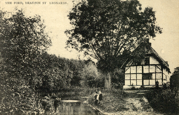
The natural beauty & intrigue of the River Thame has captured the imaginations of many over the years. The River has been immortalised in paintings by Artists such as William Turner & Mortimer Menpes. It has also been the subject of Poetry & Prose in the works of Michael Drayton & Isaac Walton as well as being mentioned in Edmund Spenser’s “The Faerie Queene” where it is quizzically referred to as the Father of the Thames. The River Thame has long been a part of many traditions like the Shabbington/Tiddington Tug-of-War and the Drayton St Leonard Duck Race. The River has provided Leisure activities such as Canoeing & Angling for years and is the backdrop to many peoples’ Local Countryside Walks. In the past it has been host to popular Bathing Sites & to this day continues to provide beautiful Scenery for Communities to enjoy.
Miraculously, although Cuddington Mill can be surrounded by Floods, the Water never encroaches the Building. The River Thame Flows through Aylesbury Vale & there are several old Watermills located near the Picturesque Villages. Cuddington Mill is one, with a particularly lovely Mill-Race, reminiscent of Claude Monet’s Lily Pond Paintings. The River passes some Historic Sites, such as the Moat System at Chearsley & Notley Tythe Barn & Abbey, before skirting the Crendon Industrial Park & crossing the County Border at River Thame. By this time, the River has been fed by Water from a number of good-sized Brooks, so is wider and has a more regular Flow, although in the Winter the River Floods across a wide area of Water Meadows to the West of Town.
There is a Footpath that runs from Cuddington to Chearsley that starts at the Lane of Bridgeway at the edge of the village and enters Chearsley at one of Manor Farm’s Fields below the Church. This contains the Manor Moat System that gave the Farm its name. Another footpath crosses Manor Farm from the Church & leads down to the Railway & Crosses a Brook before entering Notley Farm & continuing to Long Crendon.

The Environment Agency Water Framework Directive Classifications split this Upper Section of the Thame into 2:
Thame to Aylesbury. This Section is Classified as “Moderate”, based on multiple Factors including Fish, Facrophytes & Invertebrates. Both dissolved Oxygen & Phosphates are Classed as “Poor”, with Macrophytes being “Moderate”. This is not surprising due to the Large Sewage Treatment Works & presence of Agricultural Land. Currently there is no Data listed for Fish, but following the restocking of the River that took place in 2014, Chub, Roach & Dace of all sizes have been seen & Anglers Report some improvements. Surveys currently in progress will give us a better Picture of the River’s health.
It is not easy for Fish to move along the River owing to a number of Mills & other Blockages, although there have been improvements at Eythrope & Cuddington Mill. There are no 2027 Targets available at the Moment.
Aylesbury to Marsworth. This Section is classified as “Poor”, which is an improvement from its 2009 “Bad” Status. According to the Data, this Section is only “Poor” due to the Macrophytes, with all other measurables being at least “Good” or “High”, which may be surprising considering the slow flow & Clogged Status of the River Channel. There are some Gaps in the data here, and we would like to see more recent Water Quality Analysis. This Section is Targeted to reach “Good” Status by 2027.
Lower Section of the River Thame – Thame to Dorchester.

The Old Fisherman Pub in Shabbington is a former Watermill & is now a popular Riverside Attraction. There are various references to the Watermill valued at 10s yearly in 1086; the Site only is named in 1683. It is noted in the Domesday Survey that 100-eels came from the Fishery at Shabbington & Fishing Rights in the Thame have Descended with the Manor.


The River Thame has long been a part of many traditions like the Shabbington/Tiddington Tug of War & the Drayton St Leonard Plastic Duck Race. The River has provided Leisure Activities such as Canoeing & Angling for years & is the backdrop to many peoples’ Local Countryside Walks. In the past it has been host to popular Bathing Sites & to this day continues to provide beautiful scenery for communities to enjoy.

The Sluice on the River Thame at Waterstock Mill was a complete Barrier to Fish Passage (except when the River was in very High Flow). On each Flank, the Concrete & Stone Walls were also Structurally failing. The removal of the Sluice Structure was not an option so instead, to provide Fish Easement a Pool was created on the Structure itself by Constructing a Wall at the Upstream & Downstream ends of the Structure to back up the Flow of Water.

A Channel which is a Secondary Channel to the main River Thame was also restored as part of the Project. It had been highly shaded by Trees, with steep Banks, it was over wide & very Silty. Brushwood Berms were created by hand with the help of a Team of Fishery Officers from the Environment Agency & Gravel was added. These Works narrow the Channel and speed up the Flow of Water which helps to keep the new Gravels clean of Silt. It creates a variety of habitat for Fish & Invertebrate Species. The Clean Gravel is also important for Gravel spawning Fish such as Chub & Dace. Trees were managed along this stretch of Channel to create a mixture of shaded & Open Channel. It’s all about variety when it comes to River Habitats!


Wheatley Bridge replaced a former Ford, over the River Thame 1st Recorded in the 12thC. A number of Complaints & Petitions in the 16thC raised the Issue of Oxford Carriers Transporting “Unreasonable Loads” across the Bridge & Ruining it. It was clearly an important Landmark to the Local People & as a result Archbishop Laud requested that no more than 6-Horses to a Cart were to be used to Cross the Bridge. Repairs from the 17th to the 19thC considerably changed the appearance of the Bridge & it was re-Built in 1809.

Site of an old Wooden Bridge over an Old Weir at Chippinghurst said to connect Milton to Oxford & other Villages in the immediate Locality. Research showed that until the 1880s there was a Weir at this Point which was also used as a Footbridge. People crossed the River between Little Milton on the left (East) Bank & Cuddesdon on the West. On the East Bank 2-Footpaths converged at the Site. On the West Bank 2-Paths also converged (see Map). Whichever your direction the Weir-Bridge saved a deal of circuitous Walking to the next Bridges (2-miles to the North & South).


Chiselhampton Bridge – is another important Historical Site on the River Thame – when built it determined the Site of the Village of Chiselhampton, & the River has since marked the Boundary between Chiselhampton & Stadhampton. The earliest Recorded date of the Bridge is 1444, when the Men of Chiselhampton were Granted Pontage (the Right of Toll for Bridge Upkeep) for it. It has been re-Built over the years with Stone Arches, altered by multiple Repairs, extended & in 1899 widened with Steel Troughing. It is now 54M long & has 8-Stone Arches. The Bridge played an interesting role in the Civil War – in 1642 King Charles’s Court was at Oxford, so Control of the Bridges on the River Thame became vital to their Defence. In 1643 the Bridge was Gated – nobody was allowed to Cross it apart from on Market Days & other minor exceptions. Prince Rupert led 1,000 of his Cavalry & 800 Infantry from Oxford across the Bridge, in an unsuccessful attempt to Capture the Payroll of the Parliamentary Army of the Earl of Essex.
Numerous Fords, Weirs, Fishponds, Watermills & Moated Sites are Historical Locations across the Catchment which have been used by people for Centuries. Many of these features are no longer in use, but remain in dilapidated states which are often characterful additions to the River Scenery.

Overy is a small & pretty Hamlet in a Conservation Area Southeast of Dorchester-on-Thames. Beyond the Garden, fronting the Mill Stream is a Water Meadow with Mature Trees & a Large Pond. A Footpath across the Water Meadow Leads directly to the Village & Walks to the Wittenham Clumps, the Thames Path & Days Lock. The Hurst Water Meadow, Historically attached to Overy Mill & open space of vital importance to the area, was Secured in 1996 when it was Purchased by the Residents & Parish Council of Dorchester to save it from unsuitable Development & to provide a place for Recreation.
The Hurst & Old Bridge Meadow

Bridge at the Confluence of the River Thame & the Thames: Dorchester Bridge is possibly the Oldest Bridge over the River, the earliest reliable evidence of its presence is from 1146 but it is thought that it may have been Built as early as Anglo Saxon times. A New Bridge was Built 100-yds above the old Structure in 1815 but the Foundations were badly washed away in Less than 10-yrs so it had to be Underpinned in 1824. In 1847 the Ladies of Dorchester complained about nuisances on the Seats of the Bridge which were described as a disgrace to the Parish – Brickwork was sloped up the Seats to remedy this which can still be seen today. Illustrations show that Barges used to Transport Goods under these Bridges but the River is now almost entirely non-Navigable by Boats.

Joseph Mallard William Turner’s Original Title for this Picture in Exhibitions at his Gallery in 1808 & 1809 is commonly used today, although he showed it again in 1810 as ‘Dorchester Mead, Oxfordshire’. It depicts the Confluence of the River Thames & the River Thame near Dorchester. The River Thame, hardly more than a Stream, is in the foreground while the Thames is glimpsed beyond the Old Wooden Bridge on the Right.

The natural beauty & intrigue of the River Thame has captured the imaginations of many over the years. The River has been immortalised in Paintings by Artists such as William Turner & Mortimer Menpes. It has also been the subject of Poetry & Prose in the works of Michael Drayton & Isaac Walton as well as being mentioned in Edmund Spenser’s “The Faerie Queene” where it is quizzically referred to as the Father of the Thames.

River Thame Catchment Area: Rising in tiny Headwaters to the East of Aylesbury the River Thame then Curls around the Western edge of the Town before flowing roughly South-west, into Oxon past Thame & Wheatley & on to its Confluence with the River Thames just below Dorchester-on-Thames. The River Thame Catchment is 682-km2 with 340-km Length of Waterway & has a Population of 183,000 people & 32 Sewage Treatment Works, one of the highest concentrations of in any of the River Thames Catchment areas. The River Thame Catchment straddles Bucks & Oxon (and also touches Herts near Tring) & encompasses only 2-significant Towns (Aylesbury & Thame). Land use is predominantly Agricultural with a few protected areas within its Valley including a small number of SSSI’s along the Chilterns Escarpment & the Shabbington Wood Complex in the West.

The Study Area covers 684-km2 & is predominately Rural in character with the Main Urban Area being Aylesbury, with a Population of 55,700. There are also a number of smaller Settlements including Thame, Tring & Princes Risborough. The Study Area has a total Population of approximately 90,000. There are a number of Tributaries of the Thame including:- Fleet Marston, Denham, Hardwick, Bear, Scotsgrove, Cuttle, Haseley, Chalgrove, Baldon, Holton, Danes, Thomley, Worminghall, Peppers Hill & Chersley Brooks.
Geology – The Solid Geology of the Thame Catchment is characterised by a sequence of Jurassic & Cretaceous Strata all dipping comparably in a South-easterly direction. As such, the Geology appears as a succession of South-west to North-easterly elongated Outcrops, with a progressively younger Strata to the South-east. The Geology of the Catchment is illustrated on Map 2.

Much of the North & West of the Catchment is underlain by Oxford Clay & Kimmeridge Clay. These soft Clays & Mudstones form the Flat relatively low-lying Vales of the Catchment & the Floodplain across which the Thame Flows. This is only broken by the Corallian Limestone & Marls to the East of Oxford, & where isolated Outcrops of Higher Ground occur such as at Brill & Long Crendon. Here, the harder Limestones, Silts & Sands of the Portland Beds, Purbeck Beds & Whitchurch Sands cap the Hills. These younger Rocks also form a more continuous Outcrop further to the Cast between Thame & Aylesbury. Several Erosional surfaces, or unconformities, exist within the Geological succession causing parts of the sequence to be absent in places. The Lower Greensand Formation is limited to a few patchy Outcrops as a consequence of this & has been deposited on the Erosional surfaces of the Kimmeridge Clay & Purbeck Beds. Further to the South & East & up-sequence, the Gault Clay forms another Outcrop of Flat Clay-Land. Above this, the Upper Greensand is present as a distinct Escarpment at the Base of the larger North-west facing Escarpment of the Chalk. The top of the Steep-sided Chalk Escarpment forms the South-eastern Boundary of the Thame Catchment, with the Dip Slope of the Chiltern Hills falling away to the South-east. The Chalk sequence comprises Lower Chalk at the Base, rising through Middle Chalk, with Upper Chalk forming the top of the Escarpment at the Catchment Boundary. Several Drift Formations have been deposited overlying the solid Geology. Glacial & Glacio-fluvial Sands, Gravels & Clays Cap parts of the Higher Ground outside of the Valley Bottoms in the Northern part of the Catchment. The Thame Valley & its Main Tributaries are lined by a thin covering of Alluvium & Terrace Gravels.
Hydrology:- Much of the Catchment is underlain by Impermeable Clays in which there is little Groundwater Flow of any significance. Where these Clays Outcrop, surface run-off will provide the dominant Input to the River System. The only Major Aquifers within the Catchment are the Chalk & Upper Greensand. In places these can form a Single Aquifer, but the presence of a Double Spring-Line within the Chalk & Upper Greensand would suggest that the low permeability Chalk Marl that forms the lower part of the Lower Chalk acts as an Aquiclude between the 2. Spring-lines emerge from within the Lower Chalk at the Chalk Marl Boundary & near the contact between the Upper Greensand & the underlying Impermeable Gault Clay. To obtain higher yields, it is common for Boreholes & Wells in the area to extend through the Chalk & into the Upper Greensand. The Portland & Purbeck Beds, Whitchurch Sands & Lower Greensand Formation all yield small quantities of Groundwater that are Tapped for Domestic & Agricultural use. Where these Strata form Outliers on High Ground, the Outcrop is drained by Springs emerging at the Base of the Portland Beds where they Overlie the Kimmeridge Clay. Several small Abstractions also Exist within the Corallian Beds.
Water Resources – The National River Authority’s principal aim in relation to Water Resources is to:-
Manage Water Resources to achieve the right balance between the needs of the Environment & those of the Abstractors. To achieve this Aim the NRA seeks to: plan for the sustainable development of Water Resources, developing criteria to assess reasonable needs of Abstractors & of the Environment;
Collect, validate, store & provide Hydrometric Data & Environmental Data in order to assess Water Resources;
Apply a Nationally Consistent Approach to Abstraction Licensing; implement a consistent approach to the resolution of inherited problems caused by Authorised over-Abstraction;
Protect the quality of Water resources by working with other functions & external bodies.
Hydrometric Data – In order to ensure that there is sufficient Information on Water Resources the NRA carries out regular measurements from Flow Gauging Stations, Groundwater Monitoring Boreholes, Current Meter Gauges & Rain Gauges which are Located throughout the Catchment. A proportion of the Rainfall falling on the Catchment is subsequently lost as evaporation or transpiration. The remainder, termed the ‘Effective Rainfall’ is the total Water Resource available to the Catchment in the form of either Surface run-off or Groundwater Recharge. The River Thame Catchment has an average Annual Rainfall of 650mm (taken from 1941-70). The average Effective Rainfall for the same time period, (i.e. Water Resource available to the Catchment as Run-off or Groundwater Recharge) is 175mm.
Abstraction Licensing – The NRA administers a System of Licensing Abstractions & has wide powers as to whether or not to Grant a Licence & to apply Conditions. There are currently 110-Abstraction Licences in Force within the Thame Catchment area.

Thames Water Utilities Limited (TWUL) are the Sole Water & Sewerage Undertaker operating within the Study Area. The 4-Thames Water Abstraction Sites are Linked together, in that there is a total limit on the Total of the 4-Abstractions which is less than if they could Abstract Independently.
Development & Water Resources – Local Councils have expressed concern about the adequacies of Water Supply for Aylesbury. However there is no deficit in Supply before 2011 unless the growth in demand follows the high NRA Forecasts- Recent growth has been below the Low Forecast. The Catchment is a net Importer of Water for Public Supply from Farmoor, New Ground, Hawridge & Medmenham.
Cuttle Brook: This Tributary Water Course has 2-Arms, one running down from near Princes Risborough (the Kingsey Cuttle Brook) & the other from near Chinnor (the so-called Chinnor Brook). The former takes the outflow from the Princes Risborough Sewage Treatment Works (STW), the latter from the STW at Henton (often called Chinnor STW) & another at Towersey. The 2-Branches converge 300M Upstream of the Cuttlebrook Koi Farm (near Towersey) before continuing on to join the Scotsgrove Brook between Thame & Haddenham. Much of the Kingsey Cuttlebrook is the Boundary between Oxon & Bucks. In 2015, the Environment Agency classified the Chinnor Brook Section as “moderate”: the Brook needs improvement to both the Phosphate & Invertebrate Status which are both set at “moderate”. It is likely that the Sewage Treatment Works is having significant impacts on Phosphate levels & this will then have an impact on the Invertebrates that are able to survive. The Chinnor Brook is targeted to reach “good” Status by 2027.
The rest of the Kingsey Cuttle Brook was classified as “Poor” in 2015. The Water quality, as in many of the Waterbodies within the Thame Catchment, is all classified as “High”, except for the Phosphate levels, with poor Phosphate concentrations having impact on both Invertebrates & Fish. By 2027 the Brook is targeted to meet “Moderate” status; this target of “Moderate” is due to poor Phosphate levels which are deemed as unfeasible to improve. We hope that over time as practises change in both Sewage Treatment & Agriculture, that a better Water quality will be achieved.
The Scotsgrove Brook: – starts off in Little Kimble, Flows past Bishopstone & through Ford before skirting Haddenham & joining the Kingsey Cuttle Brook. Both Haddenham & Stone Sewage Treatment Works discharge into this Brook, resulting in the potential of a very large Phosphate, Nitrate & Ammonia Load. Additionally, a lot of new Housing Estates being added to the Villages will increase the Sewage Flow considerably. However, Thames Water maintain that the STW is more than capable of dealing with the Loads placed on it.
The Land-use along the Brook is predominantly Arable & some parts are prone to Flooding in the Winter, which has been exacerbated by the straightening of some of the Drainage Ditches that feed into it. The Flooding might be eased through allowing Water to find its own Route to Flow off the Land as it did in the past, which might improve how the Waterways cope with Heavy Rainfall; but more Work is needed in order to fully understand the Water Flows & Land-use. In 2015, the Environment Agency Classified the Scotsgrove Brook Section as “Moderate”, which met its 2015 Target. Invertebrate samples have shown that the Brook supports a wide range of Invertebrates in the sample location, however Phosphate Levels are classed as “Poor” & dissolved Oxygen as “Moderate” (targeted to reach “Good” by 2027). An overall Target for the Brook is yet to be Set.
