Ewelme means “the Source of the Spring,”. The Hundred corresponds to the Domesday Half-Hundred of Benson and was renamed in 1070. It was called a Half-Hundred into the 16thC, despite being the largest of the Chiltern Hundreds.
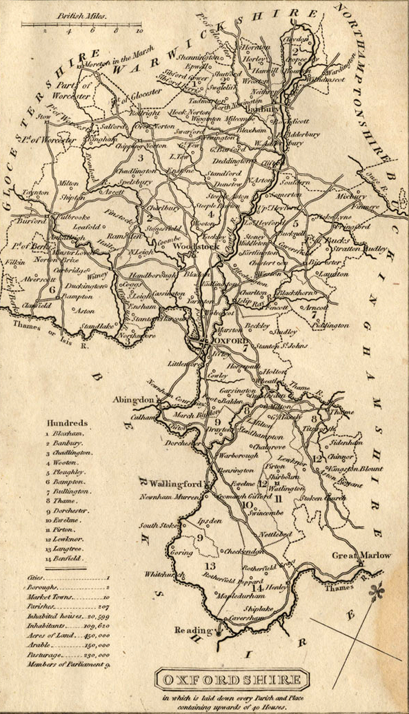
Map of Oxford County: Surveyed by a Local man, Richard Davis of Lewknor & Published in 1797. This Large Map consists of 16-Sheets at an impressively detailed Scale of 1:31,680 or 2-ins to 1-mile. No more than 200-Copies were ever made, the evidence is based on all Sets of the Map having Manuscript Serial No.s. Very few complete Copies survive. In terms of what the Map shows, a clear break has been made from the Christopher Saxton-led Traditional County Map, as here far more detail than previously is featured. Not only are County & Hundred Boundaries, Rivers & Streams, Towns & Villages, Parks & Woodland depicted, but here we have Roads, Tracks, Hedges, indeed every Field can be seen and Relief is beautifully represented by the use of hachures. Davis was also Topographer to His Majesty, George III.

Ewelme, is in a District which may be called the Chilterns. This name is sometimes given to a considerable part, if not to the whole, of the Great Range of Chalk Hill is which extends from Norfolk to Dorset; but the real Chilterns, the familiar “Chiltern Hundreds” which pass through the hands of so strange a variety of Parliamentary ‘Stewards’. The “Half-Hundred” of Ewelme being one of the 5 which constitute that imaginary Domain. The Range here is bare of the beautiful clothing of Beech Woods which adorns them in the South-Eastern corner of Oxfordshire and in the Neighbouring County of Bucks, and has, for the most part, passed under the Plough. Ewelme, consequently, has something of the look of a Down Village nestling with its trees in a hollow among bare rolling Hills. Its Greenery is, however, made more than usually Vivid by the natural Spring from which it takes its name. A genuine Fountain, bubbling up perennially from the Earth, is not a common sight anywhere in England, and among the Chilterns, a Waterless Country, as its Inhabitants know to their Cost, it is peculiarly rare. It rises, indeed, in a very unpretending way at the back of a Cottager’s Garden, and might be taken for a Water-cress Ditch till you see the little swirling Eddy’s where the Water bursts out of the Soil; it is strong and little influenced by Drought. A lover of Springs, as any man who drinks Tap Water, may well be, should time for the Summer. The Village itself, with its broken Ground & Steep Acclivities, Dominated by St Mary the Virgin Church and by a Stately Red-Brick Mansion in which we recognise as the old Rectory, is remarkably Picturesque.

Such were the Alliances of Thomas Chaucer’s Family, that it was possible that a Descendant of the earliest of our Poets might sit on the Throne of England. Thomas Chaucer himself married the Heiress of the Burghersh. His own Heiress Alice Chaucer was 3 times married, each time in an ascending scale of Status. Her 1st marriage was to a wealthy Landowner, Sir John Phelip who died of Dysentery contracted at the Siege of Honfieur, and made way for Montacute, Earl of Salisbury, who was killed at Agincourt. At her father’s death Alice was a Widow, not yet 26-yrs-of-age, and afterwards married William de la Pole, Earl of Suffolk, a cousin of the Nevilles. It was in this 3rd Husband of its Heiress that Ewelme found its Patroness. Its Church was erected by him. A curious Token of his regard for the unfortunate Master whom he served still exists on its Walls. Close above the Font is a Crowned Head which, represents the features of Henry VI. The Face bears a strong resemblance to the well- known lineaments of the Plantagenets.

There is a growing Scholarly interest in the daily life & perceptions of ordinary Medieval People, yet there has been little attempt to conceptualise the Social space of the Rural Settlements in which the great majority of the Population lived. This diagram examines how a Village or Hamlet in England might have been used and perceived in the later-Middle-Ages (c.1200 to 1500), especially in terms of access & permeability – in other words how open or closed (or, more crudely, ‘Public’ or ‘Private’) the components of a Settlement were, and how the Spatial relationships between these components affected their use and Social Significance. The data is drawn mainly from lowland England, with a special focus on Ewelme Hundred in Oxfordshire, an area of mixed Countryside including Open-field Villages & dispersed Wood-Pasture Settlements. It will be argued that differences in Openness & Closure across Space & Time supply a guide to Rural Social Interaction as a whole.
Draycott, a Hamlet, in the Parish of Ickford, Union of Thame, Hundred of Ewelme, County of Oxford; containing 12-Inhabitants.
The 14-Rural Parishes covered occupy a varied Landscape in South-East Oxfordshire, straddling both the Clay Vale beneath the Chiltern Scarp, with its nucleated Villages and (Historically) large Open-fields, and the contrasting Chiltern Uplands with their dispersed Settlement, early Inclosure, and extensive Wood-pasture. Despite those contrasts, close ties across the area have been a recurrent theme, reinforced by long-established Routeways, Economic interdependence, and (in the early-Middle-Ages) by the unifying influence of a large Royal Estate focused on Benson, which extended across the Chilterns. The Estates fragmentation between the 9th & 13thCs created the modern Parish Structure, while the area’s inclusion within a single Administrative Hundred (known initially as Benson Hundred) reflects Benson’s early importance. The name Ewelme Hundred became Established from the 13thC.
The nearest Towns lay Outside the area included here, at Dorchester, Wallingford, Watlington, & Thame, with both Oxford & Henley (and more distantly London) exerting important influences. Benson (and to a lesser extent Nettlebed) emerged as Coaching Stops in the 17th–18thCs, but otherwise, the Parishes remained predominantly Agricultural until the 20thC, save for the usual Rural Trades & Crafts, and a significant Pottery & Brickmaking Industry around Nettlebed. The chief modern development has been the growth of a Military Airfield at Benson, established just before WW2 and subsequently expanded into one of Oxon’s 2-Main RAF Stations. A Wartime Airfield at Chalgrove survived as a self-contained Industrial Site. The Site has recently been appraised on the basis that it has capacity for 3,000 Dwellings.
The Uplands, in particular, have long been noted for their Scenic charm, protected since 1964 by inclusion in the Chilterns Area of Outstanding Natural Beauty. The attractiveness of the Landscape is complemented by a variety of buildings in Timber, Brick, Chalk Clunch, & Flint, of which the 15thC Brick-built Almshouse complex at Ewelme, co-founded by Chaucer’s granddaughter Alice de la Pole, is particularly notable. Sizeable Post-Medieval Mansion Houses (some now demolished) were Built at Rycote, Newington, Britwell Prior, Great & Little Haseley, Swyncombe, & Brightwell Baldwin, while a more recent addition is Nuffield Place, remodelled in 1933 for the Pioneering Oxford Car Manufacturer William Morris (Lord Nuffield), and transferred to the National Trust in 2011.
Landscape
The Chiltern Hills cut across Ewelme Hundred in a South-Westerly direction, dividing it into 2 contrasting zones. On the West, Parishes from Warborough to Great Haseley lie below the Chiltern Scarp, occupying an open, flat, and (further north) gently undulating Landscape of few sharp contrasts, watered by the Rivers Thames & Thame or their Tributaries. Benson & Ewelme Parishes straddle the 2-Zones, their Eastern parts extending into the Chiltern Foothills, while Swyncombe, Nuffield, & Nettlebed lie entirely in the Uplands. The latter is characterised by a typical Chiltern Landscape of deep-etched dry Valleys and of dispersed and often secluded Settlement, set amidst Woodland, Wood-pasture & irregular Hedged Closes. Such contrasts echo the Geology, the Lowland Parishes resting mostly on Gravel, Clay, Alluvium, or Greensand, and the Uplands on Chalk, their higher parts capped extensively by Clay-with-Flints. On the higher or more undulating Ground, Valley-related place names such as Huntercombe, Swyncombe, Gangsdown, & Holcombe predominate, while at the Foot of the Scarp a series of Stream-related names (including Ewelme, Brightwell, Britwell, & Cadwell) Trace out the Spring-line. Water supply on the Uplands themselves came chiefly from Wells, scattered Ponds, & Cisterns, leaving Meadow generally in short supply. High Ground in Nettlebed & Nuffield also attracted Windmills, with others on more gently rising ground at Great Haseley & Rycote. In the Vale, Watermills were predictably more common.
The apparent lack of intensive Iron-Age or Roman Settlement in the 3-Upland Parishes suggests that the contrast between the open, more heavily populated Vale & the Wooded, more sparsely settled Hills is long-established. Even in the 16thC the term ‘Chiltern‘ still denoted a distinctive Upland Zone, which c.1916 was described as ‘marked off’ from the rest of the County ‘with considerable definiteness’. Nevertheless, the 2 have probably always been closely connected. The Roman Road from Dorchester to the Henley River-crossing traversed the Hills, while Charter references to a 10thC fildena wudu weg (‘Open-country Wood-way’) suggest Anglo-Saxon transhumance Routes linking the Upland Wood-pastures with the Lowland ‘fielden‘ areas. Equally, the density of Wood-cover has never been static. Lowland place names such as Haseley (Hazelwood or Wood-pasture) suggest more extensive Woodland in the Vale in the Anglo-Saxon Period, while Field Names such as ‘Grubbings’ point to partial Woodland clearance for Cultivation in the Uplands. Other Woods were reorganised as Medieval Deer Parks (established in all 3-Upland Parishes), while some new 19thC Plantations in both Vale & Upland were similarly created as Game Coverts.

Ewelme Hundred c.1865, Boundaries & Relief: Open-fields were emerging in the Vale by the 10th or 11thCs & survived in many Parishes until the 19thC, despite some early inclosure at Rycote, Latchford, Rofford, Newington, Easington, & Preston Crowmarsh, and in the Chiltern Foothills in Benson & Ewelme Parishes. By contrast, Open-fields in the Uplands were generally small, ill-recorded & Fully Inclosed by the 13th–15thCs. Sizeable Commons (including Greens) were found in both Zones, although Swyncombe was unusual amongst Upland Parishes in retaining large swathes of open Chalk Downland. Post-Medieval Landscaping of Parkland was mostly confined to Lowland Country Houses at Brightwell Baldwin, Britwell Prior, & Rycote, although large Houses in their own Grounds developed also on the Chilterns, as at Joyce Grove or Soundess in Nettlebed.
Former Pits or Quarries remained widespread in the 19thC, dug at various times for extraction of Chalk, Flint, or Gravel, of Building Stone (as at Great Haseley) or Clay (for Brick or Tile making), and of Lime or Marl (partly for Fertiliser). Others are reflected in Medieval names such as Mogpits (in Benson), or the place name Chalgrove (possibly ‘Chalk or Lime-pit’), while Chalk-Pit Way (cealc seapes weg) was mentioned in 996. Commercial Gravel Workings (now used for Waste processing) remain South-east of Ewelme.
Communication – Roads: Several major Roads cross the area from North-West to South-East, traversing the Chilterns and linking Vale & Upland. Most important are the Oxford-Henley Road (part of a Route from the West Country to London), which formerly passed through Dorchester & Benson Villages, and the more Northerly Oxford-London Road through Tetsworth, which crosses Haseley Parish and is now partly followed by the M40 Motorway. The Dorchester-Henley Route is of Roman or earlier Origin, and both Roads remained important from the Anglo-Saxon Period onwards. A roughly parallel Route runs from Oxford through Stadhampton, Cuxham, & Watlington, intersecting the Ancient Knightsbridge & Hollandridge Lanes. Those last 2 formed part of an Anglo-Saxon Route from Assendon (near Henley) through Pyrton to Oxford, running possibly along the ‘Broad Army Path’ crossing Little Haseley’s Northern Boundary in 1002, and perhaps continuing to Worcestershire.

Landscape & Settlement in 1797, showing a clear contrast between the Chiltern Uplands (bottom right), and the Villages & Open-fields below the Chiltern Scarp. The London Road through Benson & Nettlebed cuts across the Map.
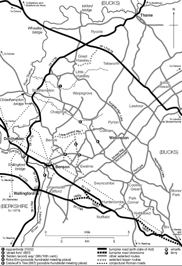
Communications in Ewelme Hundred c.1800, showing Major Roads & Turnpikes and some earlier features.
Major North-South Routes include the Thame-Wallingford Road through Newington & Warborough, crossing the Thames at Shillingford. Some Sections may roughly follow the Roman Road from Fleet Marston (Bucks.) to Dorchester & Silchester, the Roman River crossing shifting to its present more Easterly position probably when Wallingford’s 9thC Burgh was established.

A Medieval Bridge at Shillingford was superseded by a Ferry from the 15thC and by new Bridges in 1767 & 1826-27, the alternative approach to Wallingford being through Crowmarsh Gifford and over Wallingford’s Medieval Bridge. Roads through Chalgrove, Brightwell Baldwin, & Watlington ran parallel to the Ancient Icknield Way, which in the Middle-Ages remained an important long-distance Route along the Foot of the Chiltern Scarp, and formed occasional stretches of Parish Boundary. Further East, Red Lane and its continuation through Cookley Green & Nuffield may have formed part of a Prehistoric or Anglo-Saxon Ridgeway, while the Watlington-Nettlebed Road formed part of a through Route to Reading by the 13thC. The Lower Icknield Way, a Romanised prehistoric Route on Lower Ground, ran probably through Cuxham, Brightwell Baldwin, & Hollandtide Bottom (North of Berrick Salome), a ‘Street Ford‘ identified on Chalgrove Brook (a little way to the North) suggesting either a Branch or an intersecting North-South Route. Medieval Field names suggest a further Roman Road running North-South through Newington & Ewelme Parishes, some stretches of which remain in use.
A dense Network of Lesser Routes linked the Hundred Villages and scattered Upland Settlements from the early Middle-Ages, allowing Villages such as Cuxham & Great Haseley to transport Grain across the Hills to Henley, and thence by River to London. Routes mentioned in Anglo-Saxon Charters include the present-day Rumbold’s & Turners Green Lanes (bordering Brightwell Baldwin & Cuxham), while the Ford from which Rofford is named was mentioned in 1002. Routes converging on the possible Hundredal Meeting Place at Roke Elm or Ceolwulf’s Tree were presumably also Ancient.
18thC improvements saw Turnpiking of the Northerly London Road in 1719, the Oxford-Henley Road in 1736, the Thame-Wallingford Road in 1764–70, and the Nuffield-Wallingford Road in 1765, with an improved link from that to the Henley Road, laid out c.1819–27. The improvements facilitated but did not initiate the large-scale development of Coaching, which on the Dorchester-Henley Road was established by the 1660s, and from which Nettlebed and particularly Benson benefited considerably until Coachings demise in the 1840s. Nettlebed also became a significant early Postal Centre. 19thC Inclosures affected numerous lesser routes but largely preserved the Major Roads, until the development of Benson & Chalgrove Airfields during WW2 severed the Dorchester-Henley Road and Roads North of Chalgrove Village. Both were ultimately replaced by Bypasses, substantially altering the Henley Route past Benson. The M40 Motorway was Built in the 1970s, crossing Haseley Parish between Great Haseley & Rycote.

River & Rail
The Thames was an important Transport Corridor throughout the early-Middle-Ages, and Benson’s possession of Salt Rights may reflect involvement in a well-documented River Trade stretching from Radcot to London. From the late-13thC Vale Villages such as Cuxham habitually sent their Grain across the Chilterns by Road, however, avoiding the Rivers long southerly loop, and by the later Middle Ages large-scale Commercial Navigation as far as Wallingford & Benson had largely ceased, as demand Upstream fell and the River became increasingly obstructed. Following the Rivers reopening to Oxford and beyond from the 1630s Wharves were constructed at Shillingford & Benson, remaining in use until the early-20thC for grain, timber, malt, & coal. Shillingford Wharf included a Malthouse in 1848, and Timber from Great Haseley was possibly Shipped via Shillingford in 1823. Overland Trade with Henley continued in the 18thC, however, and by the mid 19thC the Wharfs’ chief use was apparently import of Coal.
Early Railways largely bypassed the area, and though a Branch to Wallingford was opened in 1866 and a separate Branch to Watlington (from Princes Risborough) in 1872, Schemes to join the 2 via Benson never reached fruition. Both Lines were used for export of Livestock & Agricultural produce (including milk), and for Import of raw materials, while some Nettlebed Farmers probably used Henley Station (Opened 1857). Nevertheless, some Chiltern Farms remained handicapped by the relative inaccessibility of Local Markets in the early-20thC. Passenger Services through Wallingford & Watlington ended in the late-1950s, and the Stations Closed in 1965 & 1961 respectively. Abortive Plans included Schemes for a Ewelme-Watlington Railway (1881) and a Didcot-Watlington Light Railway (1898), crossing Benson and several nearby Parishes and with a Link to Wallingford.
Settlement – Prehistoric to Roman Settlement: Prehistoric activity across the area is well attested, with a particular focus on the important (and now largely destroyed) Neolithic & Bronze-Age Monument complexes around Dorchester, close to the Thames-Thame confluence. Mesolithic & Neolithic Tools have also been found in the Upland Parishes, with Mesolithic Flintworking Sites in Nettlebed probably seasonally occupied by Hunter-gatherers. Later Settlement was chiefly on the Lower Ground & River Gravels, with Bronze-Age & Iron-Age Sites identified in Warborough, Berrick Salome, Chalgrove, & Haseley Parishes, alongside isolated finds elsewhere. The late-Iron-Age saw the development of a large enclosed Oppidum at Dyke Hills near Dorchester, probably providing a regional Focus, while the South Oxon Grims Ditch, a probable late-Iron-Age Tribal Boundary running Eastwards from the Thames, extends into Nuffield & Nettlebed. A Dyke along the Northern edge of Swyncombe Downs is undated.
In the Roman Period, Dorchester became a Walled Town & Roman Rural Settlement in the Vale Parishes was apparently widespread, focused on low-status Farmsteads. No Villas are known, despite 2-possible Candidates noted in Warborough. 3rdC Coin Hoards found in Ewelme & Swyncombe Parishes probably reflect Traffic along the Road from Dorchester across the Chilterns, while a possible Votive Figurine found at Ewelme has prompted suggestions of a small Shrine associated with nearby Springs.
Anglo-Saxon Settlement & Territorial Organisation
Burials near Dorchester (recently re-dated) suggest that Anglo-Saxon Cultural practices were supplanting sub-Roman ones in the area by the AD450s, notwithstanding suggestions that a British Enclave on parts of the Chiltern Uplands may have continued into the 6thC. Within Ewelme Hundred, 5th or 6thC Anglo-Saxon Settlement is known at Benson, Rycote and possibly Warborough, while a poorly recorded Cemetery on the Ewelme/Brightwell Baldwin Boundary has yielded Anglo-Saxon Grave Goods of similar date. Some of the Area’s numerous Stream & Valley or Hill-related place names probably also reflect relatively early Colonisation, at least in the Lowlands.
By the late-6thC most of the area was subject to the Gewisse, a dominant Tribal grouping from which later West Saxon Kings claimed Descent. Probably their local Power Base was near the former Roman Town of Dorchester, where King Cynegils of the Gewisse was Baptised c.635, and which he gave to St Birinus as an Episcopal Seat, establishing it as the Areas dominant Ecclesiastical Focus. Whether nearby Benson was already a Royal Centre (chosen presumably for its proximity to Dorchester) is unclear: Cynegils (accompanied by his Overlord King Oswald of Northumbria) must have been Lodged in the Vicinity, but no high-status Residential Site at Benson has yet been discovered, and the earliest written evidence is of uncertain reliability. By the late 8thC, however, when King Offa of Mercia reportedly seized it from Wessex, Benson was emerging as a valuable & strategically important Royal Possession, with both an extensive dependent Territory and (possibly) an outlying Royal Residence at Kingsbury, in Newington Parish. From the 9thC its Territory was reduced by piecemeal Grants, but at the Conquest it still stretched across the Chilterns to Henley, and it has been plausibly suggested that it may have once comprised much of the 4½-Chiltern Hundreds (Ewelme, Pyrton, Lewknor, Binfield, & Langtree) whose ‘Soke’ (or Jurisdiction) remained attached to Benson Manor beyond the Middle-Ages. If so, this vast Royal Territory of some 500-Hides was presumably linked to Benson through renders of Corn & Livestock, the vestiges of which may be visible in the £30 ‘Corn Rent’ (annona) still payable to Benson Manor in 1086.
Mid & Late Anglo-Saxon Settlement took shape within the emerging Royal Estate. Berrick (just North of Benson) began as an outlying Farm or berewic, while 8th & 9thC Coin & Metal finds between Benson & Ewelme (close to the earlier Cemetery) point to Trading or other activity probably associated with Benson as an Estate Centre, or with a nearby Hundredal Meeting Place. Warborough (‘Watch Hill‘) may be named from a Look-out Post overseeing Benson, while the names Haseley & Warpsgrove (further North) imply areas of specialised Woodland. The scale of early Upland Settlement is unclear: place names (probably early) suggest a relatively uncultivated Landscape of rough wood Pasture, which was probably initially exploited by Lowland Settlements needing Upland resources. Certainly, both Nettlebed & Huntercombe remained attached to Benson relatively late, and several other Lowland places retained Upland outliers beyond the Middle-Ages. Nevertheless, by the mid-11thC, there were small independent Agricultural Communities at Gangsdown (in Nuffield), and probably in Swyncombe & Nettlebed. The Benson Estates subsequent fragmentation also affected Lowland Settlement, with Newington (the new Tun) probably reflecting reorganisation by Canterbury Cathedral Priory after it received an extensive Estate there in the early 11thC. Late Anglo-Saxon ‘Hide Farms’ may have existed at Ewelme & Brightwell Baldwin.
Benson’s centrality was undermined by Foundation of the Fortified Royal Burgh at Wallingford in (probably) the late-9thC, the area assigned for the Burgh’s Fortification & Upkeep (through Garrisoning and other Services) extending almost certainly into Benson’s Territory. Residual connections continued in 1086 when 6–Ewelme Hundred Manors included Property in Wallingford, and several others formed part of the Emerging Honour, a complex of Estates extending into several Counties, but with a concentration in South-east Oxon. Why Wallingford was chosen over Benson as a Burghal Site is not entirely clear, although the reasons were probably strategic. Either way, Wallingford’s emergence may have contributed to Benson’s failure to develop Urban characteristics, despite its continuance as an exceptionally valuable Royal Estate Centre into the Norman Period. The creation of Oxfordshire c.1007 involved further re-alignment, bringing Benson and its dependencies within the New Shire despite their Wallingford Connections, but leaving Wallingford itself in Berkshire. By 1086 the later-Hundredal groupings were also firmly Established, Benson’s Jurisdiction over the 4½-Chiltern Hundreds reflecting its continued but waning significance.
Medieval & Later Settlement
Fragmentation of Benson’s Royal Estate continued into the 13thC, creating the later pattern of Manors & Parishes and, in many cases, perpetuating lowland-Chiltern links designed to give access to woodland. Newington & Ewelme retained detached Upland Outliers until 1932, some of Newington’s extending beyond Ewelme Hundred into Bix & Pishill. Several Parishes similarly shared detached Riverside Meadow in Drayton St Leonard (in Dorchester Hundred). Fragmentation also caused some pre-existing Settlements to become divided between different Estates & Parishes, producing some highly complex shared Field Systems & Inter-commoning.
In the Vale, nucleated Villages set amidst Open-fields were the norm by the 13thC, some of them showing signs of Planning. At Great Haseley Tenant Housing extends from the Lordly nucleus of Church & Manor House along the Village Street, part of which was probably widened for a Market in 1228, while at Chalgrove (where the present High Street may have been Laid out along an Open-field Headland) separate Manor Sites created rival Nuclei, giving rise to separate ‘Ends’. Several other Settlements were Grouped around Greens, along Roads & Road Junctions, or alongside Commons, with some (like Cuxham) showing evidence of Social ‘Zoning’, the larger Villein Plots kept separate from humbler Cottage Holdings. Village sizes varied considerably and the larger Lowland Parishes all contained Outlying Hamlets, although some small wics or worths mentioned in the 10thC had disappeared by the 13thC. Settlement on the Chilterns was much more dispersed, with the partial exception of Nettlebed where the Dorchester-Henley Road provided a possibly early Focus. Small Upland clusters of Houses were generally Grouped around Greens or Commons, while more isolated Medieval Farms included the aptly named Hayden (later Hidden) Farm in Nuffield. Additional areas of peripheral dispersed Settlement existed in the Chiltern Foothills in Benson & Ewelme Parishes, while 2 Outlying Farms in Newington probably began as Medieval Freeholds.
Late-Medieval Population decline led to uneven Settlement shrinkage, most strikingly at Warpsgrove which, by 1453, was all but Deserted. Fifield & Cadwell (in Benson & Brightwell Baldwin Parishes) became essentially Single Farms by the 16thC, and several Villages (including Cuxham) saw long-term abandonment of House Plots. Nonetheless, some Settlements proved more resilient than others, presumably by attracting Incomers. Some Upland Parishes may have seen disproportionate Population loss and perhaps some Shifts in Settlement, although the precise form of Settlement shrinkage there is harder to determine.
Depopulation was exacerbated by late-Medieval and 16thC Inclosure, particularly at Rycote & Latchford in Great Haseley Parish, while in the 16th-17thCs the building of Mansion Houses at Soundess (in Nettlebed) & Swyncombe may have involved clearance of Tenant Housing. Subsequent inclosure of Greens at Newington & Berrick Prior (in the 17th & early-19thC) led to further House losses, although by then rising Population was fuelling incipient infill & fringe development across the area. A handful of Outlying Farms were established in the Vale in the 16th to 18thC, and 1 or 2 more followed Parliamentary Inclosures.
Modern development has been relatively limited. The largest areas of new housing appeared in Benson, Chalgrove, Warborough, & Shillingford after the WW2, but most other Villages witnessed less extensive infill & fringe expansion, and new Housing in the Upland Parishes largely preserved their dispersed character. The largest Landscape changes were the development of Chalgrove and especially Benson Airfields, the latter now accompanied by an extensive fenced Compound (near Ewelme) for Service Personnel. Huntercombe Golf Course was established on Nuffield Common in 1901, while Huntercombe Place became a WW2 Internment Camp and later a Young Offenders’ Institution. Despite such Developments, many Settlements remain small & secluded, even in the Vale.
Economics – Agriculture: From the Middle-Ages until the 20thC the areas Economy was based primarily on Arable-based mixed Farming, with sheep important for wool & manuring, and Dairying gaining in importance from the 16thC. In general, that was true of both Vale & Uplands, although on the latter the Arable was Farmed in Private Closes rather than Open-fields, and Woodland & Wood-pasture provided an important additional element, the Woods themselves kept mostly in hand for underwood, coppicing, & Timber sales. Lack of Meadow & Open-field grazing seems not to have seriously handicapped Upland Stock-rearing, which benefited from more extensive Grassland than some Lowland Parishes, while careful Husbandry was capable of producing fair Upland crop yields at least in the post-Medieval Period. Nevertheless, poor soils, small scattered populations, and (probably) more difficult access to Markets rendered the Chiltern Uplands amongst the poorest areas in the County in 1334 (measured by Taxable wealth per acre), by contrast with the slightly richer Farmlands of the Vale.
Medieval Demesne Farming in the Vale was characterised by intensive Arable Cultivation, which generally provided the largest profits despite some sizeable sheep flocks. Crops included wheat, barley, oats, & rye. Upland Arable Farming in the mid-11thC was much less intensive, and despite some subsequent expansion most Demesnes there seem to have generated only modest profits in the 13th-14thCs, an experience perhaps shared by Tenants. Wallingford provided an important early Market for both zones but was superseded from the late 13thC by other Markets including Watlington, Thame, and especially Henley, through which produce was exported to London. Local Markets or Fairs at Great Haseley, Nuffield, & Swyncombe all ultimately failed, despite some initial modest profits at Swyncombe. Wood Sales (including firewood) raised additional modest sums for Lords, some of it Sold within the immediate area and some probably shipped to London. Even so, some Building and other Timber was imported from outside, both from across the Chilterns and from places such as Reading, Woodstock, Abingdon, & Shipston-on-Stour (Warwickshire)
Late Medieval contraction & population decline prompted the usual responses in both Vale & Upland: Demesnes were Leased, larger Holdings were accumulated, and in some places, Pastoral Farming was expanded, although the scale & chronology of the changes varied, and Arable remained important in the Chilterns as in the Vale. Thereafter farming was dominated throughout the 16th & 17thCs by moderately prosperous Yeomen who benefited from expanding Markets, selling principally wheat & barley (much of it for malting) through Abingdon, Oxford, Wallingford, Watlington, Reading, Henley & London, and generally combining their cereal-growing with sheep-rearing and (increasingly) dairying. Woods, comprising a mixture of coppices, underwood, & standards, were still generally kept in hand by Landowners: at Nettlebed the Stonor’s made regular Wood Sales in the late 17th & 18thC, while Beech Poles & Faggots were sold from Newington’s Shambridge Woods in the 1770s, together with some Ash, Oak (including bark) & Elm. Some Upland Rents per acre remained relatively low for the Region in the 18thC, with Soils unable to sustain wheat crops more than every few years. Nevertheless, careful manuring & new fertilisers improved yields, while conversely some Lowland Parishes, still wedded to Open-field Agriculture, suffered from over-cultivation & lack of investment.
Sheep-corn Farming focused on larger units continued in the 1850–60s, which saw the Hundreds last Parliamentary Inclosures. Thereafter the National Agricultural depression prompted a partial shift towards Dairying, partly using the Railway. Even so, a belief in the traditional balance of corn, sheep, & cattle remained strong in the early 20thC when the Agriculturally productive area from Benson & Ewelme to Little Haseley was said to illustrate ‘the achievements as well as the possibilities of English Agriculture’. Results on the Uplands were ‘better than [Chiltern Farmers] think’, despite a sharp fall in sheep numbers, with good crop yields around Nettlebed (improved partly by regular Chalking), and milk production geared partly to the Reading Market. Railways also facilitated some late-19thC Watercress production, particularly at Ewelme. The later-20thC saw a general return to Arable on increasingly large Mechanised Farms, although dairying, pig-breeding, poultry-raising, & sheep-farming continued.
Trade, Crafts, & Industry: Though Agriculture remained predominant until the 20thC, most larger Parishes supported Rural Crafts and some a wider range of services, alongside Nettlebed’s early Pottery, Tile, & Brick Industry, some small-scale Quarrying, widespread domestic Brewing, and (from the 17thC) some Malting, combined in the 18thC with Benson’s Coaching, Innkeeping, & Coach-building. Medieval Crafts & Trades were apparently concentrated in larger Lowland Villages such as Benson, Chalgrove & the Haseleys, all of them on or near Major Routes and containing significant numbers of Freeholders. Occupational surnames (besides smith, carpenter, baker, & butcher) included weaver, dyer, tailor, cobbler, ironmonger, skinner, potter, chandler, soaper, & barber, while Cuxham briefly possessed a Fulling Mill, and the occasional Merchant or Trader was noted in Benson, Ewelme, Warborough & Shillingford (by the Thames River Crossing). Smaller Hamlets & Upland Parishes had very few non-Agricultural occupations, save for Nettlebed where widespread Brewing presumably served Traffic along the Oxford-Henley Road. The Nettlebed Tile & Brick Industry (substantially confined to the Parish) was established by the mid-14thC, while other Upland surnames suggest Charcoal Burning.
The Range of Trades expanded during the 17th & 18thCs, with Grocers & other Retailers appearing in Nettlebed and some larger Vale Villages, particularly but not exclusively on Turnpike Routes. In Benson (as in Nettlebed) the expansion was partly related to the development of Coaching, which saw some Benson Innkeepers setting up as Coach-masters, and some Harness-makers or Wheelwrights expanding into Coachbuilding. Malt was mentioned from the 17thC, although large-scale commercial Malthouses were apparently confined to places within close reach of the Benson & Shillingford Wharfs. Shillingford had a Brewery in the 19thC & Innkeepers elsewhere mostly Brewed their own Beer until external Breweries moved in from around the 1880s. The Wharfs also attracted Coal Dealers. Wood-related workers in the Uplands in the 19thC included Sawyers and (in Swyncombe) a few female Chairmakers, while Nettlebed’s Brick & Pottery-making Industry expanded considerably in the 19thC, accompanied by sporadic small-scale Brickmaking in several other Parishes between the 18th & 20thCs. The Nettlebed Site closed in 1938, presumably through outside competition.
Most larger Villages retained a range of Shops & Services until the WW2, but as Car ownership increased many closed and traditional Crafts declined, leaving Benson as the Main Service Centre. Small Industrial Estates were Established at Great Haseley & Chalgrove, whose former Airfield accommodated the Martin-Baker Aircraft Co from 1946, while Gravel Extraction continued in several Parishes. From mid-Century commuting gradually became predominant, new Incomers working in Oxford, Wallingford, Reading, London, or the Atomic Research Laboratories at Harwell & Culham. The Uplands acquired no new Industry, although Huntercombe retained its Golf Course, Prison, and a Nursing Home.
Society – Medieval to 1600: Despite Benson’s decline as a Royal Centre, the Crown exerted a strong Local influence throughout the Medieval Period. Benson and its Outliers remained Royal Property until 1627/8, while from 1501 Ewelme became the Site of an occasional Royal Residence and (in 1540) the Centre of a new Royal Honour, briefly succeeding Wallingford Castle as the Region’s favoured Royal Retreat. Crown Estates were used to reward Royal Officers, kinsmen & favourites from before the Norman Conquest until the later Middle-Ages: several recipients were important Magnates in their own right, although many held for only short periods, and probably had limited local impact. Benson itself was frequented by lesser Royal Officials into the 14th or 15thCs, some of them associated with the Administration of the Honour of Wallingford, while Ewelme’s elevation attracted high-status Courtiers & Royal Servants throughout the 16thC.
Amongst Resident Medieval Lords, a substantial number were involved in County Administration & Royal Service, forming an intricate Social Network interconnected by marriage. Some were lesser Knightly Families focused (like the Rycotes of Rycote) on a single Manor, and supplementing their income through Lucrative Offices. Others included Upcoming Landowners such as John James (d.1396) of Wallingford, who cultivated Links with the Black Prince’s Circle, and served repeatedly as MP. On a different level were the Chaucers & de la Poles of Ewelme or, in the 16thC, Sir John Williams at Rycote, all of them National Players forging a Power-base in the Thames Valley, within easy reach of Woodstock, Oxford, Windsor & London. Many (though not all) such Lords maintained local Residences, and some (like Thomas Chaucer & Williams) created Parks. Several other Manors were owned by Ecclesiastical or other Institutions, some (like Dorchester & Osney Abbeys or Merton College, Oxford) fairly Local, others (Canterbury Cathedral Priory, St Georges Chapel, Windsor, & Bec Abbey) more distant, although still exercising Authority through Local Officers. A few Ecclesiastical Lords were succeeded by Laymen at the Reformation, and others by Oxford Colleges, while Magdalen & Lincoln Colleges acquired substantial Estates through purchase.
The bulk of the Medieval Population in both Vale & Chilterns comprised a mix of Free & unfree Tenants, most of the latter holding a Yardland or less during the 13thC. Benson, as Ancient Royal Demesne, had (for Oxfordshire) an exceptional concentration of Free Sokemen, who enjoyed Legal Privileges but occupied very varied Holdings. Elsewhere the proportion of Freeholds varied considerably, with significant numbers recorded (alongside Villein Holdings) in Chalgrove, Ewelme, Latchford (in Great Haseley), & Holcombe (in Newington). Some had apparently been created since 1086, while a few at Swyncombe may reflect Medieval Assarting. Nevertheless, Villeinage was as widespread in the Chilterns as in the Vale, albeit within a more dispersed Settlement pattern which must (like varying Village sizes) have profoundly affected inhabitants’ daily experience. Judging from Surnames some of the larger Lowland Villages included a few Incomers from surrounding (and occasionally more distant) Counties by the 13th–14thCs, although Migration between Vale & Upland seems (with the possible exception of Nettlebed) to have been limited. Local & longer distance mobility increased in the later-Middle-Ages, with some 16thC Migrants coming from Wales. The later-Medieval Period also saw the emergence of larger Tenants & Freeholders in both Zones, although even in the 13thC many Parishes had complex Tenurial structures involving much Subletting.
Competition over Agricultural resources (especially grazing) emerges from Local Court Rolls and perhaps lay behind some of the occasional Raids on Lords’ Property by local Gangs. Social tensions were heightened in some Parishes by late-Medieval & 16thC Inclosure, the Targeting of Sir John Williams during the failed Oxfordshire uprising of 1549 almost certainly reflecting, at least in part, his recent Imparkment of Rycote. On a smaller scale, a Resident Landholder’s attempts to Inclose parts of Nettlebed Common in the late 16thC led to Fence-breaking & impounding of sheep.
Society Since 1600
By the 17th & 18thCs most Parishes were dominated by moderately prosperous Yeoman Farmers, who as elsewhere enjoyed increasing levels of domestic comfort, and often monopolised Parish Offices. In addition, some important Country Seats were occupied at least sporadically by Rresident Lords or Gentleman Lessees, amongst them the short-lived Ewelme Park in Swyncombe (Built before 1649 for the Earl of Berkshire), or Rycote House (home in the 18thC to the Earls of Abingdon). Some such Places developed a largely ‘Closed’ character, notably Rycote with its Inclosed Park & depleted Population, or Brightwell Baldwin, which under the Carletons & Lowndes Stones was increasingly dominated by the newly created Brightwell Estate. By contrast, such places as Benson, Warborough, Chalgrove, & Great Haseley emerged as vibrant ‘Open Villages with strong outside Links, a high degree of Independence, and (at least by the 19thC) marked Religious Nonconformity. Benson’s role as a Coaching Stop introduced a further element, prompting some fashionable remodelling & attracting a few prosperous Incomers. Most Upland Parishes displayed similar Independence, particularly Nettlebed with its Crafts & Brick Industry & Roadside Inns.
Beneath the Gentry & better-off Farmers was a much larger & poorer Population of Smallholders, labourers, & servants, supplemented by less visible numbers of Travellers, Itinerant Traders & Gypsies. Charitable Bequests, unevenly spread across the Parishes, met only a tiny fraction of Poor-relief Costs by the later 18thC, and amounts raised by Parish Rates (as measured by expenditure per head of population) were high compared with many parts of Oxfordshire. Even so, expenditure varied considerably between places, not always reflecting obvious distinctions between Closed & Open Parishes or between Upland & Lowland.
Farming in most Lowland Parishes continued until the 19thC within a highly traditional Open-field framework, reliant on custom & cooperation. Conflict with modernising Farmers promoting Inclosure was especially marked around Benson, the strongest opposition coming from fellow Farmers & Landowners, while in 1830 the area was also caught up in Swing Riots & Machine-breaking. Inclosure cemented the larger Farmers’ dominance and turned the bulk of the Population into Landless Agricultural Labourers until the large-scale decline in Agricultural Employment after WW1. At the same time the areas Social Life, long focused on Village Pubs & traditional Parish Festivities, became more varied, encompassing Clubs, Friendly Societies & Organised Sports which were often supported by Local Clergy or Gentry, not least in the Uplands, where Pubs & Commons provided Social Foci. In several Vale & Chiltern Parishes, Resident Gentry exercised an old-fashioned Paternalistic Role well into the 20thC, amongst them Incomers like the Scottish Financier Robert Fleming (d.1933) at Nettlebed.
Gentrification began in some Parishes in the late 19thC, gaining momentum from the 1920s–30s as weekenders (including some from London) sought Cottages for renovation & accelerating from the 1970s thanks to new Motorway Links. Nonetheless, the area remained socially mixed, with many places acquiring Council Housing in the 1940s–60s. In 2011 c.19% of Inhabitants worked in higher Managerial or Professional Jobs, slightly above the regional average; nonetheless, some Parishes retained over 10% Social Housing, & Employment in Agriculture or Forestry still averaged some 4%. Non-white ethnic minorities remained minimal.
The Built Character: The area’s most characteristic Buildings, in both Vale & Uplands, are relatively modest vernacular structures of Timber, Chalk Clunch, or Brick, Roofed usually in Clay Tile and sometimes in Thatch – materials all widely available. Locally Quarried Limestone rubble features around Great Haseley & Cuxham, & Flint particularly (though not exclusively) on the Uplands. Grander buildings are mostly confined to Manor and other Gentry Houses, some Medieval but most later. Others include former Inns in Benson & Nettlebed, where Coaching prompted some 18thC re-fronting in fashionable Brick-built or Stuccoed styles.
Timber-framing (now chiefly infilled in Brick) survives in most Parishes and was almost certainly commoner in the Middle-Ages before buildings were replaced (or in many cases encased) in Brick or Rubble. Many use Elm rather than Oak, some of it of very poor quality, suggesting that good Building Timber was not always easily available to ordinary Peasants or Smallholders. House sizes, too, seem generally to have been quite small: a Survey of 1609 suggests that while 30-Bay and larger Houses were not uncommon in the Vale, Single-Storeyed 1 & 2-Bay houses comprised over half the Housing stock, and in 1665 nearly 56% of Houses were still Taxed on fewer than 3-Hearths. The area lies on the Cusp of the Western Cruck tradition & the Eastern Box-frame Tradition and furnishes examples of both. One of the earliest Cruck Frames (dendro-dated to 1414) survives at Crocker End in Nettlebed (No.18), where a small 3-Bay house acquired a Box-framed Cross-wing in 1441. Similar enlargement probably characterised many Houses in the later Middle Ages, while others (like a late-15thC 4-Bay house in Warborough with a Hall, 2 Service Rooms, & Solar) were probably built anew by prosperous Tenants on Amalgamated Holdings. At Russetts in Roke, a detached Cruck-framed Kitchen of c.1468 and a Box-framed Chamber-block of c.1550 were apparently brought together in a subsequent remodelling, forming a single dwelling. Modernisation through the insertion of Chimneys & Flooring of Halls was underway by the 1550s, probably accompanied by encasing in rubble & by the 17thC prosperous Yeoman Farmers were erecting some larger Houses in Timber, Brick, or Clunch, sometimes with Lobby entries and often with Parlours. Even so, significant numbers of Open-hall Dwellings apparently survived in the earlier-17thC. Some large Farm complexes, including Barns, Granaries, & Shelter Sheds, survive from the 18th & 19thCs.
Early Manor Houses include Chalgrove Manor, a substantial 15th & 16thC Timber-framed House on a Moated Site, while Haseley Court (though remodelled later) contains remnants of the Barentins‘ 14th & 15thC Stone-built House. The grandest Medieval Dwelling was almost certainly the de la Poles’ mid-15thC Moated Manor House at Ewelme, subsequently adopted as a Royal Residence but mostly Demolished c.1612. Like the associated Almshouses & School, it incorporated some of the earliest (and finest) Medieval Brickwork in the County, probably partly reflecting the Family’s Hull & East Anglian connections. Comparable in scale was the Great Tudor Mansion at Rycote, built probably by the Courtier Sir John Williams (also in Brick), but mostly Burned down in 1745. In both cases, Bricks may have been made on Site. Some other Manor-House complexes are known through excavation, and Great Haseley retains a formerly 10-Bayed and partially Cruck-framed Demesne Barn of 1313, repaired in the 1480s–90s. 17th or 18thC Mansion Houses (many of them Stone-built) include Newington House, Great Haseley Manor, Britwell House, and the bulk of Haseley Court, while lost examples existed at Ewelme Park (one of the largest in the County), Swyncombe, & Brightwell Park. The latter’s Parkland was Landscaped possibly by Humphry Repton, while Capability Brown worked at Rycote. Clergy Houses varied greatly in size & prestige, the largest including those at Great Haseley (which incorporates some heavily remodelled 15thC Fabric), Ewelme (with a Brick-built 18thC Frontage overlooking the Valley), and Cuxham (rebuilt in Regency style in 1823).

The 19th & early-20thCs saw new Chapels & Schools, some rebuilt Clergy Houses, new Labourers’ Accommodation particularly in Benson, and some new Country Houses in eclectic styles, notably Joyce Grove (1904/5) in Nettlebed (In 1903, Robert Fleming purchased the Nettlebed Estate which included 2000 acres, cottages, clayworks, and Joyce Grove Estate with its Manor House & Land), Ewelme Down House (1905) & Nuffield Place (1914, remodelled 1933). The new Council & Private housing built in the 1940s–90s was mostly of standard design, with occasional attempts at mock ‘vernacular’ styles, and from the 1980s several former Farm buildings were converted to domestic or other uses. Conservation areas were created in Warborough, Shillingford, Ewelme & Cuxham in 1978, followed by several more over the next 17-yrs.
The Area’s Churches range from small, Aisleless Flint or rubble-built structures at Swyncombe & Easington (the former with an Eastern Apse) through to larger-scale Buildings at Great Haseley, Chalgrove, Ewelme, & Newington, characterised by Aisles & Side Chapels, West Towers, and (at Newington) a Steeple. Chalgrove’s Chancel includes early-14thC Wall Paintings Commissioned probably by the Barentins as Lords of the Manor, and in general, all the larger Vale Churches achieved their present form piecemeal, reflecting L:ocal and often Lordly Patronage, and in some cases adoption of Aisles as Private or Mortuary Chapels. Berrick Salome’s small Chapel acquired an unusual Timber-framed Tower (probably a Community Initiative) c.1429, and Ewelme Church, substantially remodelled by the de la Poles in the 1430s–70s, displays East Anglian influences unusual for the area. Benson‘s Tower was replaced by a Classical-Gothic Structure in the 1760s–80s, but few other Churches saw significant post-Medieval additions until the Victorian Period when varied restorations included an almost complete rebuilding of Nettlebed Church and the transformation of Berrick Salome Chapel with external Barge Boards & Fish-scale Tiles.
Reproduced from VCH Oxfordshire, available British History Online
