The superficial Deposits of the Escarpment & Dip-slope to the Thames have been reviewed; here only one Deposit calls for attention, namely, the prominent spread of Flint-gravel which Stretches from Cuxham to Ipsden, Britwell Salome & Ewelme being situated on its Margins. Pits have revealed as much as 20-ft of Angular & Rolled Flint Gravel, with Seams of Sand & no constituents beyond those available from the Chalk & the Eocene Deposits of the Crest of the Chilterns seem to occur. Locally the Upper parts of the Gravels are much disturbed. The Deposits thus seem to be the products of Streams flowing down the Escarpment under exceptional conditions rather than Ancient Gravels of the Thames. Osborne White Associates them with the Coombes & Valleys of the Uplands, now Dry. They are of special interest on account of the Lower Palaeolithic Implements which have been found in them, notably near Ewelme: several Implements from Rumbold’s & Painter’s Pits near Ewelme are in the Ashmolean Museum. In view of the nature of the Deposits, these Implements have little Stratigraphical importance. Remains of Mammoth & Red Deer have also been found. In the same District, similar Implements have been found in the Gravels near Benson & Wallingford.

Cuxham (Holy Rood), a Parish, in the Union of Henley, Hundred of Ewelme, County of Oxford, 5-miles (SSW) from Tetsworth; containing 222-Inhabitants. It comprises 497-acres, of which 29 are Common or Waste. The Living is a Rectory, valued in the King’s books at £9-10s-5d; net income, £275; Patrons, the Warden & Fellows of Merton College, Oxford. The Tithes have been commuted for a Rent-charge of £182; there is a good Glebe-house, and the Glebe contains nearly 24½-acres.
(Inset) Cuxham Village in 1796, looking South over the Village Stream to Cuxham Church. Cottages in the foreground were replaced by the School (now the Village Hall) in 1848, while Manor Farm’s curtilage lies behind the Stocks on the right.

Cuxham is a small rural Parish at the Foot of the Chilterns, c.2Km North-west of Watlington. The Village lies along the Chalgrove–Watlington Road, which runs through the middle of the Parish, while an isolated former Mill (Cutt Mill) stands by a Stream Chalgrove Brook close to the Northern Boundary. The Village contracted in the late Middle Ages & remains small despite some modern house-building.
Until the 20thC the Parish was dominated by Merton College, Oxford (as Lord & Major Landowner), by a few leading Tenant Farmers, and by the Rector. The latter was almost invariably a current or former College Fellow and was a sizeable Cuxham Landholder. Small Freeholders were mostly replaced by Villeins in the 13thC, and from then until the 19thC, most Inhabitants were Customary College Tenants, many of whom occupied only modest Holdings. Fertile Soils supported prosperous Arable Farming, the main beneficiaries of which were the College and it’s larger, often long-standing Lessees. Besides Links with surrounding Parishes, there was a close connection with Henley-on-Thames, which from the Middle-Ages was the Main Market for the Sale of Grain.
Cuxham Parish Plan

Parish Boundaries & Landscape: In 1877 the Ancient Parish comprised 492-acres, much the same as the measured acreage in 1767. An Estate described in a Charter of 995 probably broadly equated to the Later Parish, and a reference to ‘the Boundary of the Cuxham Folk‘ in a Charter of c.887 suggests that Cuxham emerged as a clearly defined Unit relatively early, during the 1st Phase of the creation of small Local Estates in the 9thC. Its Boundaries seem to pre-date the creation of Open-fields, since only in the far North-west do they follow the tell-tale right-angle corners of Arable Furlongs, here possibly related to an early ‘Hide Farm‘ in neighbouring Brightwell Baldwin. Most of the Western Boundary follows a Track called Hyde Lane and (in the South) Turner’s Green Lane, which leads South through Britwell Prior. The Route was described as a ‘fildena weg‘ (or ‘Fielden Way‘) in 995, and was one of several similarly named Local Tracks which connected Vale Dwellers with Chiltern Wood–pastures to the South. The Northern Boundary (with Easington) cuts across a Stream and surrounding Meadowland before joining the Thame Road, while the Southern Boundary follows a disused Lane called Burrough Way in 1767, which Branched off Turner’s Green Lane towards the Watlington Road. The Eastern Boundary follows that of the Hundred, possibly another early-Routeway. In 1932 the Parish was United with Easington to form the Civil Parish of Cuxham with Easington.
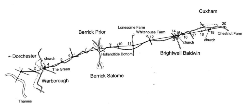
OS Map 1881 Sheet 40 -Adwell, Aston Rowant, Brightwell Baldwin, Brightwell Upperton, Cuxham, Easington, Kingston Blount, Lewknor, Postcombe, Pyrton, Shirburn, South Weston, Watlington, Wheatfield
The Parish is characterised by an undulating Landscape of Large Fields, small Brooks, & Meadows. A Stream Marl Brook (called the ‘Merlebrok‘ in the 16thC) enters between 2-Low Hills in the South-east, turning North to join the Stream which Flows past Cutt Mill. The Village lies in the narrow Valley between the Hills, and before the Stream was Culverted in the later-19thC it often Flooded the Main Street. The Parish’s rounded Hillocks foreshorten horizons from the Valley Floor, but there are no dramatic differences in relief. The lowest areas by the Streams are c.80M above Sea Level, while the highest points in the extreme East & South reach 108–115M.
Alluvium near the Streams supports Meadow & Pasture, though before modern drainage much of the Land there was Marshy. The Parish’s 3-Open-fields (Inclosed in the mid-19thC) occupied the slightly Higher Ground, where Greensand, Marl, Chalk & Gravel support a ‘rather heavy, but useful‘ Loam. Little Woodland has existed since the Middle-Ages, with Trees restricted to Hedgerows, Closes in the Village, and the Banks of Streams. In the late-Anglo-Saxon Period there was some Woodland on the higher ground in the South, however, and the Estate probably included a separate detached portion of Woodland in the Chilterns.
Communications: The Road through the Village (the modern B480) Links Cuxham to Watlington and (via Stadhampton & Cowley) to Oxford, and was labelled the ‘Oxford Road‘ on a Map of 1767. In the far North of the Parish it joins a Road running North-eastwards past Cutt Mill towards Thame, while at the Village’s Western end it meets the Road from Brightwell Baldwin, which follows the Course of the Lower Icknield Way.

Other early-Routes survive partly as Bridleways or Footpaths, though in some cases their Courses were altered at Inclosure or later. In the 18th & 19thC a Track led across the Fields North of the Village, one Fork heading towards Easington, and the other (doubtless a Grazing Route) leading to Pyrton Heath. At that time the Lane past the Church, which today stops just South of Manor Farm, continued cross-Country towards Britwell Salome. Other early North-West to South-East Routes form part of the Parish Boundary, running roughly parallel to Knightsbridge Lane in neighbouring Pyrton, which in the Anglo-Saxon Period Linked the Henley Area to Royal Centres near Oxford.

The Village did not have its own Carrier, although Watlington Services ran to Oxford, Abingdon, Thame, Reading, & London from the early 19thC. The Parish was also close to the Main London Road through Lewknor, and by 1830 a Coach which met the London Road at Stokenchurch could be boarded at the Red Lion Pub in Watlington. The Watlington to Princes Risborough Branch Railway Opened in 1872 but was closed to Passengers in 1957, making Cuxham considerably less accessible other than by Motor Car: Bus Services to Oxford, Wallingford, Watlington, Henley & Reading were Established in the 20thC, but were never frequent. A Post Office was opened in Watlington by 1823, and a Sub-Post Office in Cuxham by 1847. The latter changed Location several times before its Closure in 1970 when it was in the Half Moon Pub.

Population: In 1086 the recorded Population comprised 11-Tenants & 4-Servi, implying c.15-Households or 70-people. The real Total was probably higher: the men running Cuxham’s 3-Mills were not mentioned, and there may have been unrecorded Freemen & Servants. The Parish was already intensively exploited, with apparently little potential for further Arable expansion; nonetheless, there seems to have been additional Population growth in succeeding Centuries. By 1279 there were 23-Tenants, many of whom had their own Labourers, in addition to Demesne Servants & the Rector’s Household. By the late 1340s, the Adult Population probably exceeded 110. The Black Death (which arrived in early 1349) had a dramatic short-term effect: all 12-Villeins died that year, and 4 of the 8-Cottagers by 1352 when 9 of the Parish’s 13½–Yardlands lay vacant. Some limited recovery followed, although in 1377 the Adult Population was still only 38, about a 3rd of the pre-Plague Level.
The 15thC probably saw further reversals, since several Houses were abandoned. Rentals record c.12–16 Tenants, several of them non-Resident and growth remained slow, with 15-Taxpayers recorded in 1543, and only 19-Households assessed for Hearth Tax in 1662. In 1676 the Adult Population was c.66, and in 1738 there were said to be 24-Houses, while 128-people in 28-Households were inoculated against Smallpox in 1772/3. Numbers rose from 144 in 1801 to 222 in 1841, accommodated in 43-Houses; thereafter a sharp drop to 172 by 1851 was followed by a more gradual decline to 104 in 1921, rising to 129 in 1931 & to 183 (including Easington) by 1961. The later trend was generally downwards, especially in the 1960s & 1980s, and in 2011 the combined Population (occupying 61-Houses) was only 135.
Settlement: No evidence of Prehistoric activity is known, although Archaeological Investigation has been limited. Sherds of Roman Pottery, including Samian Ware, were found close to the Spring South of Manor Farm in the 1930s, apparently associated with remains of a Wall & fragments of Roof Tile. The character & extent of Roman Settlement remain uncertain, although this part of the Thames Valley was densely Settled throughout the Iron-Age & Roman Periods. Mention of ‘Cuda’s Tumulus‘ in the Charter of 995 suggests an early Anglo-Saxon Burial Mound, associated possibly with the Memory of a Kinsman of Ceawlin of Wessex (d.c.593). A Settled Farming Population seems to have been established before the late-9thC, and the ‘Hamm‘ Element of the place name Cuxham (‘Cuc’s River Meadow’) may reflect even earlier Colonisation, before c.730.
Settlement probably became concentrated close to the present Village in the late-Anglo-Saxon Period, although the regular Roadside House Plots Documented in the 13thC may not have been created until as late as the 12thC. An Outlying Farmstead or ‘Wic‘ located on the Parish’s South-Eastern Boundary in 995 was not mentioned later. Medieval Settlement was probably initially clustered on the Southside of the Village Street around the Manor House & Church and close to the Stream, but as Population expanded in the 12th & 13thCs Cottage Holdings were apparently Built on the Northside of the Street, in the Lane which led South between the Church & Manor House, and on Poor Land North of the Rectory House (these last converted to ½−Yardland Holdings in 1290-93).
The Village shrank considerably in the late-Middle-Ages. Two Homesteads in its North-Western Arm were abandoned in 1349 & 3-others in the late-15thC, while at least 6-Cottages South of the Church and further East were abandoned before 1388. The Tenement belonging to the Oldman Family, just East of the Rectory House, was an empty House Plot (or ‘Toft‘) by the 1480s and another Cottage (Burdens) was ‘very ruinous’ in 1513. Post-Medieval Development was limited, and most of the abandoned Tenements remained Pasture Closes in 1767.
The Village expanded little thereafter. A few New Houses were built in the late 18th & 19thC, but others were Demolished, and in 1901 there were the same number of Houses (38) as in 1831. The most significant 20thC additions were a row of 6-Council Houses (‘Mill View‘) Built at the Village’s Eastern end in 1926, and 8 (the ‘Gregory Estate‘) added to the Western end after the WW2 (4 in 1951 & 4 in 1960).

Built Character: Cuxham retains a mix of Medieval to early 19thC Vernacular Buildings & Modern Housing. The earliest surviving structure is the Church, and the one piece of ‘polite’ Architecture the early-19thC Rectory. Older houses are interspersed with modern Council Houses, Bungalows & Suburban Houses of standard design, creating a lack of Visual Unity. Nevertheless, most Buildings feature Red Brick & Tile, and many older Houses are built of (or encased in) Limestone Rubble, which was Quarried in the Parish. A number of Houses are painted White, sometimes over Render, and the Stream running along the Street’s Southside is marked off by White Railings. Some Houses still have Thatched Roofs, but the proportion is lower than in the early-1970s.


Yew Tree Cottage: House. Early-17thC: mid/late-18thC & early 19thC Flanking & Rear Extensions. Roughcast, originally Timber-framed; Gabled 20thC Tile Roof; Brick right end Stack & 2 Ridge Stacks (end Stacks of early-17thC House). 2-Unit extended to 4-Unit Plan. 2-Storeys; 4-window Range. Central 2-Bays have mid-19thC bracketed flat Hood over 6-panelled door, and 3-light leaded casements. Right outer Bay has horizontal sliding Sash above 8-pane Sash, and left outer Bay has 2-light Casement above 8-paned horned Sash. Mid-18thC 2-Storey rear Range, rough-cast with half-Hipped old Tile Roof: leaded Casements, & 18thC Plank Door to left.
Interior: early 17thC House (probably Built as 2-Cottages) has chamfered & stopped Beams, winder Stairs to right, Timber-framed rear Wall with braced Posts & 2-Bay Queen-post Roof with Clasped Purlins.
The oldest Houses include Yew Tree Cottage, an originally 2-Bay Box-frame House of c.1500–30, whose Open Hall was Floored over c.1600.
College Farm & Wheelwrights are similar Houses of probably later 16thC date, both Floored from the start, while Brook Cottage & The Thatch probably also pre-date 1600. College Farm was long occupied by Members of the Crooke Family, and in 1602 included a Hall, Lower Chamber, Upper Chamber & Servants’ Chamber; it was altered probably in the late-18thC, when occupied by a Sub-tenant of the Rector, and from the 1930s to 1970s it Accommodated the Cowman & other Labourers from Manor Farm. 17thC Houses include Middle Farm, the Half Moon & Old Rectory Cottage (which has some re-used Medieval Timbers). Middle Farm, on the Southside of the Street, is a 2-Storey L-shaped House partly rebuilt in 1967; its Western Range was originally Timber-framed, but the Framing has been replaced almost entirely by coursed rubble. The Eastern Wing was probably added in the later-17thC by the Cousin or Johnson Families. Roger’s Hill Farmhouse (Glenroy), Rose House (Orchard Cottage), Rose Cottage, & Stone Cottage all date from the 18thC.
Manor: By the 9thC, Cuxham belonged to the Bishop of Worcester’s extensive Readanora Estate, which included nearby Pyrton and which may have once formed part of Benson’s early Territory. It remained in the Bishop’s hands in 887 but was Granted to the Bishop of Dorchester probably in the later 10thC. Thereafter it passed to a succession of mostly minor Landholders until the late-13thC, when Walter de Merton bought it for his new Foundation (later Merton College) in Oxford. The College retained the bulk of the Estate in 2015, following more than 7-Centuries of unbroken Possession.
Descent: In 995 the Bishop of Dorchester Granted 5 Mansae at Cuxham to his Servant Æelfstan. By 1066 the 5-Hide Estate belonged to Wigod of Wallingford, whose Lands were acquired by Norman Baron Miles Crispin before 1086 as part of the Honour of Wallingford. The Overlordship remained with the Lords of the Honor until Richard of Cornwall (d.1272) surrendered the Right. The Domesday Tenant, Alured, is possibly identifiable with Wigod’s nephew of the same name, and by 1166 the Manor was Held by the Foliots, of whom some seem to have lived in Cuxham. Walter Foliot, Lord from c.1190 to c.1233, was Sheriff of Oxfordshire in 1225.
Miles Crispin (d.1107), also known as Miles or Milo of Wallingford, was a wealthy Norman Landowner, particularly associated with Wallingford Castle in Berks (now Oxon). The Domesday Book records Miles as a major Landowner with Holdings in Berks, Bucks, Oxon, Surrey, Wilts and 2 other neighbouring Counties as well as being Tenant-in-Chief in a lengthy list of Places. Miles is believed to be a Member of the Crispin Family of Neaufles in Normandy: suggestions include son of William Crispin, Baron of Neaufles (Neaufles-Saint-Martin or Neaufles-Auvergny), part of William the Conqueror’s Invading Force, and a relation of Gilbert Crispin, Abbot of Westminster, but this is uncertain. Miles married Matilda, daughter of Robert D’Oyly, in 1084. While D’Oyly is generally credited with Building Wallingford Castle, it has also been suggested that Miles Crispin was its 1st Castellan of Wallingford, and Owner of the Lands of Wigod. Matilda later married Brien FitzCount. During the Rebellion of 1088, Miles Crispin was a supporter of William II, and was in the Army that later Arrested William de Saint-Calais.
Before 1235/6 the Manor passed to Ralph Chenduit (d.1243), who had married Foliot’s daughter & Heir Joan. Ralph’s son Stephen, a close companion of Richard of Cornwall, became heavily indebted to Jewish Creditors, and in 1268 sold the Manor & Advowson to Walter de Merton (d.1277). Walter used Cuxham and other Properties to Endow the House of Scholars (Merton College) he had Founded in 1264, which soon after settled in Oxford; the Grant of Cuxham (in 1271) incorporated Life Annuities of £38-15s shared between Walter & his Relatives. Merton College remained in possession of the Manor thereafter, though from the later-Middle-Ages it was Leased rather than kept in hand. In 1910 and still in 2012 the College owned 429a in Cuxham, comprising the whole of the Parish apart from some Land in the North; Village Housing, however, was Sold off piecemeal during the 19th & 20thCs. In the 12thC the Manor also included 2-Hides in Chalgrove, and though the Land there was Sub-infeudated the College retained an interest in part until 1517.
Manor House (Manor Farm): A Manorial Complex on the Site of Manor Farm was mentioned in 1244 and probably had much earlier Origins. Air Photographs suggest that the Domestic Buildings, including the Lord’s Room & a Hall, stood within a small Spring-fed Moat, to the West of which were 2-Rectangular Fishponds. The Stone-built Lord’s Room, a Solar-like Chamber located most likely above a Dairy & Cellar, was fitted out to accommodate Fellows & College Guests & probably (after the Black Death) the College Bailiff; by contrast, the sparsely furnished Timber-framed Hall seems to have been used mainly for Demesne Workers’ meals. The Farm Buildings lay on the Eastern side of the Moat around a Yard. The whole Complex was enclosed within a large Walled Garden which produced leeks, onions, beans, hemp, apples, pears, cherries, nuts & vines (Hops). By the 14thC, the Ancillary Buildings included a Gatehouse, Kitchen, Bakehouse, Barns, Byres, Stable, Carthouse, Granary, Hayhouse & Pigsty; 2–Dovecots stood in the Northern part of the Garden, and a Malt Oven in the South. The majority of those Buildings were Built or reconstructed between 1294 & 1330 when many Thatched Roofs were upgraded to Tiles. The most important addition was a probably 5-Bayed Wheat Barn, built in the 1320s to replace one of the 2 older Barns. The 2nd Barn (probably the Old Wheat Barn) was extended in 1335/6, when it was used for Oats & other Crops.
Timber-framed Manor Barn, possibly 18thC, with some late 20thC renewal.
The Frame is of Oak and probably Elm; the Timber Weatherboarding was renewed c.1990, which is also the date of the Corrugated Iron Roof. The Brick Plinth has been partly replaced with Blockwork.
The Barn is Timber-framed, of 4-Bays, with a Cart Bay projecting forward from the 3rd Bay from the left (as seen from the West, Farmyard side). There is no rear Cart Entrance, although there is a Pedestrian Door which may have provided a modest cross-draught for Threshing if the Barn was used for Cereal Storage & Processing. The main Ground Sill is underpinned with Brick, partly replaced, especially to the left, by Blockwork. The Weatherboarding was replaced c.1992, and the Roof was clad in Corrugated Iron at the same time. The Main Trusses have slight jowels to the Main Posts which support Tie Beams. These Tie Beams are only lightly squared and retain much Bark; this suggests they are probably of Elm, whereas the rest of the Timber is apparently mainly Oak. The Queen Post variant Roof has principal Rafters which are lightly braced with Collar Plates & Angle Baces, Common Rafters & Twin Purlins; many Timbers are waney & retain Bark. Some Lathes were left in-situ when the Roof covering was replaced; their regular spacing suggests the previous Roof covering was of Tile. The side walls have narrow, fairly closely-spaced Studs with long Angle Braces running from Wall Plate to Ground-Floor Sill. Many of these Studs & Braces were replaced in the 20thC. No trace of a Threshing Floor was visible.
From the late-Middle-Ages, Merton & its Lessees shared responsibility for maintaining the Buildings, extensive repairs in 1419-20 including work on the Hall, ‘High Chamber’ (presumably the Lord’s Room) & Great Chamber. An Inventory of 1530 mentioned the Hall, High Chamber, Kitchen, & Brewhouse. In the 16th & 17thCs the House was large enough to accommodate College Members fleeing outbreaks of Plague in Oxford; probably it was remodelled during this Period by the Gregorys (as Lessees), and by 1662 it had 12-Hearths. A Map of 1767 shows a House with an irregular but broadly L-shaped Plan, while a more regular Plan was depicted from the 1840s, presumably reflecting further rebuilding. The House was badly damaged by Fire c.1900, and a steep-Gabled, 4-Bay Brick & Stone Frontage was added to surviving parts of the Rear. In the later 20thC 2-old Thatched Barns were Demolished and the remains of the Moat partly filled in.
Economic History: Cuxham’s Economy has always been based on Agriculture. From the Middle-Ages, its mixed Farming was strongly biased towards Grain production, with Farmers benefiting from access to the London Market via the Thames at Henley, and from the presence of nearby Towns such as Abingdon & Thame. The Farmland was primarily divided between Merton College (whose Demesne was Leased out from 1359), the Rector (who was a substantial Occupier), and Customary Tenants with smaller Holdings. The Demesne was consolidated into Blocks in the 13thC, but the Tenant Land remained in Strips scattered across the 3-Open-fields until Inclosure in 1846-48. Two Medieval Mills remained important Assets, though Craft & Retail activity was limited.
Cuxham Tithe Map of 1848

Agricultural Landscape: From the Middle-Ages to the early-19thC the Village was surrounded by its Open-fields, with Inclosures (mostly of Medieval Origin) restricted to the edge of the Settlement and to the low-lying areas of Grassland beside the Streams. There were a few small Copses & Orchards in the Village, but otherwise, trees were found only singly or in small groups around the Village and on the edge of the Fields & Streams. The Open-field System Documented after 1200 was probably laid out in the 11th or early-12thC: parts of the Fields in the South & East of the Parish were still Wooded in 995 but had apparently been cleared by 1086. In the 13thC & later there were 3-Fields, each of 120–130a.; during the Middle-Ages they were usually identified by their proximity to Pyrton, Brightwell & Britwell respectively, but in the 16thC their names changed to North Field, West Field & South Field. Field Boundaries & Furlong Layout apparently altered little from the 15thC (and probably earlier) until Inclosure, although one Furlong was transferred from the South to the West Field before 1614.

Grassland totalled 107-acres in 1767, much of it (61-a) Held in Closes. Town Meadow (13-a) in the far North-east Corner of the Parish was Lot Meadow in the later-Middle-Ages, but by 1614 its Strips were permanently attached to particular Holdings. The only significant piece of Common Pasture, called ‘the Common’ in 1677 and earlier ‘the Moor‘, covered 29-a, having been slightly enlarged in the late-Middle-Ages by the incorporation of abandoned Tenements in the North-West of the Village. In addition, there were 2-small Greens, Tower Green (3-a) in the same area & Upper Green (1-a) next to the Church. The amount of Pasture in the 13thC was apparently smaller.
Medieval Tenant & Desmene Farming: Cuxham’s mixed Farming can be traced back to the Anglo-Saxon Period, when, as later, Stream-side Meadow provided Fodder for Plough Beasts & other Livestock. The Chalk & fertile Greensand of the Lower Ground was probably the main Arable area, but the presence of a ‘wudu wic‘ (or ‘Farmstead by the Wood’) on the South-Eastern Boundary in 995 shows that Farming was already encroaching onto the Gravel-topped Hills where early Woodland was concentrated, some of it probably in the 2-Valleys called ‘Symmysdene’ & ‘Hecchelesdene‘. Domesday recorded no Woodland in Cuxham, but 5-Ploughs were in use on Land sufficient for 5, suggesting an expansion of Arable since 1066. Two Ploughs belonged to the Lord and were run by 4-Slaves or Servi, while the other 3 were held by Tenants. Intensive Cereal production is suggested by the presence of 3-Mills on what was a small (5-Hide) Estate.
Little is known of Farming in the 12thC, but the Survival of the Merton Archives makes this one of the best-Documented Small Manors in England after 1200, and especially in the Period of Direct Management by the College (1271–1359). Like Merton’s other Manors Cuxham was run as an Individual Unit, though Sheep Farming may have been centrally organised for a time. The Warden & Fellows Administered the Manor personally, making regular visits & supervising the Harvest. The College enjoyed the Services of several long-serving Reeves chosen from among the more substantial Tenants, including Robert Benet (1288–1311) & Robert Oldman (1311–49). These men managed the Demesne in return for the remission of Rent & other perquisites. Six to 9 Workers (or Famuli) provided the main Demesne Labour Force, their efforts supplemented by the heavy Labour Service of the Villeins (worth £6-£7 a year) & casual hired Labour.
The Cuxham Demesne was highly Productive, though it is difficult to put a precise value on its Output. By the late-13thC c.269-a were sown with seed each year: 87½-a in the North Field, 88¼ in the South Field, and 93¼-a in the West Field. Half of that area was sown with Wheat, which was the main cash Crop; Oats (the next most important) were used mainly for Fodder, while dredge, barley, peas, beans, & vetch were grown in smaller quantities. Around 70-Sheep (more after 1310) produced both Wool & Milk, augmenting that produced by 12-Cows, while c.20-Pigs were kept as well as Poultry, and the Dovecot produced 500–1,500 young Doves for the College Table. Gross income in the 1st half of the 14thC was c.£60 a year, including Rents & Profits of Court (c.£5), but not the Produce delivered to the College or consumed on the Manor. Income from Cereals totalled 5 to 8 times that from Livestock, Wool & Cheese, while Net Profit, including the value of food consumed by the Fellows, averaged just over £40.
This was a large Sum for an Estate of under 500-acres and was achieved by high yields. Those, in turn, reflected careful Management, high Labour inputs, & good Soils, combined with excellent Market Networks. Efficiency was probably increased by Ralph Chenduit’s consolidation of his Demesne Land in Blocks around the Village in 1227–43, and in the later 13thC Merton College increased Labour, raised Rents & probably enlarged the Demesne, followed in the early-14thC by Investment in new & improved Farm Buildings. Cuxham was part of a prosperous mixed Farming Region, and nearby Thames-side Towns provided good Outlets for Agricultural Produce. Wallingford was important in the 11th & 12thCs & from the 13thC, Henley became the main Market for Cuxham’s Wheat. Much Produce was also Bought & Sold in Cuxham & surrounding Villages and in the small neighbouring Town of Watlington, which had a Chartered Market from 1252. Abingdon & Thame supplied Livestock and other items.
The Manor’s focus on Cereal cultivation nevertheless brought certain limitations & inconveniences. In 1279 the Demesne included only 11-acres of Meadow & 9-acres of Pasture (compared with 44-acres in 1767), and lack of Grassland precluded any substantial Stock-raising. Hay for Plough Oxen & Horses had to be bought in nearby Thame-side Vills to supplement customary grazing rights in neighbouring Pyrton, while Timber & Firewood was Imported from the College’s Manor of Ibstone (acquired by Walter Foliot in 1202/3), or Purchased in the Chilterns, Reading, or elsewhere. Limited Manuring & Intensive Farming using a 3-course rotation of spring corn, winter corn & fallow may have also led to some decline in Soil Fertility by the early-14thC. Yields seem to have fallen after 1300 despite continued high Labour inputs and a slight increase in the planting of legumes, although they remained very high by contemporary standards.
Tenant Farming was smaller in scale but broadly similar in type. Half-Yardlanders, of whom there were 13 by 1293, Farmed 12-a Holdings scattered across the 3-Fields, growing wheat, rye, & vetch (rather than oats), and a little barley. In 1304 most had one or more Plough Horses, a Cow & a Pig or 2, though few of them owned Sheep. Peasant Farmers also imported Hay for animal feed, John Lacheford of Cuxham being killed in 1378 while loading his Cart with Hay in Wheatfield. In the late-13th & early-14thC the Green Family, by then amongst the very few remaining Free Tenants, Farmed on a somewhat larger scale, and kept 50 or more sheep; Cottagers, by contrast, generally had no Open-field Land, and were restricted to growing Cereals on their Crofts and keeping Poultry. Nothing is known of the yields achieved by Tenant Farmers, but it cannot be assumed that they were lower than those on the Demesne, and the most successful were evidently quite prosperous. In 1349 the Reeve Robert Oldman owned a wide range of Farming Implements, 67-sheep, & 35-lbs of wool, as well as malt, maslin, 5-horses, an ox, and a few cows & pigs. All of Cuxham’s Villeins were required to perform 2-days’ Labour Service a week, but their Rents were modest, and they were aided by Family Members & hired Labourers.
The Black Death brought swift & long-term changes to both Demesne & Tenant Farming. Merton College seems to have found it hard to find a reliable Reeve or Bailiff to Manage the Demesne after 1349 and as Labour Services virtually ceased more Labour had to be hired. Profits fell to £10-13s in 1354/5, and from 1359 the Manor was Leased to a Farmer. The Rector, William Elham, took it for 7-yrs from 1361 for £20 a year, but later Farmers paid varying (and often slightly lower) amounts depending partly on what was included in the Lease. From the late-14thC small parts of the Demesne were separately Leased to Tenants & in 1441 the amount was increased to 100a, Let for £3-6s-8d Rent. None of these measures prevented the College’s Income from Cuxham being much reduced.
Depopulation, Demesne Leasing, & reduced Rents allowed some Tenants to increase the size of their Holdings. The Greens acquired additional Land at least for a time, and in 1377 the Rector William Elham rented 3½–Yardlands which he Sublet. In 1466, 8-Tenants Held over 8½-Yardlands between them, including 2-Yardlands of Demesne which were perhaps additional to that Leased out long term. Four others, however, still had only Cottage Holdings without Open-field Land. The leading Tenants were Thomas Freeman & John Parson, who Held 2-Yardlands each, and Joan Clement, who had 1¾-Yardlands & several Closes. By 1484 William Parson held 4½ out of 9¼-Yardlands, and he retained this Holding of probably over 100-acres in 1504, when his son held another 1½-Yardlands. Parson lived in the Village but may have Sublet some of his Land. Arable Farming remained central but may have been less intensive than earlier and possibly Grazing became more significant. Demesne Farmers such as John Gregory (1479–1506) seem to have also had some involvement in the Chiltern Timber Trade, helped by Merton College’s Ownership of Ibstone.
Farms & Farming 1500-1800: Post-Medieval Farming continued within a customary Open-field System, though as earlier Merton College’s Manor Farm comprised large Blocks of Land rather than scattered Strips like the other Holdings. By the 1760s it had recovered c.50-a of the 100-a previously Let to Tenants, and its 265-a (including 218-a of Arable) comprised almost 60% of the Parish’s Agricultural Land. The Rector’s 97-a Glebe & Leasehold Estate (part of which was later called College Farm) made up over 20%, with 9 Copyholds and 2 small Freeholds accounting for the rest, although none of them individually exceeded 20-acres. Subletting was Common, and many inhabitants held additional small Parcels of Freehold or Leasehold Land in Cuxham & neighbouring Parishes. Throughout the Period Land became concentrated in fewer hands so that by the 1730s there were only 4-Farmhouses.
In 1535 the College received £8 from the Farmer of the Demesne (Agnes Gregory) & £8-14s-6d from its other Tenants, net Profit totalling £15-12s-6d. Then as in the early-18thC, Agricultural affairs were organised at least partly in the Manor Court: a 3-course rotation was adhered to, and a 3rd of the Land was still left Fallow each year, with little of the hitching of Fallow Land practised in some nearby Parishes. Inventories (mainly 17thC) suggest predominantly smallscale Farming within this strong Customary framework. The value of Yeomen’s & Husbandmen’s Goods was generally rather low (mostly under £100), and as elsewhere Wealth was tied up mainly in Farming Stock. Wheat was the main crop, followed by barley, beans, peas, & pulses; there is no evidence that oats were grown, and hardly any rye, while most Farmers kept just a handful of cows & sheep. Henley & Thame (both places where Thomas Gregory owed wheat in 1530) were probably the Main Markets for Grain, while Labourers were hired possibly in Watlington, which had an Annual Hiring Fair by the 18thC.
The Gregory’s remained as Demesne Farmers until the 1680s, though from the early-17thC they Sublet all or part of the Farm to the Clark Family & others. Later Lessees and co-Lessees included the Inner Temple Lawyer Henry Stevens, John Edwards (Rector 1693-1718), Robert Eyres (a Middlesex Woodmonger), & Gislingham Cooper of Henley, followed by the Merton College Fellow John Stevens & the London Civil Lawyer Henry Stevens. Almost all of them were non-Resident and by the early-18thC Manor Farm was apparently split between several Under-Tenants. Merton College Granted 21-yr Leases for £5-6s-8d a year and a Corn Rent, with Entry Fines (usually over £60 in the 17thC) paid every 7-yrs or so. College Officials still held Court in Person until 1670 and made occasional Supervisory Visits.
The 18thC brought increased prosperity to the Parish’s 3 or 4-Principal Farmers, partly because Rents remained low while demand for produce increased. In 1761 the Rector’s Estate, Leased for many years to the Neale Family, was let for £67 a year (10–12s per acre), while its produce was worth £220 or over 3-yrs’ Rent. Around the same time, the valuation of Land on Manor Farm (Farmed as 1-Holding by 1785) was said to be ‘very easy’. Agricultural Profits were invested in extensions to Houses and the construction of New Farm Buildings, such as the Granaries at Manor Farm & Yew Tree Cottage & the Barn at Middle Farm. Mixed Farming continued to be Cereal-led, with 84% of the Parish’s Farmland Arable in 1767, and only 16% Pasture.
Farms & Farming Since 1800: In 1800 the Principal Landholders were Thomas Jackson (Sub-Tenant of Manor Farm), the Rector, and 12-smaller occupiers, of whom most held only a few acres. The Manor Farm Lease was acquired in 1808 by Paul Blackall (d.1811), a substantial Farmer in neighbouring Pyrton; his son William later Sublet it to Charles Saunders, who also took on the Rectory Estate. In 1814 Manor Farm comprised 218-a of Arable and 43-a of Meadow & Pasture, and was valued at £452 a year; £703 was paid to renew the Lease, although Agricultural difficulties led to reductions soon after. By 1821 the Fine was £693, and by 1828 (when the Farm’s Annual Value was put at only £278) it had fallen to £346. By the 1830s Blackall was in Financial trouble, and Sold his interest to Thomas Ensworth; Ensworth renewed the Lease for 21-yrs in 1835, paying a Fine of £366. The Rector’s Glebe and 2-Leaseholds (97-a) were held in 1828 by John Hicks, the College’s Tenant at Cutt Mill; by then the only other Agriculturalists on any scale were Isaac Smith, John Crake, James Brown, & William Rogers, whose 10–30a Holdings comprised a mix of Copyhold, Leasehold & Freehold, much of it Sublet.
Merton College seems to have taken little interest in Agriculture during this Period. Farm Buildings & Cottages were kept in poor repair by small Tenants with scattered Holdings, and the Rector and some other Tenants had generous Leases. From 1830 Manor Farm was Split up & Sublet to several Occupiers, and by 1843 its Land was reportedly in ‘very indifferent condition‘, although the Parish as a whole was said (in 1840) to bear ‘very heavy Crops‘. The only significant Investment seems to have been a Threshing Machine installed in an Extension to the Wheat Barn at Manor Farm before 1828, most likely by William Blackall, who ran the Farm himself in the 1820s. Nevertheless, and despite the College’s lack of attention, in 1842 the Lessee of Manor Farm paid a slightly higher entry Fine of £434. A 4-course rotation was followed, with wheat as the most important Cereal crop.
Considerable changes took place over the next 10-yrs, under the direction of the College’s energetic Agent John Dale. Holdings were Surveyed & Repairs carried out, Manor Farm was once again occupied by a single Tenant (Joseph Gale) paying a Rack Rent, and the College instigated Inclosure in 1846-48. This facilitated the consolidation & enlargement of Farms, although the Location of Manor Farm’s Land in Blocks around the Village meant that other Holdings were generally more distant from the Settlement. Merton was able to increase its Rental Income by taking back the Rector’s Leasehold Land, buying up the Copyholds (which Dale thought had ‘Pauperised’ the Parish), and introducing more Commercial Rents.
OS Map 1881 Sheet 40 -Adwell, Aston Rowant, Brightwell Baldwin, Brightwell Upperton, Cuxham, Easington, Kingston Blount, Lewknor, Postcombe, Pyrton, Shirburn, South Weston, Watlington, Wheatfield
By 1861 there were 4-dominant Farmers, some of them with Land in nearby Parishes. Joshua Smith of Manor Farm ran 270a with 9-men & 3-boys, while William Hicks (150-a) ran Cutt Mill, John Carey (sub-Postmaster at College Farm) Farmed 112-a & Thomas Tappin 47-acres. Farming was by then based on Sheep-corn Husbandry, with only a small number of Cows. In 1888 Manor Farm was described as an excellent Corn-growing Farm, though it was not well suited to keeping Sheep over Winter, and given the very low price of cereals, its annual Rental value was greatly reduced’ to only £400 (or £300 if the Tenant paid the Tithe Rent). Agriculture & Allied Occupations remained the main source of Local Employment throughout the Century, followed by Domestic Service in the Homes of the leading Farmers & at the Rectory House.
In 1910 Manor Farm (275-a) & College Farm (97-a) were run by William & Thomas Moffatt. There were also 4 small Occupiers: Thomas Hicks of Cutt Mill (with 41-a) & Frederick Stevens, David Tappin (the sub-Postmaster) & Robert Gale, all with fewer than 15-acres. Francis (or ‘Frank’) Nixey, who had recently bought neighbouring Easington Farm, took over Manor Farm in 1928, and by 1931 his Family also held College Farm. After his death in 1940 his sons (and Business Partners) Albert & Frank continued to Farm together until 1957, when their Holding comprised 1,700-acres in Cuxham, Easington, Warborough, Tetsworth, Waterstock & Clare Hill. Frank remained in Cuxham until his death in 1975, and his son Nicholas continued the Business in 2012, Farming 900-a in Cuxham, Waterstock, Great Milton & Clare. The Rent for Manor Farm rose steadily from £281 to over £670 in 1958, £1,440 in 1963, and £1,970 in 1972, partly reflecting increases in acreage & partly improvements paid for by Merton College, including new cowsheds, barns, electric lighting, & water supply. From 1973 Manor & College Farms were Leased together as a single 431-a Holding for £3,500, the College providing a new Dutch Barn, Implement Shed, & Cattle Yard at Manor Farm.

The area of Permanent Pasture increased from the end of the 19thC, but Farming remained mixed. In the early-20thC the chief commercial Crops were wheat, barley & beans and roots were grown for Fodder. Alfred Hoar ran a Cattle-dealing Business from Glenroy. In 1939 some 44-a was Ploughed up for the War Effort, and in 1941 the combined Manor & College Farms included 89-a of wheat, 32-a of oats & 61½-a of other Crops (mainly for animal feed), together with 206½-a of Permanent Grass. Nine Workers (later reduced to 4) tended 93-cattle (including 54-cows in milk), 148-sheep, 14-pigs, & 204-chickens. The Holding included a Steam Engine, 2–Threshing Machines & a Tractor, but Horses were still used for Ploughing. The main Markets for Cereals and Livestock were Thame, Reading & Oxford, and until 1961 Watlington Station was used to Export cattle & sugar beet and to bring in Fertiliser; in the 1920s milk also went by Rail to London.
The Nixeys’ Dairy Herd comprised c.70-cows in 1973 & Frank’s daughter Marygold bred Horses & Ponies, mainly for Export to Wealthy Clients. In the early 1960s the Tappin Family of Middle Farm (who still ran the Village Post Office) had a smaller Dairy Herd, but from 1966 the Nixeys were the only Farmers based in the Parish. Thereafter further drainage was carried out, milk cows were replaced by beef cattle, and the Arable acreage was increased (for wheat, barley & peas). In 2012 cattle & cereals were sold at Thame, which was the only nearby Livestock Market and had a Branch of the Grain Merchants Glencore Grain.


Half Moon Public House: The Building itself dates back to the 16thC, although it is hard to fix a precise date, as the 1st mention of a Building on the Site was in 1622 when it was known as ‘Rigsbys‘. It was 1st mentioned as a “Victuallers” in the early-19thC, while the 1st reference to its current name can be found in the Sale Records when the Young Family Sold The Half Moon to a foresighted Mr Brakspear for, it seems, a Sum of £570. It was severely damaged by Fire in 2002. The Half Moon Pub, its Sign taken probably from the Gregory Family Crest, was in Operation by the mid-18thC and remains Open currently. The much-altered Building is probably of 17thC Origin, and was originally Timber-framed; a late-18th or 19thC Rubble structure at its Eastend is used as a Beer Cellar, complete with Wooden Barrel-ramp.


OS Map 1919 Sth Oxon XLVII.9 (Brightwell Baldwin; Cuxham)
Mills, Crafts & Retailing: Domesday Book mentioned 3-Watermills. One was almost certainly on the Site of Cutt Mill in the far North of the Parish, and another at Cuxham Mill, in the East of the Village. The Location of the 3rd Mill, which had disappeared before the 13thC, is unknown. Cutt Mill belonged from the 1270s to Merton College, while Cuxham Mill was given by Robert Foliot to Wallingford Priory, and was subsequently owned by the Stonor’s and others before Merton bought it in 1807. A water-driven Fulling Mill Built by Merton in 1312 was rented usually for 13s-4d a year up to 1349, but by then it was run down, and it was Demolished shortly afterwards.
During the Middle-Ages both the Corn Mills were much improved, bringing in Rents of over £2 a year, and for a time Cutt Mill was run by the Reeve Robert Oldman and his son. Rents fell after the Black Death. Post-Medieval Millers, like their predecessors, were often part-time Farmers, and frequently Held Property in adjacent Parishes. In the 1830s Cutt Mill was Leased for £53 a year compared with Cuxham Mill’s £31-10s, but in the 1890s it ceased to operate, followed by Cuxham Mill in the 1930s.
Medieval Villagers were engaged in Brewing, and there was a Tailor & probably a Carpenter. Craftsmen were also brought in as required from neighbouring Villages and sometimes further afield. A Smithy was established at the former Oldman Tenement (‘Revesplace‘) by 1354 and possibly before the Black Death; it apparently continued there in 1401 but was abandoned before 1484. A new Forge was mentioned c.1525 and a Blacksmiths Shop in 1631, and by the late 18thC the Smithy stood on the Northside of the Village Street. It remained there until its closure during WW1, having been run by the Newell Family for over a Century. Other Craft & Retail Trades (often pursued by part-time Practitioners) were represented at various times, amongst them shoe-making, tailoring, carpentry, food & ale retailing, thatching, hurdle-making, and (in the later-19thC) Dress Making.
Social History: Until the 20thC, Cuxham supported a small, predominantly Agricultural Community. By the later-Middle-Ages, Village Society was already dominated by a few leading Farmers and by the Rector or his Curate, while the influence of Merton College, the major Landowner from 1271, was felt through its Manor Courts and visiting Officials. The Rectors were almost invariably former College Fellows and often had close personal relations with wealthier Farmers such as the Demesne Lessees or their Subtenants, with whom they shared wider Social Horizons than many of their neighbours. From the late 19thC fewer Villagers made their living from Farming, and by the mid-20thC most worked outside the Parish. Combined with falling Church attendance and the decline of Local Crafts & Retailing, such factors contributed by the early-21stC to a loosening of Social cohesion typical of many small Rural communities.
Education – In 1808 it was claimed that attempts to set up a School had failed over the previous 30-yrs because no Teacher could be found in such a small Village and because children were sent to Labour so early. In 1818 the ‘poorer classes’ were nevertheless said to desire a means of Educating their children, and a Sunday School established by the Rector Francis Rowden in 1825 had 37-Pupils in 1833. In 1848 Rowden secured £50 from Merton College towards Building a Day School for 35-Pupils on the Site of 2-Cottages North of the Church; the School was affiliated to the Church of England’s National Society but was funded by Private contributions including £5 a year from the College, raised to £20 in 1853. Later it received a Government Grant. In 1854 there were 22-Day Pupils, and 28 attended the Sunday School.
By the 1870s many older children went to Watlington Board School, and average attendance at Cuxham declined from 25 in 1883 to 8–15 in 1887–1903. Despite little subsequent increase, in 1911 the School was extended to become a 2-room mixed Elementary School for 42-Pupils. Low Pupil numbers, difficulty in securing a permanent Teacher, and the building’s dilapidated state led to its Closure in 1923, despite opposition from the Managers. Thereafter all Village children went to Watlington School, those under 9 by Bus and the older children by Bicycle.
Poor Relief & Charities: A ‘Church House Tenement’ mentioned in the 15thC was possibly maintained for the Poor, and in 1768 the Parish owned a Cottage from which the Churchwardens formerly received 20s a year, but which the current Occupant (who was Poor) held Rent Free. Some Villagers made modest Bequests to the Poor, and in 1627 William Hamildon left money to 3-named Inhabitants including 2-Widows. There were, however, no Endowed Parish Charities.
In 1776, 30s out of £55-14s-4d raised by the Poor Rate was spent on Housing. A Row of 6-Cottages was built on Waste near the Church in the early 19thC and was used for the Poor until 1850. As elsewhere Poor Rates rose considerably in the late 18th and early 19thC, reaching £257-5s in 1818; costs fell by the 1820s, but Poor Relief remained a problem after 1834, when Cuxham joined the new Henley Poor Law Union. In 1843 Merton College’s Agent reported continual complaints about the Burden of Parish Rates and a surplus of Labourers, ascribing the difficulties to an excessive number of Lifehold Tenants with large Families chargeable to the Parish. Rates were reduced after Inclosure in 1846-48. A Cottage used for the Parish Clerk and later the Sexton was sold in 1978.
Local Government – Manor Courts & Officers: In the Middle-Ages the Lords of Cuxham had a Manor Court without Leet Jurisdiction, the Tithing Group owing attendance at the Honour of Wallingford’s View of Frankpledge at Chalgrove. The earliest surviving Court Roll dates from 1279, and a long Series of Extant Records from 1294 to 1885 is broken by relatively few gaps. Until the early-18thC (and especially until the 1680s) the Manor Court dealt with a wide range of Business including the Regulation of Agricultural Affairs, but afterwards, it was almost solely concerned with Customary Tenancy Transfers. Latterly it convened when Tenancies required Renewal, or otherwise every 7-yrs. Representation at the Chalgrove View continued until 1847 when a Constable & Tithingmen were still appointed there.
Parish Government & Officers: For a long time, the Manor Court probably organised all functions of Parish Government, especially as Manor, Vill & Parish were coterminous. In the Middle-Ages, the Reeve was assisted by a Constable (mentioned in 1346), a Hayward (who received a Grain Stipend from 1315), and a Butcher (who certified the Deaths of Demesne Livestock). Churchwardens were mentioned in 1427, but were at least partly under Manorial Control: as late as 1620 the Manor Court ordered the Constable & Churchwardens to carry out repairs to the Gate at the Village’s Western end, although by then the Vestry presumably oversaw Parochial Functions such as Poor Relief. Overseers of the Poor were mentioned in the 18thC and a Parish Clerk in the 19thC, but no Parish Officers’ Accounts survive from before 1852. Village Stocks near the Church were depicted on an engraving of 1796.
In 1894 Cuxham became part of the newly created Henley Rural District, and a Parish meeting was formed. Thenceforth the District Council & Parish Meeting took over Civil Functions. The New Civil Parish of Cuxham & Easington (formed in 1932) became part of the New Bullingdon Rural District and was transferred to the new South Oxfordshire District in 1974.
